
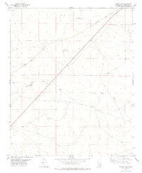
1978 Map of El Morro Ranch
USGS Topo · Published 1978About this map
El Morro Ranch and the small settlement of Sotano Blanco anchor this high-desert landscape in eastern New Mexico during the late 1970s. The map documents a sparse ranching and industrial environment where the Guadalupe and De Baca county line divides the terrain. Evidence of subterranean exploration is visible through several marked sites, including Drill Hole 5316 and other scattered Drill Holes, suggesting mineral or geological survey activity typical of the era.
Find a feature on this map
9 named features on this map. Tap any name to fly to it.
Don’t see what you’re looking for? This feature index may not catch every label — zoom into the map to look around manually.
Map Details
Editions of this 1978 El Morro Ranch Map
This is the sole edition of this map. No revisions or reprints were ever made.
Other maps of this area

1954 · Fort Sumner
USGS Topo · 1:250,000

1958 · Fort Sumner
USGS Topo · 1:250,000

1978 · El Morro Ranch SE
USGS Topo · 1:24,000

1978 · Laguna De Los Terreros
USGS Topo · 1:24,000

1978 · El Morro Ranch NW
USGS Topo · 1:24,000

1978 · Long Draw
USGS Topo · 1:24,000
1978 · Burro Lake
USGS Topo · 1:24,000

1979 · Fort Sumner
USGS Topo · 1:100,000

1980 · Corona
USGS Topo · 1:100,000

1981 · Yeso Mesa
USGS Topo · 1:24,000