
1973 Map of Tolar
USGS Topo · Published 1975About this map
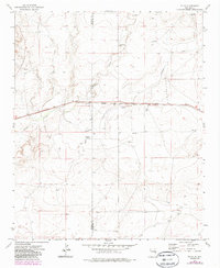
Tolar serves as the central hub of this eastern New Mexico landscape, situated at a junction of rail and road commerce in the 1970s. The Atchison Topeka and Santa Fe railroad bisects the terrain, running parallel to the route of Highway 60 84. This alignment highlights the area's role as a transit corridor across the High Plains, where the iron rail and paved road follow the path of least resistance through the drainage basins of Taiban Creek and Alamosa Creek.
Find a feature on this map
16 named features on this map. Tap any name to fly to it.
Don’t see what you’re looking for? This feature index may not catch every label — zoom into the map to look around manually.
Map Details
Editions of this 1973 Tolar Map
2 editions found
Other maps of this area

1954 · Fort Sumner
USGS Topo · 1:250,000

1954 · Clovis
USGS Topo · 1:250,000

1958 · Fort Sumner
USGS Topo · 1:250,000

1958 · Clovis
USGS Topo · 1:250,000

1968 · Lomas Gatos
USGS Topo · 1:24,000

1968 · Candy Mesa
USGS Topo · 1:24,000

1968 · Taiban
USGS Topo · 1:24,000

1973 · Krider
USGS Topo · 1:24,000
1973 · Peach Canyon
USGS Topo · 1:24,000
1973 · House SE
USGS Topo · 1:24,000