
1973 Map of Krider
USGS Topo · Published 1975About this map
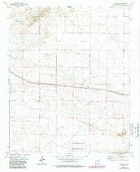
The Atchison Topeka and Santa Fe railroad serves as the primary corridor through this high plains landscape of Roosevelt County. The small settlements of Krider and Cantara are situated directly along the rail line, marking vital points of transit and commerce in the early 1970s. North of the tracks, the terrain is defined by the winding course of Alamosa Creek and the landmark Dobie Windmill, highlighting the critical importance of water management in this arid region.
Find a feature on this map
14 named features on this map. Tap any name to fly to it.
Don’t see what you’re looking for? This feature index may not catch every label — zoom into the map to look around manually.
Map Details
Editions of this 1973 Krider Map
2 editions found
Other maps of this area

1954 · Clovis
USGS Topo · 1:250,000

1957 · Melrose
USGS Topo · 1:62,500

1958 · Clovis
USGS Topo · 1:250,000

1973 · Tolar
USGS Topo · 1:24,000

1973 · Melrose West
USGS Topo · 1:24,000

1973 · Tule Lake
USGS Topo · 1:24,000
1973 · Peach Canyon
USGS Topo · 1:24,000

1973 · Field SW
USGS Topo · 1:24,000
1973 · House SE
USGS Topo · 1:24,000
1973 · Tolar SW
USGS Topo · 1:24,000