1980s Maps of De Baca County, New Mexico
Explore 5 historic maps of De Baca County from the 1980s. These maps offer a rare glimpse into what life looked like during the 1980s — showing old roads, neighborhoods, homes, and landmarks that have changed or disappeared over time.
Whether you're researching your family's past, planning a metal detecting trip, or studying how De Baca County's landscape evolved across the 1980s, these high-resolution maps are a powerful tool for exploring the history of this region.
- Focus on a specific era: All maps on this page are from the 1980s, giving you a focused view of this time period.
- See what’s changed: Compare century-old streets, trails, and buildings to today's modern landscape using overlays and satellite layers.
- Research with precision: Use these maps for genealogy, historical research, land use analysis, or educational projects.
- View, download, or print: Maps are fully viewable online in high resolution, and can be downloaded or printed for your own records.
Start exploring De Baca County's history through authentic maps from the 1980s. This is your window into the past.
De Baca County, NM maps
(5)- 1981 Map of Loco Draw
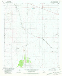
 1981 Loco Draw1981 Print · USGSLincoln County ranch lands are captured here in the early 1980s, showing a landscape defined by water management and open range. Researchers can trace the layout of the Mile High Ranch and locate remote livestock features like Barvel Lake and Twin Windmills.
 - 1981 Map of Yeso Mesa
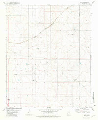
 1981 Yeso Mesa1981 Print · USGSDe Baca County ranch lands and rail sidings are frozen in time during the early 1980s. Genealogists and historians can trace the Atchison Topeka and Santa Fe line through Cardenas and locate family-named sites like Perez Ranch.
 - 1981 Map of Yeso Mesa SE
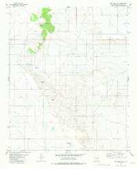 1981 Yeso Mesa SE1981 Print · USGSDe Baca County ranchlands are captured here in the mid-1970s, showing the intersection of high mesa terrain and essential water infrastructure. Trace the early pastoral development of the region through named landmarks like Johnson Windmill, Boney Well, and the C C Camp Windmill.
 - 1981 Map of Duoro, 1982 Print
 1981 Duoro1982 Print · USGSRanching and rail transport dominate this eastern New Mexico landscape in the early eighties. Genealogists and researchers can trace vital water sources and family-named landmarks like Byrd Ranch, Snell Well, and the remote station at Duoro.
 - 1984 Map of Santa Rosa, 1992 Print
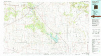 1984 Santa Rosa1992 Print · USGSEast-central New Mexico is captured here in the mid-1980s, centered on the strategic river crossing at Santa Rosa. Researchers can trace family-named landforms and small outposts like Puerto de Luna, Pastura, and the varied arroyos feeding into Lake Sumner.
End of results
Showing maps 1-5 of 5
Top cities of De Baca County
Frequently asked questions
- What are the different types of historical maps available for De Baca County?
- What is the oldest map of De Baca County?
- Where can I purchase historical maps of De Baca County for my home or office?
- Where can I download high-res historical maps of De Baca County?
- Are there historical topographic maps available for De Baca County?
- Is there historical aerial imagery available for De Baca County?
- Where are historical maps of De Baca County sourced from?