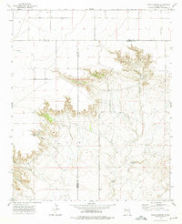
1973 Map of Peach Canyon
USGS Topo · Published 1975About this map
Peach Canyon Spring and Bull Tank Spring serve as critical water points in this arid stretch of eastern New Mexico where the high plains break into a network of steep escarpments. The landscape is defined by the convergence of Quay, De Baca, and Roosevelt counties, a remote ranching region marked by seasonal watercourses like Peach Canyon, Cottonwood Canyon, and the winding Sand Creek. Cultural details are sparse but significant, revealing a solitary Grave on the northern plateau and various evidence of resource extraction, including a Gravel Pit and scattered Drill Hole sites. The survey illustrates the stark transition between the flat upland mesas and the eroded breaks, where property and land use are guided by the availability of water at isolated wells and springs.
Find a feature on this map
12 named features on this map. Tap any name to fly to it.
Don’t see what you’re looking for? This feature index may not catch every label — zoom into the map to look around manually.
Map Details
Editions of this 1973 Peach Canyon Map
This is the sole edition of this map. No revisions or reprints were ever made.
Other maps of this area

1954 · Fort Sumner
USGS Topo · 1:250,000

1954 · Clovis
USGS Topo · 1:250,000

1958 · Fort Sumner
USGS Topo · 1:250,000

1958 · Clovis
USGS Topo · 1:250,000

1968 · Hassell
USGS Topo · 1:24,000

1968 · Candy Mesa
USGS Topo · 1:24,000

1968 · Taiban
USGS Topo · 1:24,000

1973 · Tolar
USGS Topo · 1:24,000

1973 · Krider
USGS Topo · 1:24,000

1973 · House
USGS Topo · 1:24,000