1950s Maps of Doña Ana County, New Mexico
Explore 33 historic maps of Doña Ana County from the 1950s. These maps offer a rare glimpse into what life looked like during the 1950s — showing old roads, neighborhoods, homes, and landmarks that have changed or disappeared over time.
Whether you're researching your family's past, planning a metal detecting trip, or studying how Doña Ana County's landscape evolved across the 1950s, these high-resolution maps are a powerful tool for exploring the history of this region.
- Focus on a specific era: All maps on this page are from the 1950s, giving you a focused view of this time period.
- See what’s changed: Compare century-old streets, trails, and buildings to today's modern landscape using overlays and satellite layers.
- Research with precision: Use these maps for genealogy, historical research, land use analysis, or educational projects.
- View, download, or print: Maps are fully viewable online in high resolution, and can be downloaded or printed for your own records.
Start exploring Doña Ana County's history through authentic maps from the 1950s. This is your window into the past.
Doña Ana County, NM maps
(33)- 1950 Map of Lake Lucero
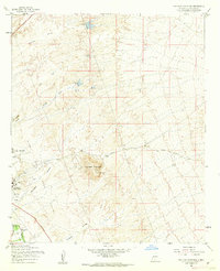
 1950 Lake Lucero1950 Print · USGSThe Tularosa Basin meets the high ridges of the San Andres Mountains at mid-century, where military testing grounds and wildlife refuges overlap. Researchers can find the site of Lucero Ranch, the expanse of Lake Lucero, and remote landmarks like Ash Canyon.
 - 1950 Map of Lake Lucero SW
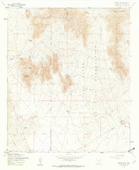
 1950 Lake Lucero SW1950 Print · USGSThe San Andres Mountains meet the military frontier of New Mexico in the early Cold War years. Genealogists and historians can trace isolated desert outposts like Saunders Ranch, Lathermans Well, and the SK White Ranch.
 - 1951 Map of Mt. Riley
 1951 Mt. Riley1951 Print · USGSThe high Chihuahuan Desert and international borderlands come into focus in the early twentieth century. Researchers can trace ranching history at Phillips Ranch and Cox Ranch or follow the path of the El Paso and Southwestern railroad.
 - 1952 Map of Parker Lake
 1952 Parker Lake1952 Print · USGSIn the mid-century New Mexico desert, military expansion and ranching heritage intersect within the Tularosa Basin. Researchers can trace early water management at Parker Lake and Old Bennett Tank or locate the historic Hall Ranch and White Sands settlement.
 - 1953 Map of El Paso
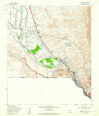
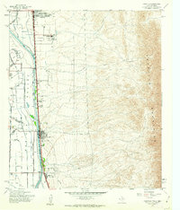
 1953 El Paso1953 Print · USGSEl Paso and the border region are shown here in the early fifties, documenting a landscape of shared river life and rising military presence. Genealogists and historians can trace rail-tied communities like Smeltertown, San Elizario, and the grounds of Fort Bliss.
 - 1954 Map of Tularosa, 1963 Print
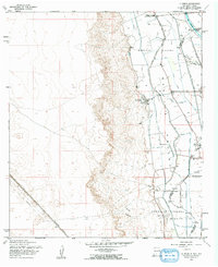
 1954 Tularosa1963 Print · USGSSouth-central New Mexico in the early fifties shows a landscape of desert basins and high peaks under heavy military and water-reclamation use. Trace the path of the Atchison Topeka and Santa Fe Railway past San Marcial and into the massive White Sands Proving Ground.4 unique versions available
 - 1955 Map of Tortugas Mountain, 1962 Print
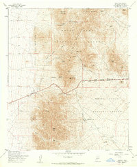
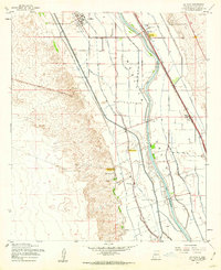
 1955 Tortugas Mountain1962 Print · USGSDona Ana County in the mid-fifties showcases a landscape of growing academic institutions and historic land colonies. Genealogists and historians can trace the foundations of New Mexico State College, the Fort Fillmore (Ruins), and the Tortugas Cem.2 unique versions available
 - 1955 Map of Bishop Cap, 1962 Print
 1955 Bishop Cap1962 Print · USGSSouthern New Mexico’s high desert and peaks are captured here in the mid-fifties, dominated by the northern Organ Mountains. Researchers can trace the early layout of the Fort Bliss Military Reservation and locate landmarks like Bishop Cap and the Dona Ana Range Camp.2 unique versions available
 - 1955 Map of Smeltertown, 1962 Print
 1955 Smeltertown1962 Print · USGSEl Paso and the borderlands are seen here in the mid-fifties, where industry and education meet the high desert. Researchers can trace the riverfront development of Smeltertown or locate historical sites like La Guna Cem and the University of Texas Western College.5 unique versions available
 - 1955 Map of Organ, 1962 Print
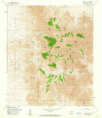
 1955 Organ1962 Print · USGSThe high desert landscape near Organ in the mid-fifties reveals a critical era of mining activity and military expansion. Genealogists and researchers can locate the Cem near Organ, or trace historic mining operations at the Empire Zinc Mine and Hilltop Mine.4 unique versions available
 - 1955 Map of Strauss, 1962 Print
 1955 Strauss1962 Print · USGSThe borderlands of southern New Mexico meet the Texas line in the mid-1950s, centered on the vital rail traffic of the southwest. Genealogists and rail historians can trace the Southern Pacific through Strauss, find the Santa Nina Ch, and follow the Old Railroad Grade near Mastodon.
 - 1955 Map of Canutillo, 1962 Print
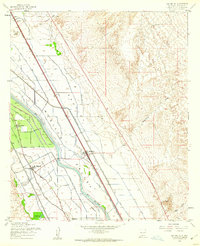
 1955 Canutillo1962 Print · USGSThe Mesilla Valley at the New Mexico-Texas border shows a desert landscape transformed by river engineering in the mid-1950s. Genealogists and historians can trace the rail-side growth of Canutillo and Anthony or locate the Federal Correctional Institution and Mt Zion Ch.4 unique versions available
 - 1955 Map of Anthony, 1962 Print
 1955 Anthony1962 Print · USGSThe Texas-New Mexico borderlands meet the slopes of the Franklin Mountains in the mid-fifties. Genealogists and historians can trace the irrigation canals of the Three Saints Lateral and locate local landmarks like La Purisima Ch and the Cemetery in Anthony.2 unique versions available
 - 1955 Map of Davies Tank, 1962 Print
 1955 Davies Tank1962 Print · USGSDona Ana County was a focal point of military expansion in the mid-fifties, dominated by defense reservations and arid basin landscapes. Researchers can trace the boundaries of the White Sands Proving Ground and locate desert landmarks like Condron Air Force Auxiliary Field or Davies Tank.3 unique versions available
 - 1955 Map of Organ Peak, 1962 Print
 1955 Organ Peak1962 Print · USGSThe high peaks of the New Mexico desert meet mid-century defense infrastructure in the mid-fifties. Researchers can trace historical sites like the Hayner Resort, the Modoc Mine, and vital water sources such as Aguirre Spring and Dripping Springs.3 unique versions available
 - 1955 Map of San Miguel, 1962 Print
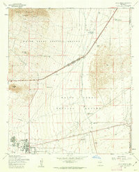
 1955 San Miguel1962 Print · USGSThe Mesilla Valley thrived as a corridor of irrigation and rail commerce during the mid-fifties. Genealogists can trace family footprints through the Santo Tomas de Yturbide Colony and settlements like San Miguel and Mesquite.2 unique versions available
 - 1955 Map of Newman NW, 1962 Print
 1955 Newman NW1962 Print · USGSThe eastern slopes of the Organ Mountains met the desert training grounds of the mid-fifties at the edge of Otero County. Researchers can locate infrastructure like the Airway Beacon and topographic landmarks such as Old Coe Lake and the Black Hills.3 unique versions available
 - 1955 Map of La Union, 1962 Print
 1955 La Union1962 Print · USGSThe Mesilla Valley landscape comes alive in this mid-fifties study of the irrigated corridor south of Las Cruces. Genealogists and local historians can trace the foundations of La Union, the Refugio Colony, and rural landmarks like St Lukes Ch and Central Sch.2 unique versions available
 - 1955 Map of La Mesa, 1962 Print
 1955 La Mesa1962 Print · USGSThe Mesilla Valley during the mid-fifties reveals a landscape defined by Rio Grande irrigation and the Atchison Topeka and Santa Fe line. Researchers can locate the site of Chamberino (Old Town) and rural landmarks like San Luis Ch and Berino Siding.2 unique versions available
 - 1955 Map of Newman SW, 1962 Print
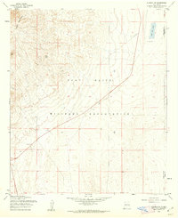
 1955 Newman SW1962 Print · USGSThe high desert borderlands of New Mexico and Texas are revealed in the mid-1950s as they functioned under military and ranching use. Genealogists and historians can trace remote desert landmarks like Quake Lake, a small Cem, and isolated sites such as Jessie Well and local Ruins.
 - 1955 Map of White Sands, 1962 Print
 1955 White Sands1962 Print · USGSWhite Sands at the height of the mid-century Cold War reveals a landscape dedicated to military testing and desert survival. Researchers can trace the development of the White Sands Proving Ground and locate landmarks like Parker Station, the Bonney Spring Mine, and the unique Landing Strip in Road.2 unique versions available
 - 1955 Map of Organ Peak NW, 1962 Print
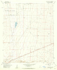 1955 Organ Peak NW1962 Print · USGSSouthern New Mexico’s high desert is captured here in the mid-fifties, showing the intersection of scientific research and military land use. Researchers can trace essential water infrastructure across the Jornada basin through features like Isaack Lake, Petts Tank, and Washington Tank.2 unique versions available
 - 1955 Map of Las Cruces, 1963 Print
 1955 Las Cruces1963 Print · USGSSouthern New Mexico comes into focus during the mid-fifties, showing the growth of Las Cruces alongside major military and scientific installations. Genealogists and historians can trace the Southern Pacific tracks through small rail towns like Cambray and Afton, or locate family sites near Hatch and Deming.3 unique versions available
 - 1956 Map of Parker Lake
 1956 Parker Lake1956 Print · USGSThe Doña Ana desert comes alive in the mid-1950s as military infrastructure expanded across the foothills of Buck Mountain. Trace the early development of White Sands and remote sites like Hall Ranch or the Bonney Spring Mine.
 - 1958 Map of Las Cruces
 1958 Las Cruces1958 Print · USGSSouthern New Mexico in the late fifties was a landscape of rapid scientific and military growth centered on the Rio Grande. Local historians can trace the development of Las Cruces, the campus of New Mexico A and M College, and remote rail sidings like Aden Siding.
Showing maps 1-25 of 33
Top cities of Doña Ana County
- Las Cruces historical maps
- Sunland Park historical maps
- Chaparral historical maps
- Anthony, NM historical maps
- Santa Teresa historical maps
- Mesilla historical maps
See more
Frequently asked questions
- What are the different types of historical maps available for Doña Ana County?
- What is the oldest map of Doña Ana County?
- Where can I purchase historical maps of Doña Ana County for my home or office?
- Where can I download high-res historical maps of Doña Ana County?
- Are there historical topographic maps available for Doña Ana County?
- Is there historical aerial imagery available for Doña Ana County?
- Where are historical maps of Doña Ana County sourced from?