1960s Maps of Doña Ana County, New Mexico
Explore 6 historic maps of Doña Ana County from the 1960s. These maps offer a rare glimpse into what life looked like during the 1960s — showing old roads, neighborhoods, homes, and landmarks that have changed or disappeared over time.
Whether you're researching your family's past, planning a metal detecting trip, or studying how Doña Ana County's landscape evolved across the 1960s, these high-resolution maps are a powerful tool for exploring the history of this region.
- Focus on a specific era: All maps on this page are from the 1960s, giving you a focused view of this time period.
- See what’s changed: Compare century-old streets, trails, and buildings to today's modern landscape using overlays and satellite layers.
- Research with precision: Use these maps for genealogy, historical research, land use analysis, or educational projects.
- View, download, or print: Maps are fully viewable online in high resolution, and can be downloaded or printed for your own records.
Start exploring Doña Ana County's history through authentic maps from the 1960s. This is your window into the past.
Doña Ana County, NM maps
(6)- 1961 Map of Nutt, 1964 Print
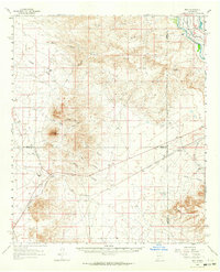 1961 Nutt1964 Print · USGSThe high desert at the meeting of Sierra, Dona Ana, and Luna counties is captured here in the early sixties as the rail-and-ranch economy shaped the landscape. Trace family history at North Cem or Duncan Ranch, and follow the old Atchison Topeka and Santa Fe line past Nutt.2 unique versions available
 - 1961 Map of Garfield, 1964 Print
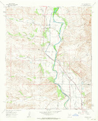 1961 Garfield1964 Print · USGSThe Rio Grande valley in southern New Mexico during the early sixties reveals a landscape shaped by massive irrigation projects. Researchers can trace family homesteads and local infrastructure through labels like San Isidro Sch, Percha Dam, and John Trujillo Windmill.2 unique versions available
 - 1964 Map of El Paso
 1964 El Paso1964 Print · USGSThe El Paso and Juarez borderlands are shown in detail during the mid-sixties, from the urban center to the remote volcanic craters of the West Potrillo Mountains. Trace the rail-and-river network through Asarco Smeltertown, the Fort Bliss Military Reservation, and Columbus.
 - 1965 Map of El Paso
 1965 El Paso1965 Print · USGSEl Paso and the Mesilla Valley are shown in the mid-1960s as the region's military and transport infrastructure expanded. Researchers can trace the irrigation network along the Rio Grande, find old border stations like Columbus, and locate Hueco Tanks.
 - 1965 Map of Camel Mountain, 1967 Print
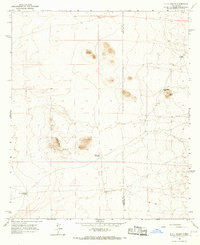
 1965 Camel Mountain1967 Print · USGSThe Chihuahuan Desert along the international boundary in the mid-1960s shows a landscape defined by ranching and old industrial corridors. Researchers can trace the Old Railroad Grade past Birchfield Ranch and identify early mining prospects near Camel Mountain.
 - 1965 Map of P O L Ranch, 1967 Print
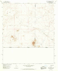
 1965 P O L Ranch1967 Print · USGSThe High Desert along the border of Luna and Dona Ana counties was a landscape of remote cattle operations in the mid-sixties. Trace the locations of P O L Ranch, family-named water sources like Birchfield Well, and the Prospect mine.
End of results
Showing maps 1-6 of 6
Top cities of Doña Ana County
- Las Cruces historical maps
- Sunland Park historical maps
- Chaparral historical maps
- Anthony, NM historical maps
- Santa Teresa historical maps
- Mesilla historical maps
See more
Frequently asked questions
- What are the different types of historical maps available for Doña Ana County?
- What is the oldest map of Doña Ana County?
- Where can I purchase historical maps of Doña Ana County for my home or office?
- Where can I download high-res historical maps of Doña Ana County?
- Are there historical topographic maps available for Doña Ana County?
- Is there historical aerial imagery available for Doña Ana County?
- Where are historical maps of Doña Ana County sourced from?