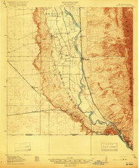
1910s Maps of Doña Ana County, New Mexico
Explore 10 historic maps of Doña Ana County from the 1910s. These maps offer a rare glimpse into what life looked like during the 1910s — showing old roads, neighborhoods, homes, and landmarks that have changed or disappeared over time.
Whether you're researching your family's past, planning a metal detecting trip, or studying how Doña Ana County's landscape evolved across the 1910s, these high-resolution maps are a powerful tool for exploring the history of this region.
- Focus on a specific era: All maps on this page are from the 1910s, giving you a focused view of this time period.
- See what’s changed: Compare century-old streets, trails, and buildings to today's modern landscape using overlays and satellite layers.
- Research with precision: Use these maps for genealogy, historical research, land use analysis, or educational projects.
- View, download, or print: Maps are fully viewable online in high resolution, and can be downloaded or printed for your own records.
Start exploring Doña Ana County's history through authentic maps from the 1910s. This is your window into the past.
Doña Ana County, NM maps
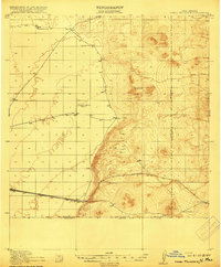
(10)- 1916 Map of Tonuco
 1916 Tonuco1916 Print · USGSDona Ana and Socorro counties are shown during the mid-1910s, capturing a landscape of isolated desert ranches and railroad stops. Genealogists can trace family outposts and water sources such as Flat Lake Ranch, Baird's Ranch, and Red Lake well.
 - 1916 Map of Tularosa
 1916 Tularosa1916 Print · USGSNew Mexico ranching and railroading define this pre-war survey of the valley during its early years of statehood. Genealogists and historians can trace family landholdings at Jackson Ranch and Chosa Ranch or follow the path of the El Paso and Southwestern railroad.2 unique versions available
 - 1916 Map of Point Of Sands
 1916 Point Of Sands1916 Print · USGSThe Tularosa Basin in the years before the Great War was a world of remote cattle ranches and alkali plains. Researchers can trace the heritage of the Tularosa frontier through family landmarks like Pelman Ranch, Bairds Wells, and the Eddy Soda Prospect.2 unique versions available
 - 1917 Map of Camel Mountain
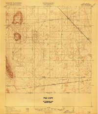
 1917 Camel Mountain1917 Print · USGSThe high desert along the New Mexico-Mexico border comes into focus during the early twentieth century. Genealogists and historians can trace isolated homesteads such as Engle and Minor Ranch and the railroad siding at Arena along the El Paso and Southwestern line.2 unique versions available
 - 1917 Map of Canutillo, 1957 Print
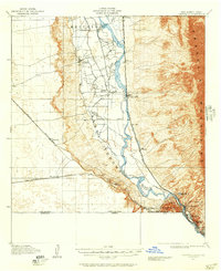 1917 Canutillo1957 Print · USGSThe Rio Grande valley and the international border come to life in this survey from the early twentieth century. Genealogists and researchers can trace the rail-and-river economy through old stations like Strauss, local landmarks like La Vista School, and the industrial Smelter district.
 - 1917 Map of Noria, 1963 Print
 1917 Noria1963 Print · USGSSouthern New Mexico’s high desert was a remote ranching and rail frontier in the years following the border conflicts. Genealogists and historians can trace rail stops like Noria and Lanark or find the locations of Herrington's Home Ranch.
 - 1917 Map of Mt. Riley, 1974 Print
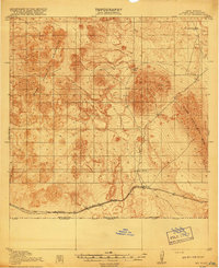
 1917 Mt. Riley1974 Print · USGSDona Ana County ranch lands and volcanic peaks are captured here in the years before the Great War. Genealogists and historians can trace the early path of the El Paso and Southwestern railroad and locate family outposts like Phillips Ranch and Cox Ranch.
 - 1918 Map of Mt. Riley
 1918 Mt. Riley1918 Print · USGSSouthern New Mexico was a critical frontier during the Great War, characterized by strategic rail lines and remote desert ranches. Researchers can trace the path of the El Paso and Southwestern railroad and locate family landmarks like Phillips Ranch or Cox Ranch.2 unique versions available
 - 1918 Map of Noria
 1918 Noria1918 Print · USGSSouthern New Mexico was a critical rail and ranching corridor during the early twentieth century. Researchers can trace the path of the Southern Pacific railroad through desert outposts like Lanark and the family-owned Herringtons Home Ranch.2 unique versions available
 - 1919 Map of Canutillo
 1919 Canutillo1919 Print · USGSThe Rio Grande valley at the Texas and New Mexico border comes to life in this survey from just after the Great War. Genealogists and historians can trace family-named locations and early institutions like La Vista School, the Smelter, and West El Paso PO.3 unique versions available
End of results
Showing maps 1-10 of 10
Top cities of Doña Ana County
- Las Cruces historical maps
- Sunland Park historical maps
- Chaparral historical maps
- Anthony, NM historical maps
- Santa Teresa historical maps
- Mesilla historical maps
See more
Frequently asked questions
- What are the different types of historical maps available for Doña Ana County?
- What is the oldest map of Doña Ana County?
- Where can I purchase historical maps of Doña Ana County for my home or office?
- Where can I download high-res historical maps of Doña Ana County?
- Are there historical topographic maps available for Doña Ana County?
- Is there historical aerial imagery available for Doña Ana County?
- Where are historical maps of Doña Ana County sourced from?