1990s Maps of Doña Ana County, New Mexico
Explore 55 historic maps of Doña Ana County from the 1990s. These maps offer a rare glimpse into what life looked like during the 1990s — showing old roads, neighborhoods, homes, and landmarks that have changed or disappeared over time.
Whether you're researching your family's past, planning a metal detecting trip, or studying how Doña Ana County's landscape evolved across the 1990s, these high-resolution maps are a powerful tool for exploring the history of this region.
- Focus on a specific era: All maps on this page are from the 1990s, giving you a focused view of this time period.
- See what’s changed: Compare century-old streets, trails, and buildings to today's modern landscape using overlays and satellite layers.
- Research with precision: Use these maps for genealogy, historical research, land use analysis, or educational projects.
- View, download, or print: Maps are fully viewable online in high resolution, and can be downloaded or printed for your own records.
Start exploring Doña Ana County's history through authentic maps from the 1990s. This is your window into the past.
Doña Ana County, NM maps
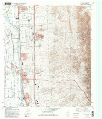
(55)- 1994 Map of Smeltertown
 1994 Smeltertown1994 Print · USGSEl Paso and the international borderlands come alive in the 1990s as industry and education reshape the river valley. Trace the legacy of the Copper Smelter in Smeltertown, locate old family sites near La Calavera, and follow the American Canal.
 - 1994 Map of Strauss
 1994 Strauss1994 Print · USGSThe Chihuahuan Desert meets the international border in the early nineties, revealing a landscape shaped by aviation and rail. Trace the transition from the arid Strauss uplands to the Mesilla Valley via the Southern Pacific and an Old Railroad Grade.
 - 1995 Map of Canutillo
 1995 Canutillo1995 Print · USGSThe Rio Grande valley meets the high desert in the mid-1990s as suburban and institutional development spreads along the Texas and New Mexico border. Researchers can trace the rail corridor of the Atchison Topeka and Santa Fe RR and locate landmarks like the La Tuna Federal Correctional Institution and Aztec Caves.2 unique versions available
 - 1995 Map of La Union
 1995 La Union1995 Print · USGSThe Mesilla Valley river corridor comes into sharp focus in the mid-1990s as it straddles the border between New Mexico and Texas. Local researchers can trace family landmarks and civic roots at St Lukes Ch, the Cem at La Union, and the Gadsden High Sch campus.
 - 1996 Map of Afton NW, 2001 Print
 1996 Afton NW2001 Print · USGSThe high desert of southern New Mexico appears in the late nineties as a landscape defined by survey geometry and industrial utility. Genealogists and historians can trace the New Mexico Principal Meridian and the paths of several desert Pipelines.
 - 1996 Map of Black Mesa, 2001 Print
 1996 Black Mesa2001 Print · USGSThe Mesilla Valley during the late twentieth century reveals a highly engineered landscape of colonial tracts and irrigation canals. Researchers can trace land grants like the Mesilla Civil Colony and local landmarks such as Stahmann Farms Airfield.
 - 1996 Map of Sleeping Lady Hills, 2001 Print
 1996 Sleeping Lady Hills2001 Print · USGSThe high desert of Doña Ana County in the mid-1990s is captured here, showing a landscape shaped by ranching and old western routes. Researchers can trace the path of a Historic Trail or locate remote landmarks like Reichey Butte and Rough and Ready Gap.
 - 1996 Map of Upham Hills, 2001 Print
 1996 Upham Hills2001 Print · USGSSierra and Dona Ana counties appear in the 1990s as a high-desert landscape centered on cattle ranching and rugged landforms. Local historians can trace water infrastructure and remote outposts like Flat Lake Ranch, Chicken Well, and Pot Hole Tank.
 - 1996 Map of Sierra Alta, 2001 Print
 1996 Sierra Alta2001 Print · USGSThe Rio Grande corridor north of Las Cruces appears here in the mid-1990s, revealing a landscape of desert ranching and river-fed irrigation. Genealogists and historians can locate established sites like Sierra Alta Ranch, Kimball Place, and the Tonuco Bridge.
 - 1996 Map of Alivio, 2001 Print
 1996 Alivio2001 Print · USGSSouthern New Mexico’s high desert landscape is documented here in the mid-1990s, where the Sierra and Doña Ana county line crosses rugged terrain. Researchers can locate remote water sources like Upside Down Tank and trace the rail corridor through Alivio near the prominent Point of Rocks.
 - 1996 Map of Afton, 2001 Print
 1996 Afton2001 Print · USGSThe high desert of Doña Ana County is captured here in the mid-nineties, showing a landscape defined by volcanic geology and rail transport. Researchers can trace the desert infrastructure around Afton and Rutter, or locate water sources like Norwood Well near the edge of The Malpais.
 - 1996 Map of Organ Peak, 2001 Print
 1996 Organ Peak2001 Print · USGSThe high desert of Doña Ana County is captured here in the mid-1990s as recreation and military interests converged. Genealogists and historians can trace old access routes like Soledad Road, the location of Hayner Resort, and the historic Modoc Mine.
 - 1996 Map of Bishop Cap, 2001 Print
 1996 Bishop Cap2001 Print · USGSDoña Ana County's high desert peaks and military boundaries are captured here in the mid-1990s as the landscape transitions from recreation to range. Trace early ranching and mining sites like Mosey Tank, the Hiebert Mine, and the Dona Ana Range Camp.
 - 1996 Map of Mount Aden, 2001 Print
 1996 Mount Aden2001 Print · USGSDona Ana County ranching and volcanic terrain are captured in the late nineties, centered on the West Potrillo Mountains. Researchers can locate isolated ranch sites like the Lazy E Ranch and historic water stops such as R R Tank near Aden.
 - 1996 Map of Aden Crater, 2001 Print
 1996 Aden Crater2001 Print · USGSThe volcanic landscape of Doña Ana County is captured here in the late twentieth century, showing the rugged basalt flows of The Malpais. Researchers can trace remote ranching infrastructure like Johnson Tank and the landmark Aden Crater Volcano.
 - 1996 Map of Prisor Well, 2001 Print
 1996 Prisor Well2001 Print · USGSSierra and Dona Ana counties appear in the late 1990s as a landscape defined by water scarcity and federal land boundaries. Researchers can locate remote ranching outposts and infrastructure like Renick Well, Martin Tank, and Blackshire Draw.
 - 1996 Map of Little Black Mountain, 2001 Print
 1996 Little Black Mountain2001 Print · USGSDoña Ana County ranching and utility infrastructure are preserved here in the mid-1990s. Researchers can trace land use through landmarks like Nunn Ranch, the Afton Pumping Sta, and mineral Prospects near Black Mountain.
 - 1996 Map of Souse Springs, 2001 Print
 1996 Souse Springs2001 Print · USGSDona Ana County ranching and rugged desert peaks define this area in the mid-nineties. Genealogists and historians can trace isolated desert outposts and water sources like Las Uvas Ranch, Souse Springs, and Escondido Ranch.
 - 1996 Map of Aden Hills, 2001 Print
 1996 Aden Hills2001 Print · USGSSouthern New Mexico desert life and industry are captured here during the mid-nineties. Trace the infrastructure of the high desert through the small settlement of Aden, the Aden Hills, and local ranching markers like Indian Tank and a Corral.
 - 1996 Map of Mount Aden SW, 2001 Print
 1996 Mount Aden SW2001 Print · USGSThe southern New Mexico desert is revealed in this mid-nineties study of the volcanic landscape near the Mexican border. Genealogists and desert historians can locate specific ranching infrastructure and natural landmarks like the Corral, Salty Tank, and the Sinkhole.
 - 1996 Map of Magdalena Peak, 2001 Print
 1996 Magdalena Peak2001 Print · USGSArid ranching lands in Doña Ana County are documented here during the late twentieth century. Genealogists and local historians can trace the network of water features like Miguel Tanks and Cahoon Tank surrounding the prominent Magdalena Peak.
 - 1996 Map of Hockett, 2002 Print
 1996 Hockett2002 Print · USGSArid grazing lands and high-desert ranges define this mid-1990s region at the intersection of three counties. Genealogists and historians can trace the remote settlement of Hockett or locate infrastructure like the Sub Sta and the Gravel Pit near Horse Canyon.
 - 1996 Map of Smeltertown, 2002 Print
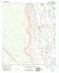
 1996 Smeltertown2002 Print · USGSEl Paso and its neighbors in New Mexico and Mexico are shown in detail during the late nineties, showcasing the area's dense urban and industrial infrastructure. Genealogists and local historians can trace the foundations of Smeltertown, locate Memory Gardens Cem, and find local institutions like the University of Texas at El Paso.
 - 1996 Map of Thorn Well, 2002 Print
 1996 Thorn Well2002 Print · USGSThe high-desert ranching lands of Doña Ana County are shown here as they appeared in the mid-1990s. Local researchers can locate isolated water sources and industrial markers like Thorn Well, South Well, and the Detroit Tank.
 - 1996 Map of San Andres Peak, 2002 Print
 1996 San Andres Peak2002 Print · USGSThe high San Andres Mountains of New Mexico appear here during the late twentieth century as a hub of federal research and defense. Researchers can trace historic water sources and land use through landmarks like Sewell Well, Goldenburg Springs, and the Mines near Lead Camp Canyon.
Showing maps 1-25 of 55
Top cities of Doña Ana County
- Las Cruces historical maps
- Sunland Park historical maps
- Chaparral historical maps
- Anthony, NM historical maps
- Santa Teresa historical maps
- Mesilla historical maps
See more
Frequently asked questions
- What are the different types of historical maps available for Doña Ana County?
- What is the oldest map of Doña Ana County?
- Where can I purchase historical maps of Doña Ana County for my home or office?
- Where can I download high-res historical maps of Doña Ana County?
- Are there historical topographic maps available for Doña Ana County?
- Is there historical aerial imagery available for Doña Ana County?
- Where are historical maps of Doña Ana County sourced from?