1980s Maps of Doña Ana County, New Mexico
Explore 48 historic maps of Doña Ana County from the 1980s. These maps offer a rare glimpse into what life looked like during the 1980s — showing old roads, neighborhoods, homes, and landmarks that have changed or disappeared over time.
Whether you're researching your family's past, planning a metal detecting trip, or studying how Doña Ana County's landscape evolved across the 1980s, these high-resolution maps are a powerful tool for exploring the history of this region.
- Focus on a specific era: All maps on this page are from the 1980s, giving you a focused view of this time period.
- See what’s changed: Compare century-old streets, trails, and buildings to today's modern landscape using overlays and satellite layers.
- Research with precision: Use these maps for genealogy, historical research, land use analysis, or educational projects.
- View, download, or print: Maps are fully viewable online in high resolution, and can be downloaded or printed for your own records.
Start exploring Doña Ana County's history through authentic maps from the 1980s. This is your window into the past.
Doña Ana County, NM maps
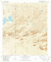
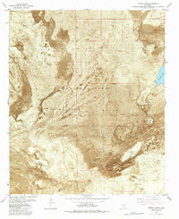
(48)- 1981 Map of Gilmore Draw
 1981 Gilmore Draw1981 Print · USGSThe high desert of Doña Ana County in the early eighties reveals a landscape of cattle ranching and military research. Genealogists and historians can trace the water infrastructure of Hills Ranch and the isolated House Pasture Windmill near the White Sands Missile Range.
 - 1981 Map of Fleck Draw
 1981 Fleck Draw1981 Print · USGSThe northern Chihuahuan Desert in the early eighties shows a unique overlap of military and agricultural research lands. Researchers can trace remote desert outposts and water infrastructure like Fleck Ranch, Britton Camp, and Cedar Well.
 - 1981 Map of San Andres Peak
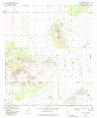
 1981 San Andres Peak1981 Print · USGSDona Ana County in the early 1980s reveals a high-desert landscape managed for wildlife and missile testing. Researchers can trace the location of vital water sources like Ropes Spring and Lead Camp Spring among the peaks of the San Andres National Wildlife Refuge.
 - 1981 Map of Gardner Peak
 1981 Gardner Peak1981 Print · USGSThe high desert of Doña Ana County in the early 1980s reveals a unique landscape of military testing and wildlife conservation. Researchers and genealogists can locate vital water sources like San Andrecito Spring and remote landmarks including Gardner Peak and Oñate Mountain.
 - 1981 Map of Columbus
 1981 Columbus1981 Print · USGSSouthern New Mexico’s borderlands are detailed here in the early eighties, centered on the historic village of Columbus. Researchers can trace the legacy of mining and transit through the Mahoney Mines, the Old Railroad Grade, and the grounds of Pancho Villa State Park.
 - 1981 Map of Prisor Well
 1981 Prisor Well1981 Print · USGSSierra and Dona Ana counties are seen in the early eighties as a landscape of remote ranching outposts and military restricted zones. Researchers can trace historic water sources and backcountry routes through Prisor Well, the CCC Tank, and Lyons Draw.
 - 1981 Map of Tularosa
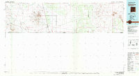
 1981 Tularosa1981 Print · USGSThe high-desert basin around Tularosa is captured here in the early eighties as a hub of military and rail activity. Trace the Southern Pacific line past Three Rivers or explore the vast White Sands Missile Range.2 unique versions available
 - 1981 Map of Hembrillo Basin
 1981 Hembrillo Basin1981 Print · USGSThe high desert of Sierra and Doña Ana Counties is captured here in the early eighties, showcasing the intersection of ranching history and military activity. Researchers can trace land use through Blackshire, Upper Hembrillo Spring, and the landmark Victorio Peak.
 - 1981 Map of Goldenburg Draw
 1981 Goldenburg Draw1981 Print · USGSDoña Ana County at the dawn of the eighties reveals a specialized desert landscape shared by agricultural scientists and aerospace engineers. Researchers can trace remote water sources like Wooten Well and the high-tech boundaries of the White Sands Test Facility (NASA).
 - 1981 Map of Hembrillo Canyon, 1982 Print
 1981 Hembrillo Canyon1982 Print · USGSThe high San Andres Mountains meet the military frontier in the early 1980s, revealing a landscape of remote mines and vital springs. Researchers can trace the old workings of the Pioneer Mine, locate Hospital Spring, and follow the boundary of the White Sands Missile Range.
 - 1981 Map of Bear Peak, 1982 Print
 1981 Bear Peak1982 Print · USGSThe high desert of Doña Ana County appears here as a specialized landscape of research and defense during the early eighties. Researchers can trace the overlap of the Jornada Experimental Range and White Sands Missile Range through landmarks like San Nicholas Camp and Bear Peak.
 - 1981 Map of Bennett Mountain, 1982 Print
 1981 Bennett Mountain1982 Print · USGSThe high desert of the San Andres Mountains meets the military frontiers of New Mexico during the early eighties. Genealogists and desert historians can locate isolated water sources and early landmarks like San Nicolas Spring, Letherman Well, and the Observation Tower.
 - 1981 Map of Upham Hills, 1982 Print
 1981 Upham Hills1982 Print · USGSHigh desert ranching and water management are the focus of this early 1980s survey along the Sierra and Doña Ana county line. Researchers can locate family-named sites like Flat Lake Ranch and trace vital water sources including Chicken Well and Pot Hole Tank.
 - 1982 Map of Summerford Mountain
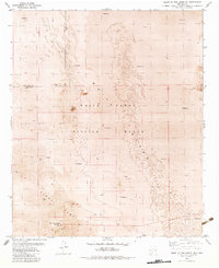
 1982 Summerford Mountain1982 Print · USGSDona Ana County research lands are captured here in the early eighties, showcasing a landscape defined by institutional ranching and desert study. Trace the layout of the Animal Science Ranch and landmarks like Summerford Mountain.2 unique versions available
 - 1982 Map of Thorn Well
 1982 Thorn Well1982 Print · USGSDoña Ana County was a landscape of remote ranching outposts and mineral prospecting in the early eighties. Researchers can trace historic water sources like Thorn Well and Caliche Tank alongside the network of desert Jeep Trails.
 - 1982 Map of Heart of the Sands NW
 1982 Heart of the Sands NW1982 Print · USGSThe Tularosa Basin desert during the early eighties served as a critical testing ground for the American space program. Researchers can trace the layout of the White Sands Space Harbor, its primary Control Tower, and several extensive Landing Strips.
 - 1982 Map of Fifteenmile Lake
 1982 Fifteenmile Lake1982 Print · USGSThe Tularosa Basin in the early eighties reveals a landscape of active dunes and military restricted zones. Researchers can trace the boundaries of White Sands Missile Range and locate landmarks like Big Salt Lake and Fifteenmile Lake.2 unique versions available
 - 1982 Map of Heart of the Sands NE
 1982 Heart of the Sands NE1982 Print · USGSThe Tularosa Basin in the early 1980s reveals a landscape defined by desert dunes and military testing facilities. Researchers can trace the perimeter of Alkali Flat and locate technical sites like Ratscat and the network of rugged Jeep Trails.
 - 1982 Map of Heart of the Sands SW
 1982 Heart of the Sands SW1982 Print · USGSThe Tularosa Basin's desert floor is captured in the early eighties, revealing the vast gypsum dunes and military land use. Trace the boundaries of White Sands National Monument and the shoreline of Lake Lucero alongside features like Andrecito Creek.
 - 1982 Map of Selden Canyon
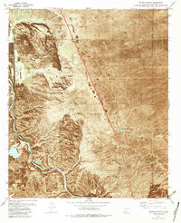 1982 Selden Canyon1982 Print · USGSThe southern Rincon Valley comes alive in the early eighties as the rail line follows the river's bend through the desert. Local researchers can trace the rail corridor of the Atchison Topeka and Santa Fe or locate isolated landmarks like Lytton Well and the community of Radium Springs.2 unique versions available
 - 1982 Map of White Sands
 1982 White Sands1982 Print · USGSNew Mexico's high desert reveals its complex military and scientific heritage during the early eighties, from the gypsum dunes to the missile ranges. Researchers can trace the massive boundaries of White Sands National Monument and locate the White Sands Test Facility (NASA) among the rugged San Andres Mountains.
 - 1982 Map of Lumley Lake
 1982 Lumley Lake1982 Print · USGSThe Tularosa Basin in the early eighties reveals a stark landscape of military testing grounds and ancient salt beds. Trace water sources and military sites like Alkali Spring, Lumley Lake, and the SW 50 Site across the gypsum dunes.2 unique versions available
 - 1982 Map of Selden Canyon NE
 1982 Selden Canyon NE1982 Print · USGSDoña Ana County was a hub for range research and ranching in the early eighties. Genealogists and historians can trace the specific locations of rural infrastructure like Wagoner Well, Red Lake Well, and the family-named Cassady Tank.
 - 1982 Map of Hatch
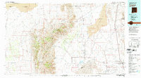
 1982 Hatch1982 Print · USGSThe Rio Grande valley and the rugged Mimbres Mountains meet in this early 1980s overview of southern New Mexico. Researchers can trace the path of the Atchison Topeka and Santa Fe railroad or locate historic mining hubs like Hillsboro and Lake Valley.
 - 1982 Map of Las Cruces
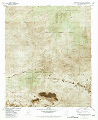
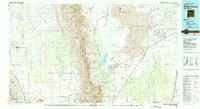
 1982 Las Cruces1982 Print · USGSThe Rio Grande valley and the Organ Mountains define this 1980s portrait of southern New Mexico's ranching and military landscape. Trace historic land divisions like the Brazito Grant alongside landmarks such as Santo Tomas and the Silver King Mine.
Showing maps 1-25 of 48
Top cities of Doña Ana County
- Las Cruces historical maps
- Sunland Park historical maps
- Chaparral historical maps
- Anthony, NM historical maps
- Santa Teresa historical maps
- Mesilla historical maps
See more
Frequently asked questions
- What are the different types of historical maps available for Doña Ana County?
- What is the oldest map of Doña Ana County?
- Where can I purchase historical maps of Doña Ana County for my home or office?
- Where can I download high-res historical maps of Doña Ana County?
- Are there historical topographic maps available for Doña Ana County?
- Is there historical aerial imagery available for Doña Ana County?
- Where are historical maps of Doña Ana County sourced from?