2020s Maps of Las Cruces, New Mexico
Explore 12 historic maps of Las Cruces from the 2020s. These maps offer a rare glimpse into what life looked like during the 2020s — showing old roads, neighborhoods, homes, and landmarks that have changed or disappeared over time.
Whether you're researching your family's past, planning a metal detecting trip, or studying how Las Cruces's landscape evolved across the 2020s, these high-resolution maps are a powerful tool for exploring the history of this region.
- Focus on a specific era: All maps on this page are from the 2020s, giving you a focused view of this time period.
- See what’s changed: Compare century-old streets, trails, and buildings to today's modern landscape using overlays and satellite layers.
- Research with precision: Use these maps for genealogy, historical research, land use analysis, or educational projects.
- View, download, or print: Maps are fully viewable online in high resolution, and can be downloaded or printed for your own records.
Start exploring Las Cruces's history through authentic maps from the 2020s. This is your window into the past.
Las Cruces, NM maps
(12)- 2020 Map of Afton NW, 2020 Print
 2020 Afton NW2020 Print · USGSCovers Las Cruces, including Doña Ana County, United States, and other nearby areas
 - 2020 Map of Dona Ana, 2020 Print
 2020 Dona Ana2020 Print · USGSCovers Las Cruces, including Doña Ana, Hill, and other nearby areas
 - 2020 Map of Tortugas Mountain, 2020 Print
 2020 Tortugas Mountain2020 Print · USGSCovers Las Cruces, including University Park, Doña Ana County, and other nearby areas
 - 2020 Map of Picacho Mountain, 2020 Print
 2020 Picacho Mountain2020 Print · USGSCovers Las Cruces, including Doña Ana County, United States, and other nearby areas
 - 2020 Map of Las Cruces, 2020 Print
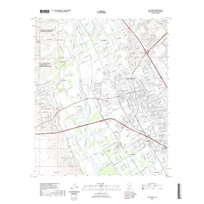 2020 Las Cruces2020 Print · USGSCovers Las Cruces, including Mesilla, Tortugas, and other nearby areas
 - 2020 Map of Organ Peak NW, 2020 Print
 2020 Organ Peak NW2020 Print · USGSCovers Las Cruces, including Butterfield Park, Doña Ana County, and other nearby areas
 - 2023 Map of Afton NW, 2023 Print
 2023 Afton NW2023 Print · USGSIn the high desert of Doña Ana County during the early 2020s, the landscape is defined by long county roads and the expanding reach of Las Cruces. Researchers can trace the survey lines of Township 24 South Range 1 West and locate transport routes like Afton Rd.
 - 2023 Map of Tortugas Mountain, 2023 Print
 2023 Tortugas Mountain2023 Print · USGSThe eastern edges of the Mesilla Valley come into focus in 2023, showing the suburban growth of Las Cruces against the desert. Researchers can trace local history through sites like Tortugas Cem, University Park, and the landmark Tortugas Mountain.
 - 2023 Map of Picacho Mountain, 2023 Print
 2023 Picacho Mountain2023 Print · USGSThe high desert west of Las Cruces comes into focus during this modern era of conservation and suburban growth. Researchers can trace the perimeter of the Las Cruces International Airport or explore the rugged canyons of the Prehistoric Trackways National Monument and Picacho Mountain.
 - 2023 Map of Organ Peak NW, 2023 Print
 2023 Organ Peak NW2023 Print · USGSThe eastern fringes of the Las Cruces area are documented in the 2020s as residential growth meets protected desert lands. Genealogists and researchers can trace local developments like Spaceport City and Butterfield Park alongside landmarks such as Baylor Canyon and Hiblar Tank.
 - 2023 Map of Las Cruces, 2023 Print
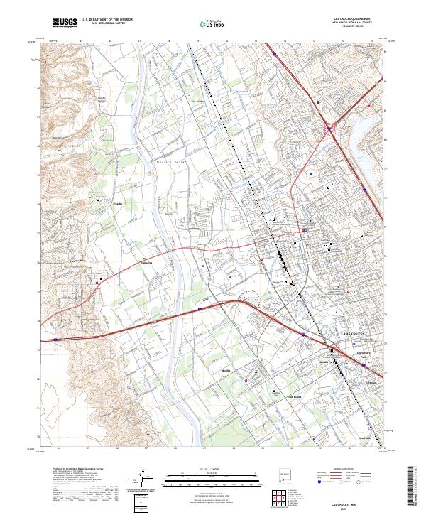 2023 Las Cruces2023 Print · USGSThe Mesilla Valley comes into focus in this contemporary survey of the Rio Grande corridor as it transitions from desert mountains to agricultural heartland. Researchers can trace intricate water systems like the Leasburg Canal or locate memorial sites such as Barela Catholic Cem and San Albino Cem.
 - 2023 Map of Dona Ana, 2023 Print
 2023 Dona Ana2023 Print · USGSThe Mesilla Valley and Doña Ana Mountains meet here in a landscape defined by desert peaks and river-fed irrigation. Genealogists can trace family sites at Historic Dona Ana, Dona Ana Cem, and the Old Methodist Cem.
End of results
Showing maps 1-12 of 12
Top cities near Las Cruces
- Mesilla historical maps
- Doña Ana historical maps
- Butterfield Park historical maps
- Organ historical maps
Top neighborhoods of Las Cruces
Frequently asked questions
- What are the different types of historical maps available for Las Cruces?
- What is the oldest map of Las Cruces?
- Where can I purchase historical maps of Las Cruces for my home or office?
- Where can I download high-res historical maps of Las Cruces?
- Are there historical topographic maps available for Las Cruces?
- Is there historical aerial imagery available for Las Cruces?
- Where are historical maps of Las Cruces sourced from?