1900s (20th Century) Maps of Grant County, New Mexico
Explore 209 historic maps of Grant County from the 1900s (20th Century). These maps offer a rare glimpse into what life looked like during the 1900s — showing old roads, neighborhoods, homes, and landmarks that have changed or disappeared over time.
Whether you're researching your family's past, planning a metal detecting trip, or studying how Grant County's landscape evolved across the 1900s, these high-resolution maps are a powerful tool for exploring the history of this region.
- Focus on a specific era: All maps on this page are from the 1900s, giving you a focused view of this time period.
- See what’s changed: Compare century-old streets, trails, and buildings to today's modern landscape using overlays and satellite layers.
- Research with precision: Use these maps for genealogy, historical research, land use analysis, or educational projects.
- View, download, or print: Maps are fully viewable online in high resolution, and can be downloaded or printed for your own records.
Start exploring Grant County's history through authentic maps from the 1900s. This is your window into the past.
Grant County, NM maps
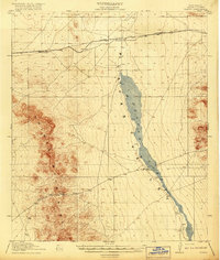
(209)- 1909 Map of Silver City
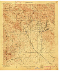 1909 Silver City1909 Print · USGSSilver City and the surrounding mining districts are shown at their industrial peak before the First World War. Researchers can trace early railroad spurs to camps like Santa Rita and Fierro, or locate the expansive Fort Bayard Military Reservation.2 unique versions available
 - 1910 Map of Mogollon, 1959 Print
 1910 Mogollon1959 Print · USGSThe high mining camps and river settlements of Catron County come alive in this survey from the early 1900s. Genealogists and historians can trace old homesteads and industrial sites like the Meader Stage Sta, Box N Ranch, and the Power Plant near Graham.2 unique versions available
 - 1911 Map of Alum Mountain, 1959 Print
 1911 Alum Mountain1959 Print · USGSThe upper Gila River wilderness is documented here just after the turn of the century, showing a landscape of remote cattle ranches and early mining claims. Genealogists and researchers can trace family-named sites like TJ Ranch and the Meerschaum Mine, or locate the Gila Cliff-Dwellings National Monument.
 - 1912 Map of Mogollon
 1912 Mogollon1912 Print · USGSNew Mexico's high timber and mining country come to life in this survey from the years just before statehood. Researchers can trace the early industrial footprint of Cooney and Mogollon or locate remote outposts like Meadows Stage Sta and N Bar Ranch.2 unique versions available
 - 1913 Map of Alum Mountain
 1913 Alum Mountain1913 Print · USGSNew Mexico's high wilderness is captured here just after statehood, documenting the remote ranching outposts and ancient sites along the Gila River. Researchers can locate early twentieth-century landmarks like Gila Cliff Dwellings National Monument, the Meerschaum Mine, and the XSX Ranch.3 unique versions available
 - 1913 Map of Morenci, 1954 Print
 1913 Morenci1954 Print · USGSArizona's copper country and high timberlands meet in this pre-war survey of the Morenci district and Apache National Forest. Researchers can trace the early industrial footprint of Morenci and Clifton or find family landmarks like Miller Cabin and Cooks Ranch.2 unique versions available
 - 1915 Map of Morenci
 1915 Morenci1915 Print · USGSGreenlee County during the early 1900s shows a landscape defined by industrial copper mining and isolated high-desert ranching. Genealogists and historians can trace family locations from the Eagle Creek School to historic homesteads like Dudley Ranch and the settlement of Oroville.3 unique versions available
 - 1918 Map of Hachita
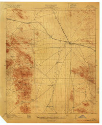 1918 Hachita1918 Print · USGSIn the southwestern New Mexico desert during the Great War, the rail hub at Hachita connected vital mining and ranching interests. Trace the early mining camps of Old Hachita and Sylvanite, or follow the Hueco Alamo Road to the remote Twelvemile Wells.4 unique versions available
 - 1918 Map of Victorio
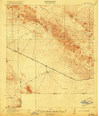 1918 Victorio1918 Print · USGSThe New Mexico borderlands during the Great War era reveal a landscape of isolated ranching outposts and international mining operations. Researchers can locate family landmarks like Bud Williams Ranch and trace the historic El Paso and Southwestern rail line.3 unique versions available
 - 1918 Map of Playas, 1961 Print
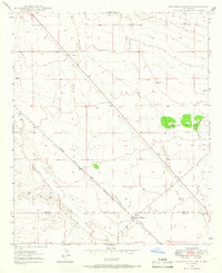
 1918 Playas1961 Print · USGSThe Playas Valley in the late nineteen-teens shows a landscape of isolated rail stops and cattle ranches at the edge of the desert. Researchers can trace early transit routes along the El Paso and Southwestern and locate family landmarks like Whitmire Ranch.3 unique versions available
 - 1919 Map of Playas
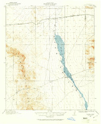
 1919 Playas1919 Print · USGSThe Playas Valley was a critical ranching and rail corridor in the high desert during the early twentieth century. Researchers can trace the path of the El Paso and Southwestern railroad and locate early sites like Whitmire Ranch and Antelope.4 unique versions available
 - 1935 Map of Hillsboro
 1935 Hillsboro1935 Print · USGSHillsboro and Kingston are documented here in the mid-1930s, surrounded by the busy mining and ranching country of the Black Range. Genealogists and historians can locate family landmarks like the J P Nunn Ranch and Wilson Ranch or trace the footprint of the Silver Tail Mine.2 unique versions available
 - 1937 Map of Santa Rita
 1937 Santa Rita1937 Print · USGSThe mining landscape of New Mexico comes into focus in the 1930s, documenting the busy rail corridors and copper districts around Santa Rita. Genealogists and historians can trace old community hubs like Fierro, Hanover, and the Vanadium Post Office.
 - 1940 Map of Hillsboro
 1940 Hillsboro1940 Print · USGSSierra County mountain life in the mid-1930s centers on mining outposts and remote cattle ranches within the Black Range. Genealogists and historians can trace family operations at the JP Nunn Ranch and Wilson Ranch or locate the historic Gray Eagle Mine near Kingston.2 unique versions available
 - 1947 Map of Allie Canyon, 1963 Print
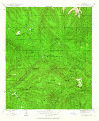
 1947 Allie Canyon1963 Print · USGSThe high country of Grant County is mapped here in the late 1940s as the Continental Divide crosses the Gila National Forest. Researchers can trace old family sites and mountain infrastructure including Hicks Cem, the Mimbres Ranger Sta, and Gos Ranch.2 unique versions available
 - 1947 Map of Twin Sisters, 1963 Print
 1947 Twin Sisters1963 Print · USGSThe high Gila National Forest country in the late 1940s was a landscape of remote camps and early logging. Historians can trace the legacy of local industry and recreation at Masons Mill, the Saw Mill Ruins, and the Gila Scout Camp.2 unique versions available
 - 1947 Map of Faywood Station, 1966 Print
 1947 Faywood Station1966 Print · USGSHigh desert ranching and rail infrastructure dominate the landscape of Grant and Luna counties in the late 1940s. Trace the diagonal path of the Atchison Topeka and Santa Fe past Faywood Station and the oasis at Warm Springs.2 unique versions available
 - 1947 Map of Fort Bayard, 1971 Print
 1947 Fort Bayard1971 Print · USGSGrant County’s high-desert mining and military landscape is captured here in the years just following World War II. Researchers can trace the sprawling Fort Bayard Military Reservation and locate early community landmarks like Pictured Rocks, the Forest Nursery, and the town of Pinos Altos.
 - 1948 Map of Twin Sisters
 1948 Twin Sisters1948 Print · USGSThe Gila National Forest and the high ridges of the Continental Divide appear here as they were in the late 1940s. Local researchers can trace old timber and recreation sites like Masons Mill, the Saw Mill Ruins, and McMillan Forest Camp.
 - 1948 Map of Santa Rita
 1948 Santa Rita1948 Print · USGSGrant County’s industrial heart is revealed in the late 1940s, when mining towns were still bustling at the edge of the Gila National Forest. Genealogists and historians can trace the family footprints at Santa Rita, find Fierro Cem, or locate the Pewabic Shaft.
 - 1948 Map of Allie Canyon
 1948 Allie Canyon1948 Print · USGSThe Gila National Forest and Continental Divide define this landscape in the late 1940s. Researchers can locate ranching sites and forest infrastructure like the GOS Ranch, Mimbres Ranger Sta, and the family-named Hicks Cem.
 - 1948 Map of Hurley East, 1976 Print
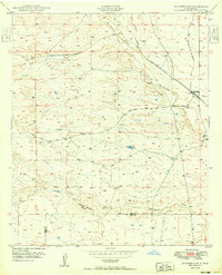
 1948 Hurley East1976 Print · USGSGrant County is captured in the late 1940s, showing the intersection of industrial processing and the high desert. Researchers can trace early infrastructure around Hurley and follow the paths of Whitewater Creek and Lambright Draw through the hills.
 - 1949 Map of Fort Bayard
 1949 Fort Bayard1949 Print · USGSThe Pinos Altos Range and the southern Gila National Forest come into focus during the late 1940s. Genealogists and historians can trace the early footprints of Fort Bayard, Pinos Altos, and Bayard alongside the Continental Divide.
 - 1949 Map of Whitewater
 1949 Whitewater1949 Print · USGSSouthwest New Mexico's high desert reveals its mid-century rail and ranching character just after the war. You can trace the transition between the active Atchison Topeka and Santa Fe and its abandoned grade near Whitewater and Hogback Mountain.2 unique versions available
 - 1949 Map of Hurley East
 1949 Hurley East1949 Print · USGSThe mining town of Hurley and its surrounding desert canyons are captured here in the late 1940s. Genealogists and historians can trace local water and mineral sites such as Whitewater Creek, a remote Prospect, and the winding Lampright Draw.
Showing maps 1-25 of 209
Top cities of Grant County
Frequently asked questions
- What are the different types of historical maps available for Grant County?
- What is the oldest map of Grant County?
- Where can I purchase historical maps of Grant County for my home or office?
- Where can I download high-res historical maps of Grant County?
- Are there historical topographic maps available for Grant County?
- Is there historical aerial imagery available for Grant County?
- Where are historical maps of Grant County sourced from?