Old Maps of Halfway, New Mexico for Genealogy
Trace your family roots with 9 historic maps of Halfway. These high-res maps reveal old neighborhoods, homesites, landmarks, and streets — helping you uncover where your ancestors lived and how the area evolved over time.
- Explore historic neighborhoods: Identify where your relatives may have lived in the 1800s or 1900s.
- Compare maps over time: Trace the changes in streets, buildings, and landmarks for multi-generational research.
- Perfect for genealogy & ancestry research: Used by family historians and researchers to map out lineage and migration.
These maps are an incredible resource for exploring your personal connection to Halfway's past.
Halfway, NM maps
(9)- 1954 Map of Hobbs, 1963 Print
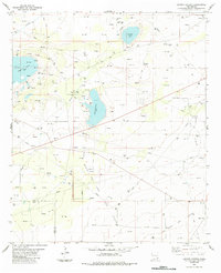
 1954 Hobbs1963 Print · USGSThe High Plains and Permian Basin transition is captured here at the height of the mid-century energy boom. Genealogists and industrial historians can trace the foundations of Humble City, locate the Potash Mine and Plant, and follow the Texas-New Mexico RR.2 unique versions available
 - 1958 Map of Hobbs
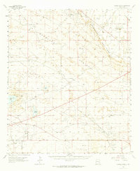
 1958 Hobbs1958 Print · USGSThe High Plains of the Texas-New Mexico border are shown here during the height of the mid-century oil boom. Genealogists and historians can trace the development of Hobbs, Lovington, and Jal, alongside ranching landmarks like James Ranch and the early Texas-New Mexico Railway.
 - 1963 Map of Laguna Gatuna, 1965 Print
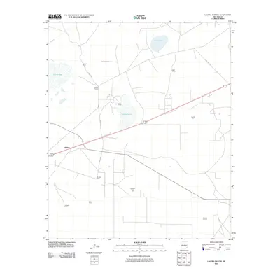
 1963 Laguna Gatuna1965 Print · USGSThe high plains of Lea County are defined by industrial growth and desert ranching in the early sixties. Researchers can trace family ranch lands like Smith Ranch and Alfred Ranch alongside the sprawling Corbin Oil Field and the Hobbs Air Force Base Auxiliary Field No 4.2 unique versions available
 - 1984 Map of Laguna Gatuna
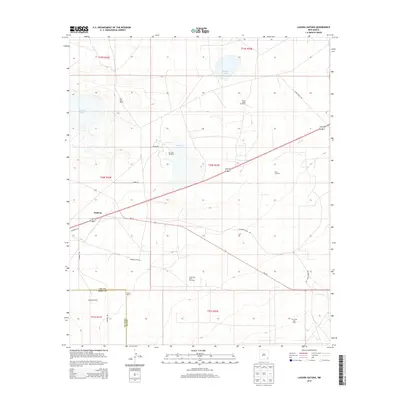
 1984 Laguna Gatuna1984 Print · USGSThe high desert of the New Mexico state line is shown in the mid-1980s as a hub of energy production and salt basins. Researchers can trace the industrial footprint of the OIL FIELD and GAS FIELD alongside isolated landmarks like Salt Lake Ranch and Three Wells Windmill.
 - 2010 Map of Laguna Gatuna, 2010 Print
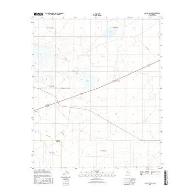
 2010 Laguna Gatuna2010 Print · USGSCovers Halfway, including Lea County, Eddy County, and other nearby areas
 - 2013 Map of Laguna Gatuna, 2013 Print
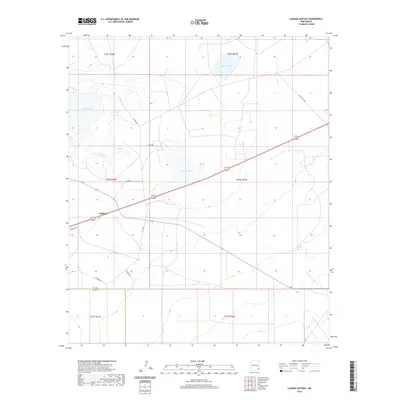
 2013 Laguna Gatuna2013 Print · USGSCovers Halfway, including Lea County, Eddy County, and other nearby areas
 - 2017 Map of Laguna Gatuna, 2017 Print
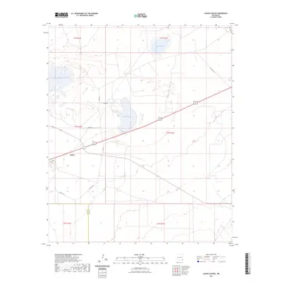
 2017 Laguna Gatuna2017 Print · USGSCovers Halfway, including Lea County, Eddy County, and other nearby areas
 - 2020 Map of Laguna Gatuna, 2020 Print
 2020 Laguna Gatuna2020 Print · USGSCovers Halfway, including Lea County, Eddy County, and other nearby areas
 - 2023 Map of Laguna Gatuna, 2023 Print
 2023 Laguna Gatuna2023 Print · USGSThe high-desert border of Eddy and Lea County comes into focus in the early 2020s, showing a landscape defined by salt lakes and ranching roads. Researchers can trace local routes like Goathead Rd and Smith Ranch Rd near the settlement of Halfway.
End of results
Showing maps 1-9 of 9
Frequently asked questions
- What are the different types of historical maps available for Halfway?
- What is the oldest map of Halfway?
- Where can I purchase historical maps of Halfway for my home or office?
- Where can I download high-res historical maps of Halfway?
- Are there historical topographic maps available for Halfway?
- Is there historical aerial imagery available for Halfway?
- Where are historical maps of Halfway sourced from?