
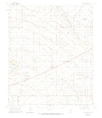
1963 Map of Laguna Gatuna
USGS Topo · Published 1965About this map
Mescalero Ridge, also known as The Caprock, dominates this high-plains landscape, creating a distinct escarpment that separates the Querecho Plains from the eastern plateaus. The 1963 survey captures an era of intensive subterranean resource extraction across the New Mexico desert, marked by a dense network of a pipeline and an aqueduct serving numerous petroleum developments. Notable centers of industry include the Corbin Oil Field, EK Oil Field, and the Teas Oil Field, alongside specialized infrastructure like a Refinery and various Quarry sites.
Find a feature on this map
31 named features on this map. Tap any name to fly to it.
Don’t see what you’re looking for? This feature index may not catch every label — zoom into the map to look around manually.
Map Details
Editions of this 1963 Laguna Gatuna Map
2 editions found
Other maps of this area

1939 · Nash Draw
USGS Topo · 1:62,500

1942 · Clayton Basin
USGS Topo · 1:62,500

1943 · Clayton Basin
USGS Topo · 1:62,500

1943 · Nash Draw
USGS Topo · 1:62,500

1954 · Hobbs
USGS Topo · 1:250,000

1958 · Hobbs
USGS Topo · 1:250,000

1962 · Lovington
USGS Topo · 1:62,500

1962 · Buckeye
USGS Topo · 1:62,500

1963 · Oil Center
USGS Topo · 1:62,500

1963 · Monument
USGS Topo · 1:62,500