1900s (20th Century) Maps of Hobbs, New Mexico
Explore 5 historic maps of Hobbs from the 1900s (20th Century). These maps offer a rare glimpse into what life looked like during the 1900s — showing old roads, neighborhoods, homes, and landmarks that have changed or disappeared over time.
Whether you're researching your family's past, planning a metal detecting trip, or studying how Hobbs's landscape evolved across the 1900s, these high-resolution maps are a powerful tool for exploring the history of this region.
- Focus on a specific era: All maps on this page are from the 1900s, giving you a focused view of this time period.
- See what’s changed: Compare century-old streets, trails, and buildings to today's modern landscape using overlays and satellite layers.
- Research with precision: Use these maps for genealogy, historical research, land use analysis, or educational projects.
- View, download, or print: Maps are fully viewable online in high resolution, and can be downloaded or printed for your own records.
Start exploring Hobbs's history through authentic maps from the 1900s. This is your window into the past.
Hobbs, NM maps
(5)- 1954 Map of Hobbs, 1963 Print
 1954 Hobbs1963 Print · USGSThe High Plains and Permian Basin transition is captured here at the height of the mid-century energy boom. Genealogists and industrial historians can trace the foundations of Humble City, locate the Potash Mine and Plant, and follow the Texas-New Mexico RR.2 unique versions available
 - 1958 Map of Hobbs
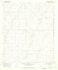
 1958 Hobbs1958 Print · USGSThe High Plains of the Texas-New Mexico border are shown here during the height of the mid-century oil boom. Genealogists and historians can trace the development of Hobbs, Lovington, and Jal, alongside ranching landmarks like James Ranch and the early Texas-New Mexico Railway.
 - 1969 Map of Humble City, 1971 Print
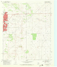
 1969 Humble City1971 Print · USGSLea County at the end of the sixties shows a landscape transformed by the energy industry and modern infrastructure. Genealogists and historians can trace the network of pipelines, several Gravel Pits, and landmarks like Wardswell Draw.4 unique versions available
 - 1969 Map of Hobbs East, 1972 Print
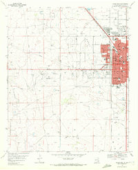
 1969 Hobbs East1972 Print · USGSThe Texas-New Mexico border near Hobbs thrived during the late sixties as the energy sector shaped the landscape. Genealogists and local historians can trace civic growth through Highland Jr High Sch, find family sites at Prairie Haven Cem, and locate the historic East Hobbs Oil Field.3 unique versions available
 - 1969 Map of Hobbs West, 1972 Print
 1969 Hobbs West1972 Print · USGSThe western outskirts of Hobbs and the small community of Nadine are documented here in the late sixties as the local oil industry flourished. Genealogists can trace family locations near Memory Gardens (Cem) or locate schools such as Sanger Sch and Heizer Jr High Sch.2 unique versions available
End of results
Showing maps 1-5 of 5
Top cities near Hobbs
Top neighborhoods of Hobbs
Frequently asked questions
- What are the different types of historical maps available for Hobbs?
- What is the oldest map of Hobbs?
- Where can I purchase historical maps of Hobbs for my home or office?
- Where can I download high-res historical maps of Hobbs?
- Are there historical topographic maps available for Hobbs?
- Is there historical aerial imagery available for Hobbs?
- Where are historical maps of Hobbs sourced from?