Old Maps of Oil Center, New Mexico for Academic Research
Study the evolution of Oil Center with 10 high-resolution historic maps. Whether you're teaching, researching, or modeling changes in land use, these maps provide essential visual documentation of urban, environmental, and geographic change.
- Analyze long-term change: Track patterns in development, transportation, and natural features.
- Ideal for environmental or urban studies: Support academic projects with primary historical map data.
- Use in the classroom or lab: Educators and researchers rely on these maps to bring historical context to life.
These maps are a powerful tool for teaching, research, and visualizing how Oil Center has changed over the decades.
Oil Center, NM maps
(10)- 1954 Map of Hobbs, 1963 Print
 1954 Hobbs1963 Print · USGSThe High Plains and Permian Basin transition is captured here at the height of the mid-century energy boom. Genealogists and industrial historians can trace the foundations of Humble City, locate the Potash Mine and Plant, and follow the Texas-New Mexico RR.2 unique versions available
 - 1958 Map of Hobbs
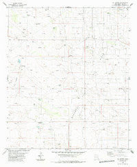
 1958 Hobbs1958 Print · USGSThe High Plains of the Texas-New Mexico border are shown here during the height of the mid-century oil boom. Genealogists and historians can trace the development of Hobbs, Lovington, and Jal, alongside ranching landmarks like James Ranch and the early Texas-New Mexico Railway.
 - 1963 Map of Oil Center, 1964 Print
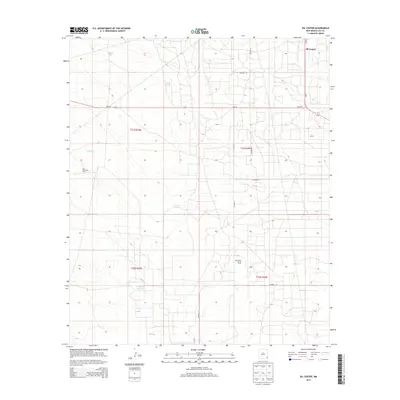
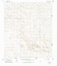 1963 Oil Center1964 Print · USGSLea County in the early sixties was a landscape defined by the growing petroleum industry and the essential search for water. Researchers can trace the mid-century infrastructure of the Monument Jal Oil Field and locate isolated landmarks like San Simon Ranch and San Simon Sink.2 unique versions available
 - 1978 Map of Jal, 1979 Print
 1978 Jal1979 Print · USGSSoutheast New Mexico in the late seventies is a landscape shaped by energy production and the rugged Llano Estacado. Genealogists and industrial historians can trace the growth of Jal and Eunice along the Texas-New Mexico RR and across the Jal Oil Field.
 - 1984 Map of Oil Center
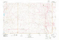
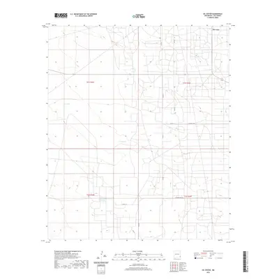
 1984 Oil Center1984 Print · USGSThe high desert of Lea County is captured here during the 1980s energy boom, centered on the settlement of Oil Center. Researchers can trace the extensive oil and gas infrastructure across the Monument Jal Oil Field, locating named sites like the Scarbrough Well and Rock Lake Reservoir.
 - 2010 Map of Oil Center, 2010 Print
 2010 Oil Center2010 Print · USGSCovers Oil Center, including Lea County, United States, and other nearby areas
 - 2013 Map of Oil Center, 2013 Print
 2013 Oil Center2013 Print · USGSCovers Oil Center, including Lea County, United States, and other nearby areas
 - 2017 Map of Oil Center, 2017 Print
 2017 Oil Center2017 Print · USGSCovers Oil Center, including Lea County, United States, and other nearby areas
 - 2020 Map of Oil Center, 2020 Print
 2020 Oil Center2020 Print · USGSCovers Oil Center, including Lea County, United States, and other nearby areas
 - 2023 Map of Oil Center, 2023 Print
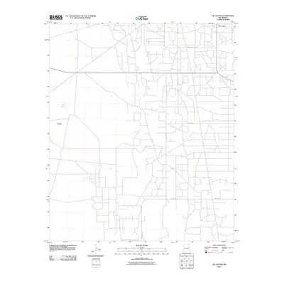
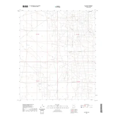 2023 Oil Center2023 Print · USGSSoutheast New Mexico's energy corridor is captured here in the early 2020s, showing the intersection of industry and the high desert. Researchers can trace the layout of Oil Center and find isolated water features like Urssey Tank and the Rock Lake Reservoir.
End of results
Showing maps 1-10 of 10
Top cities near Oil Center
Frequently asked questions
- What are the different types of historical maps available for Oil Center?
- What is the oldest map of Oil Center?
- Where can I purchase historical maps of Oil Center for my home or office?
- Where can I download high-res historical maps of Oil Center?
- Are there historical topographic maps available for Oil Center?
- Is there historical aerial imagery available for Oil Center?
- Where are historical maps of Oil Center sourced from?