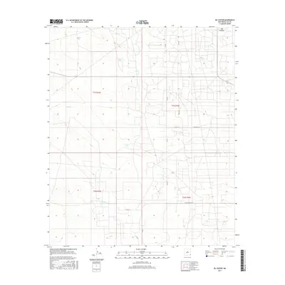
2017 Map of Oil Center
USGS Topo · Published 2017About this map
Oil Center occupies the northeastern corner of this Lea County landscape, representing a high-plains environment deeply shaped by industrial and agricultural water management. The terrain is characterized by a network of essential water sources including Rock Lake Reservoir and numerous catchment basins such as Murphy Tank, Sheep Tank, and Urssey Tank. These features, along with the notable expanse of Dry Lake, highlight the critical role of water infrastructure in this arid region of New Mexico. A dense grid of service roads, including Gulf Rd and Delaware Basin Rd, connects the various townships of t21s r35e, t21s r36e, t22s r35e, and t22s r36e. The presence of Coyote Hill provides a rare topographical break in an otherwise regulated landscape of section lines and resource extraction routes.
Find a feature on this map
19 named features on this map. Tap any name to fly to it.
Don’t see what you’re looking for? This feature index may not catch every label — zoom into the map to look around manually.
Map Details
Editions of this 2017 Oil Center Map
This is the sole edition of this map. No revisions or reprints were ever made.
Other maps of this area

1954 · Hobbs
USGS Topo · 1:250,000

1958 · Hobbs
USGS Topo · 1:250,000

1963 · Oil Center
USGS Topo · 1:62,500

1963 · Monument
USGS Topo · 1:62,500

1969 · Hobbs SW
USGS Topo · 1:24,000

1969 · Eunice
USGS Topo · 1:24,000

1969 · Rattlesnake Canyon
USGS Topo · 1:24,000

1978 · Jal
USGS Topo · 1:100,000

1984 · Oil Center
USGS Topo · 1:24,000
1984 · San Simon Sink
USGS Topo · 1:24,000