Old Maps of Encinoso, New Mexico for Academic Research
Study the evolution of Encinoso with 13 high-resolution historic maps. Whether you're teaching, researching, or modeling changes in land use, these maps provide essential visual documentation of urban, environmental, and geographic change.
- Analyze long-term change: Track patterns in development, transportation, and natural features.
- Ideal for environmental or urban studies: Support academic projects with primary historical map data.
- Use in the classroom or lab: Educators and researchers rely on these maps to bring historical context to life.
These maps are a powerful tool for teaching, research, and visualizing how Encinoso has changed over the decades.
Encinoso, NM maps
(13)- 1935 Map of Capitan Mountains
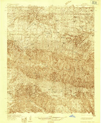 1935 Capitan Mountains1935 Print · USGSLincoln County ranching and public health history are preserved here in the mid-1930s, dominated by the massif of the Capitan Mountains. Researchers can trace early family homesteads like Merchant Ranch and the localized community centers of Richardson School and the U S Marine Hospital Reservation.2 unique versions available
 - 1940 Map of Capitan Mountains
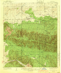 1940 Capitan Mountains1940 Print · USGSLincoln County ranching and forestry are caught in detail during the mid-1930s, showing a landscape of high-altitude lodges and remote family outposts. Genealogists can locate family-named sites like the Hinchley Ranch and Morris Ranch or the U S Marine Hospital Reservation.2 unique versions available
 - 1955 Map of Roswell, 1974 Print
 1955 Roswell1974 Print · USGSSoutheastern New Mexico is shown in transition during the mid-fifties, from the Pecos Valley ranching hubs to the high timber of the Sacramento Mountains. Researchers can trace the Atchison Topeka and Santa Fe RR through Roswell and Hagerman or locate the old barracks at Ft Stanton.3 unique versions available
 - 1958 Map of Roswell
 1958 Roswell1958 Print · USGSThe High Plains and mountain peaks of New Mexico are captured here during the mid-fifties, showing the region before the closure of Walker Air Force Base. Researchers can trace the ranching and rail landscape from Lincoln to the Pecos River valley through Hagerman and Lake Arthur.
 - 1962 Map of Roswell
 1962 Roswell1962 Print · USGSSoutheastern New Mexico in the early sixties shows a landscape defined by high mountain peaks and a growing military presence at Roswell. Genealogists and historians can trace the roads connecting Fort Stanton, Capitan, and the Mescalero Apache Indian Reservation.
 - 1981 Map of Encinoso
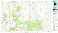
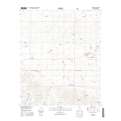
 1981 Encinoso1981 Print · USGSLincoln County ranching and forest lands are captured here during the early 1980s as they reach toward the high peaks. Researchers can locate the Encinoso settlement and Las Tablas, alongside family-named landmarks like Block Ranch and Minckey Ridge.
 - 1981 Map of Carrizozo
 1981 Carrizozo1981 Print · USGSHigh desert plains meet the timbered slopes of the Capitan and Jicarilla Mountains in the early 1980s. Genealogists and historians can trace rail-side towns like Carrizozo and old mining sites such as the American Mine and the settlement of White Oaks.2 unique versions available
 - 2004 Map of Encinoso, 2006 Print
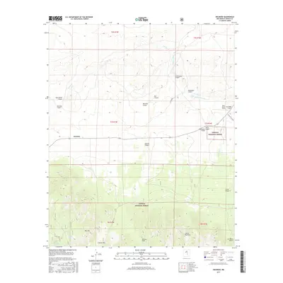
 2004 Encinoso2006 Print · USGSLincoln County ranching and forest lands are revealed in this early twenty-first-century survey as the high desert meets the northern slopes. Genealogists and researchers can trace family-named landmarks like Edgar Ranch, Block Ranch, and the mountain community of Encinoso.
 - 2011 Map of Encinoso, 2011 Print
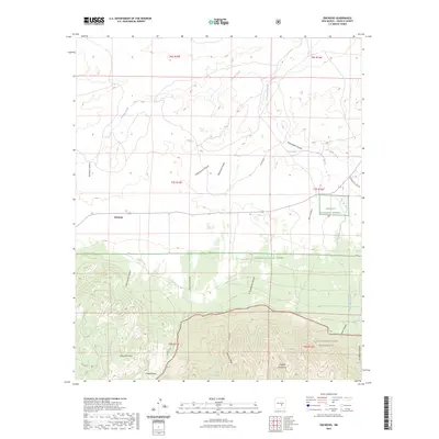
 2011 Encinoso2011 Print · USGSCovers Encinoso, including Lincoln County, United States, and other nearby areas
 - 2013 Map of Encinoso, 2013 Print
 2013 Encinoso2013 Print · USGSCovers Encinoso, including Lincoln County, United States, and other nearby areas
 - 2017 Map of Encinoso, 2017 Print
 2017 Encinoso2017 Print · USGSCovers Encinoso, including Lincoln County, United States, and other nearby areas
 - 2020 Map of Encinoso, 2020 Print
 2020 Encinoso2020 Print · USGSCovers Encinoso, including Lincoln County, United States, and other nearby areas
 - 2023 Map of Encinoso, 2023 Print
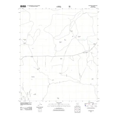
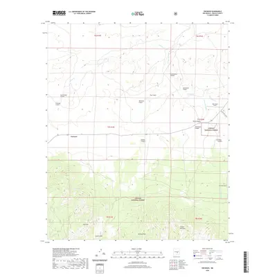
 2023 Encinoso2023 Print · USGSModern-day Lincoln County retains its cattle-ranching character in this survey of the high foothills and mountain passes. Researchers can locate the settlement of Encinoso and trace the drainage of Arroyo del Macho past Macho Spring and West Mountain.
End of results
Showing maps 1-13 of 13
Top cities near Encinoso
Frequently asked questions
- What are the different types of historical maps available for Encinoso?
- What is the oldest map of Encinoso?
- Where can I purchase historical maps of Encinoso for my home or office?
- Where can I download high-res historical maps of Encinoso?
- Are there historical topographic maps available for Encinoso?
- Is there historical aerial imagery available for Encinoso?
- Where are historical maps of Encinoso sourced from?