1960s Maps of McKinley County, New Mexico
Explore 83 historic maps of McKinley County from the 1960s. These maps offer a rare glimpse into what life looked like during the 1960s — showing old roads, neighborhoods, homes, and landmarks that have changed or disappeared over time.
Whether you're researching your family's past, planning a metal detecting trip, or studying how McKinley County's landscape evolved across the 1960s, these high-resolution maps are a powerful tool for exploring the history of this region.
- Focus on a specific era: All maps on this page are from the 1960s, giving you a focused view of this time period.
- See what’s changed: Compare century-old streets, trails, and buildings to today's modern landscape using overlays and satellite layers.
- Research with precision: Use these maps for genealogy, historical research, land use analysis, or educational projects.
- View, download, or print: Maps are fully viewable online in high resolution, and can be downloaded or printed for your own records.
Start exploring McKinley County's history through authentic maps from the 1960s. This is your window into the past.
McKinley County, NM maps
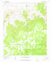
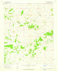
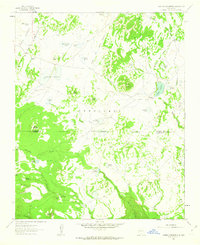
(83)- 1960 Map of Pueblo Alto Trading Post, 1963 Print
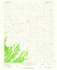 1960 Pueblo Alto Trading Post1963 Print · USGSMcKinley and Sandoval counties appear here in the early sixties as a high-desert landscape of trading posts and remote airfields. Researchers can trace the proximity of the Pueblo Alto Trading Post to ancient Ruins and the Tanner Landing Strip.2 unique versions available
 - 1961 Map of Marquez, 1963 Print
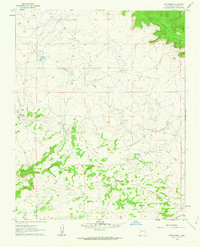
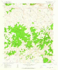
 1961 Marquez1963 Print · USGSCibola County’s high mesas and deep canyons are documented here in the early sixties, centered on the settlement of Marquez. Genealogists and historians can trace family-named landmarks like Gallegos Bridge, the Cem, and the intricate Las Cuevas de Marquez.2 unique versions available
 - 1961 Map of Ojo Encino Mesa, 1963 Print
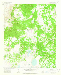
 1961 Ojo Encino Mesa1963 Print · USGSHigh-desert mesas and washes dominate the McKinley County landscape in the early sixties. Researchers can trace local development at Ojo Encino, including the Ojo Encino Trailer Sch and isolated landmarks like Eagle Spring.2 unique versions available
 - 1961 Map of El Dado, 1963 Print
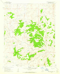
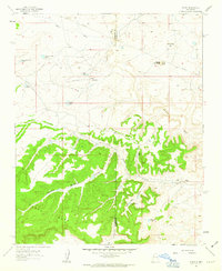
 1961 El Dado1963 Print · USGSHigh-desert ranchlands and ancient archaeological sites define this McKinley County landscape in the early 1960s. Researchers can locate Stone Ax Ruins, the landmark El Dado Peak, and numerous watering points like Coal Mine Spring.
 - 1961 Map of Piedra De La Aguila, 1963 Print
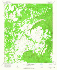
 1961 Piedra De La Aguila1963 Print · USGSMcKinley County ranching territory is mapped here in the early sixties, showing a landscape of isolated outposts and seasonal lagunas. Researchers can trace family-named sites like Voght Place and Rancho Felix, alongside landmarks such as Piedra de la Aguila.
 - 1961 Map of Star Lake, 1963 Print
 1961 Star Lake1963 Print · USGSNorthwest New Mexico at the start of the sixties reveals a transition between traditional trading hubs and modern energy infrastructure. Genealogists and researchers can trace the vicinity of the Star Lake Trading Post, find the local Mission, and locate the Star Lake Pumping Station along the Continental Divide.2 unique versions available
 - 1961 Map of Whitehorse Rincon, 1963 Print
 1961 Whitehorse Rincon1963 Print · USGSMcKinley County's high-desert plateaus are shown here in the early sixties, centered on the dramatic escarpment of Chaco Mesa. Trace the path of the Continental Divide through a landscape marked by water sources like Sand Springs and Johnson Tank.
 - 1961 Map of Cerro Parido, 1963 Print
 1961 Cerro Parido1963 Print · USGSMcKinley and Sandoval counties appear here in the early 1960s as a high-altitude ranching landscape defined by land grants and national forest boundaries. Genealogists and historians can trace family landholdings at Sandoval Ranch and Joe Montoya Ranch or locate isolated water sources like Toruno Spring.2 unique versions available
 - 1961 Map of Whitehorse, 1963 Print
 1961 Whitehorse1963 Print · USGSMcKinley County in the early 1960s was a high-desert frontier of mesas and trading posts straddling the Continental Divide. Researchers can trace the ranching life of the day through landmarks like the Prairie Dog Trading Post, Spider Well, and the Whitehorse settlement.2 unique versions available
 - 1961 Map of El Dado Mesa, 1963 Print
 1961 El Dado Mesa1963 Print · USGSMcKinley County, New Mexico, is captured here in the early 1960s within the high-elevation landscape of the Cibola National Forest. Researchers can trace historic water sources and land divisions including Laguna Grande, Ojo del Dado, and the Grant Boundary.2 unique versions available
 - 1961 Map of Mesita Del Gavilan, 1963 Print
 1961 Mesita Del Gavilan1963 Print · USGSMcKinley County is captured in the early sixties as a rugged ranching landscape defined by intricate water management. Researchers can trace land use through numerous named stock tanks like Martinez Tank and family landmarks such as Alfredo Padilla.3 unique versions available
 - 1961 Map of Hospah, 1963 Print
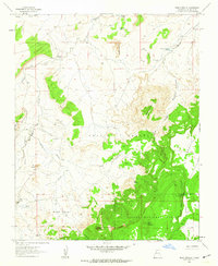
 1961 Hospah1963 Print · USGSMcKinley County, New Mexico, is seen here during a period of active oil production and desert ranching in the early sixties. Researchers can trace the layout of the Hospah Oil Field and locate family-named landmarks like the Jake Chee Windmill and Lucero.2 unique versions available
 - 1961 Map of Mesita Americana, 1963 Print
 1961 Mesita Americana1963 Print · USGSMcKinley County ranching and water infrastructure are captured here in the early sixties. Researchers can trace remote outposts like Ball Ranch and Mesita Camp BM 6789 or locate family landmarks such as the Demitro Flores Well.2 unique versions available
 - 1961 Map of Canada Calladita, 1963 Print
 1961 Canada Calladita1963 Print · USGSThe McKinley and Sandoval county line area in the early sixties reveals a landscape shaped by water and ranching. Genealogists and historians can trace the locations of the Rancho De Stephan and Tucker Ranch among the canyons of Cañada Calladita.2 unique versions available
 - 1961 Map of Tinian, 1963 Print
 1961 Tinian1963 Print · USGSHigh-desert life in early 1960s McKinley County centered around remote outposts and livestock tanks. Genealogists and historians can trace the foundations of Tinian Mission and locate features like the Torreon Trading Post and Chaco Mesa.3 unique versions available
 - 1961 Map of Laguna Seca, 1963 Print
 1961 Laguna Seca1963 Print · USGSHigh canyons and mesas mark the McKinley and Sandoval county border in the early sixties. Genealogists and historians can trace old land divisions and remote locales like Eagle Nest, La Jolla Alfalfa, and the Guadalupe Ranger Station.2 unique versions available
 - 1961 Map of Laguna Canoneros, 1963 Print
 1961 Laguna Canoneros1963 Print · USGSHigh mesa territory and seasonal water sources define this region of New Mexico in the early sixties. Researchers can locate remote seasonal sites like Casa Fria and Cuate Camp or trace the drainages of Seboyeta Creek and Laguna Cañoneros.2 unique versions available
 - 1961 Map of Mesa Cortada, 1963 Print
 1961 Mesa Cortada1963 Print · USGSMcKinley County ranching and forest lands are frozen in time during the early sixties, showing a landscape defined by arroyos and isolated homesteads. Trace ancestral footprints at the Rancho de la Punta or find early water sources like Ojo Navajo and Candido Tank.3 unique versions available
 - 1961 Map of Pueblo Pintado, 1964 Print
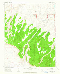 1961 Pueblo Pintado1964 Print · USGSMcKinley County, New Mexico, is documented here in the early sixties as it appeared before major modern expansions. Archaeologists and historians can trace significant ancestral sites like the Pueblo Pintado (Ruins), Cliff Dwelling, and the early footprint of the Pueblo Pintado Sch.2 unique versions available
 - 1961 Map of Rincon Marquez, 1964 Print
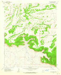 1961 Rincon Marquez1964 Print · USGSMcKinley County, New Mexico, was a rugged landscape of high mesas and cattle ranching during the early sixties. Genealogists and historians can trace family-named landmarks like Roberto Sandoval Cañon and the Elkins Star Lake Ranch along the Continental Divide.2 unique versions available
 - 1961 Map of Cottonwood Canyon, 1981 Print
 1961 Cottonwood Canyon1981 Print · USGSCibola National Forest and the Continental Divide define this high-country landscape during the mid-twentieth century. Local researchers can trace family ranching history at Irvin Ranch and Coddington Ranch or locate the remote Graves near Cottonwood Canyon.
 - 1962 Map of Aztec
 1962 Aztec1962 Print · USGSNorthwestern New Mexico in the early sixties showcases a landscape defined by the arrival of the Navajo Reservoir and the high-altitude timber of the Carson National Forest. Trace the path of the Denver & Rio Grande Western RR or locate historic settlements like Tierra Amarilla and Gobernador.
 - 1962 Map of Albuquerque
 1962 Albuquerque1962 Print · USGSAlbuquerque and the surrounding high desert are captured here in the early 1960s during a period of intense mineral and military growth. Genealogists and historians can locate early schools like the Pueblo Pintado School, major industrial sites like the Jackpile Mine, and the sprawling Kirtland Air Force Base.
 - 1962 Map of Gallup
 1962 Gallup1962 Print · USGSThe high plateau and mountains surrounding Gallup in the early sixties reveal a landscape defined by tribal lands, coal mining, and the rail corridor. Researchers can locate remote trading posts, the Gibson Coal Mine, and the historic Window Rock capital.
 - 1962 Map of Saint Johns
 1962 Saint Johns1962 Print · USGSEastern Arizona and the New Mexico borderlands come alive in the early sixties, showing a landscape of high-plateau ranching and early national monuments. Trace the path of the Atchison Topeka and Santa Fe or locate old water sources like Salado Springs and Lyman Reservoir.
Showing maps 1-25 of 83
Top cities of McKinley County
Frequently asked questions
- What are the different types of historical maps available for McKinley County?
- What is the oldest map of McKinley County?
- Where can I purchase historical maps of McKinley County for my home or office?
- Where can I download high-res historical maps of McKinley County?
- Are there historical topographic maps available for McKinley County?
- Is there historical aerial imagery available for McKinley County?
- Where are historical maps of McKinley County sourced from?