1980s Maps of McKinley County, New Mexico
Explore 17 historic maps of McKinley County from the 1980s. These maps offer a rare glimpse into what life looked like during the 1980s — showing old roads, neighborhoods, homes, and landmarks that have changed or disappeared over time.
Whether you're researching your family's past, planning a metal detecting trip, or studying how McKinley County's landscape evolved across the 1980s, these high-resolution maps are a powerful tool for exploring the history of this region.
- Focus on a specific era: All maps on this page are from the 1980s, giving you a focused view of this time period.
- See what’s changed: Compare century-old streets, trails, and buildings to today's modern landscape using overlays and satellite layers.
- Research with precision: Use these maps for genealogy, historical research, land use analysis, or educational projects.
- View, download, or print: Maps are fully viewable online in high resolution, and can be downloaded or printed for your own records.
Start exploring McKinley County's history through authentic maps from the 1980s. This is your window into the past.
McKinley County, NM maps
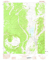
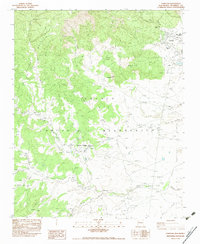
(17)- 1980 Map of Toadlena, 1981 Print
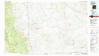 1980 Toadlena1981 Print · USGSSan Juan County and the Navajo Nation are shown in the 1980s as a landscape of high mesas and desert washes. Trace the routes between Toadlena, the Tsaya Trading Post, and the ancient grounds of Chaco Canyon National Monument.3 unique versions available
 - 1981 Map of Gallup
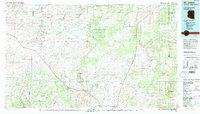
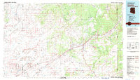
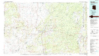
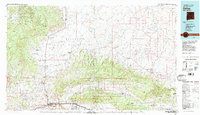 1981 Gallup1981 Print · USGSThe high desert of McKinley County comes to life in the early 1980s, centered on the hub of Gallup and its vital rail corridors. Researchers can trace the Atchison Topeka and Santa Fe line past the Fort Wingate Army Depot and through historic sites like Gamerco and the Tohatchi Trading Post.
 - 1981 Map of Zuni
 1981 Zuni1981 Print · USGSThe high plateau and mountains of western New Mexico are captured here in the early eighties, showcasing the intersection of tribal lands and national forests. Genealogists and researchers can trace local landmarks from Upper Nutria to the Black Rock Hospital and the historic Fort Wingate.2 unique versions available
 - 1981 Map of Fence Lake
 1981 Fence Lake1981 Print · USGSWestern New Mexico's volcanic landscape and tribal lands are captured here in the early eighties. Genealogists and historians can trace historic routes like the Old Zuni Treasure Road and settlements at Candy Kitchen and Atarque.2 unique versions available
 - 1981 Map of Saint Johns, 1996 Print
 1981 Saint Johns1996 Print · USGSNortheastern Arizona's high plateau comes into focus in the early 1980s, centered on the settlement of St Johns. Researchers can trace the Atchison Topeka and Santa Fe railroad through Adamana and locate landmarks like Lyman Lake and Zion Reservoir.
 - 1982 Map of Todilto Park, 1983 Print
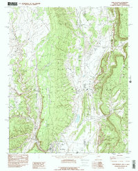
 1982 Todilto Park1983 Print · USGSThe Navajo Nation in the late 1970s is documented here through its high ridgelines and seasonal water sources. Trace the rugged geography of the Chuska Mountains and find landmarks like Venus Needle, Bowl Lake, and the remote Twin Buttes.
 - 1982 Map of Sanders, 1983 Print
 1982 Sanders1983 Print · USGSThe high desert of Apache County is captured here in the early eighties, showcasing the intersection of tribal lands and major transit corridors. Researchers can trace the path of the Atchison Topeka and Santa Fe and find remote outposts like Sanders, Houck, and Crows Nest Windmill.
 - 1982 Map of Fort Defiance, 1983 Print
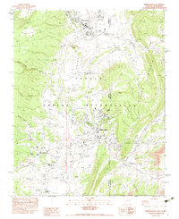
 1982 Fort Defiance1983 Print · USGSFort Defiance and the surrounding borderlands are captured in the early 1980s as they bridge the high country and the valley floor. Genealogists and researchers can trace the local landscape through landmarks like Fort Defiance, Clay Spring, and the Borrow Pit.2 unique versions available
 - 1982 Map of Crevasse Canyon, 1983 Print
 1982 Crevasse Canyon1983 Print · USGSMcKinley County, New Mexico, is shown during the late seventies as a rugged expanse of the Navajo Indian Reservation. Researchers can locate isolated landmarks like the Lone Pine Cemetery and seasonal water sources such as White Clay Spring.
 - 1982 Map of Buell Park, 1983 Print
 1982 Buell Park1983 Print · USGSThe Navajo Nation's high desert landscape is documented here in the early eighties as it straddles the Arizona and New Mexico line. Researchers can trace local landmarks like the Red Lake Chapter House, the settlement of Navajo, and the distinct geological bowl of Buell Park.
 - 1982 Map of Tohatchi, 1983 Print
 1982 Tohatchi1983 Print · USGSThe Navajo Indian Reservation comes into focus in the late seventies as desert settlements meet the slopes of the Chuska Mountains. Researchers can trace the local infrastructure and community sites of Tohatchi and Mexican Springs, including the Tse Bonita School and Cem.
 - 1982 Map of Chuska Peak, 1983 Print
 1982 Chuska Peak1983 Print · USGSThe Navajo Nation in the early 1980s reveals a high-altitude landscape where water sources and communication towers define the territory. Researchers can trace remote livestock hubs at Corral, topographic landmarks like Chuska Peak, and vital water points such as Whiskey Lake and Luka Spring.
 - 1983 Map of Window Rock
 1983 Window Rock1983 Print · USGSThe Navajo Nation's capital and surrounding settlements are documented in the early 1980s, showcasing a mix of tribal governance and historic mission life. Genealogists and historians can trace institutional sites like Saint Michaels, the St Michaels Indian Sch, and the Navajo Tribal Headquarters.2 unique versions available
 - 1983 Map of Sonsela Buttes
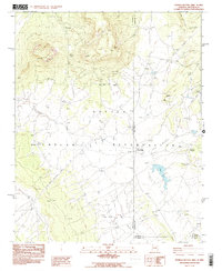 1983 Sonsela Buttes1983 Print · USGSThe Navajo Nation high desert at the start of the 1980s reveals a landscape of isolated springs and remote crossings. Genealogists and historians can locate Milkwater, find a noted site of Graves, and trace the path of Crystal Creek toward Black Lake.2 unique versions available
 - 1983 Map of Albuquerque, 1984 Print
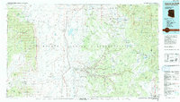
 1983 Albuquerque1984 Print · USGSCentral New Mexico in the early eighties shows a landscape where ancient pueblos and modern aerospace hubs meet. Trace the routes of the Atchison Topeka and Santa Fe RR or locate landmarks like Kirtland Air Force Base, Madrid, and the Sandia Mountains.
 - 1984 Map of Canyon De Chelly
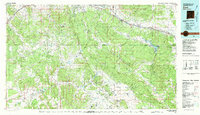
 1984 Canyon De Chelly1984 Print · USGSThe Navajo heartland in the mid-eighties shows a landscape of deep canyons and high mesas at a time of rising educational and civic infrastructure. Genealogists and researchers can locate remote trading posts like Upper Greasewood Trading Post and early campus buildings at Navajo Community College.
 - 1984 Map of Ganado
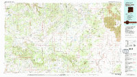
 1984 Ganado1984 Print · USGSThe Navajo Nation in the mid-eighties reveals a landscape of high mesas and vital community hubs across Apache County. Trace the development of Fort Defiance and Window Rock, or locate historic landmarks like Hubbell Trading Post and Kinlichee Boarding School.2 unique versions available
End of results
Showing maps 1-17 of 17
Top cities of McKinley County
Frequently asked questions
- What are the different types of historical maps available for McKinley County?
- What is the oldest map of McKinley County?
- Where can I purchase historical maps of McKinley County for my home or office?
- Where can I download high-res historical maps of McKinley County?
- Are there historical topographic maps available for McKinley County?
- Is there historical aerial imagery available for McKinley County?
- Where are historical maps of McKinley County sourced from?