Old Maps of McKinley County, New Mexico for Hiking & Exploration
Hike through history with 802 historic maps of McKinley County. Explore old trails, ghost towns, and forgotten backroads — perfect for outdoor adventurers and local explorers.
- Rediscover forgotten places: Map out old mining camps, roads, and footpaths that no longer exist on modern maps.
- Layer with modern tools: Combine with LiDAR or satellite views to plan hikes through historical terrain.
- Made for exploration: Popular among hikers, overlanders, and local history lovers.
Use these maps to find adventure and explore the hidden past of McKinley County.
McKinley County, NM maps
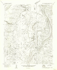
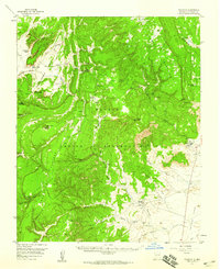
(802)- 1883 Map of Mt. Taylor
 1883 Mt. Taylor1883 Print · USGSThe high-desert frontier of New Mexico comes to life in the 1880s, centered on the towering Mt Taylor. Researchers can trace the early path of the Atlantic and Pacific Railroad and locate settlements like Old Fort Wingate and Laguna.
 - 1886 Map of St Johns
 1886 St Johns1886 Print · USGSApache County in the 1880s was a landscape of emerging pioneer outposts and high-plateau cattle ranching. Researchers can trace the early footprints of settlements like St Johns and Erastus or locate the original path of the Atlantic and Pacific Railroad.
 - 1886 Map of Wingate
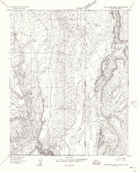
 1886 Wingate1886 Print · USGSThe high deserts of western New Mexico are shown during the expansion of the rail era in the mid-1880s. Genealogists and historians can trace early settlements and vital water sources like Gallup, Old Zuñi, and the historic Fort Wingate along the Atlantic and Pacific Railroad.
 - 1886 Map of Mt. Taylor
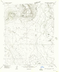
 1886 Mt. Taylor1886 Print · USGSNorthwestern New Mexico in the mid-1880s reveals a high-desert territory where early rail commerce meets long-standing mountain settlements. Researchers can trace the path of the Atlantic and Pacific Railroad past Old Fort Wingate and the historic villages of Laguna and Cebolletta.
 - 1886 Map of Fort Defiance
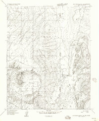
 1886 Fort Defiance1886 Print · USGSTerritorial Arizona and the high plateaus of Apache County come to life in the 1880s, centered on the strategic outpost of Fort Defiance. Researchers can trace the path of the Atlantic and Pacific Railroad and locate early stops like Allantown and Navajo.
 - 1889 Map of Largo
 1889 Largo1889 Print · USGSNorthwestern New Mexico in the late nineteenth century shows a vast network of desert canyons and river valleys before modern development. Genealogists and researchers can trace early settlements like Bloomfield and Largo or locate landmarks such as Angels Peak and the remote Stinking Lakes Sinks.
 - 1889 Map of Chaco
 1889 Chaco1889 Print · USGSNorthwestern New Mexico appears here in the late nineteenth century as a frontier of emerging river settlements and high-desert springs. Researchers can trace early footprints at Farmington and Aztec, or locate watering points like Sheep Spring and Seven Lakes.
 - 1892 Map of Fort Defiance
 1892 Fort Defiance1892 Print · USGSNorthern Arizona in the late nineteenth century remains a frontier of isolated outposts and high desert mesas. Trace the path of the A & P R R through Sanders or locate the remote station at Pueblo Colorado and the springs at Jacobs Well.6 unique versions available
 - 1892 Map of St Johns
 1892 St Johns1892 Print · USGSArizona's eastern frontier is documented here in the late nineteenth century as cattle ranching and early settlements followed the path of the river. Genealogists and historians can trace the foundations of St Johns and Springerville or locate long-standing sites like Erastus and Windmill Ranch.5 unique versions available
 - 1892 Map of Wingate
 1892 Wingate1892 Print · USGSNorthwestern New Mexico territory comes to life during the expansion of the rail era, centered on the strategic military and trade routes of the high desert. Researchers can trace the path of the Atlantic and Pacific Railroad past Fort Wingate and through early settlements like Gallup and Old Zuni.4 unique versions available
 - 1892 Map of Chaco
 1892 Chaco1892 Print · USGSNorthwestern New Mexico in the late nineteenth century reveals the early river-side foundations of the Four Corners region. Genealogists and historians can trace the development of Farmington, Aztec, and Jewett along the San Juan River and the high desert outpost of Seven Lakes.5 unique versions available
 - 1892 Map of Canyon De Chelly
 1892 Canyon De Chelly1892 Print · USGSApache County's high desert and deep sandstone canyons are documented here in the early 1890s, shortly after the initial 1883 survey. Modern researchers can trace the intricate drainages of Canyon De Chelly and find early water sources like Hospitito Spring and Tatezaka Tank.5 unique versions available
 - 1892 Map of Mt. Taylor, 1896 Print
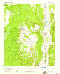
 1892 Mt. Taylor1896 Print · USGSNorthwestern New Mexico in the late nineteenth century was a territory of rail expansion and ancient volcanic landmarks. Researchers can trace the path of the Atlantic and Pacific Railroad past Old Fort Wingate and the pueblo at Laguna.
 - 1895 Map of Largo, 1897 Print
 1895 Largo1897 Print · USGSNorthwestern New Mexico appears as a rugged frontier of canyons and high peaks in the years before statehood. Researchers can trace early settlements at Bloomfield and Largo or locate iconic landmarks such as El Huerfano and the headwaters of Canon Largo.3 unique versions available
 - 1899 Map of Mt. Taylor
 1899 Mt. Taylor1899 Print · USGSNorthwestern New Mexico in the late nineteenth century is a landscape of vast mesas and early rail stops before modern highways arrived. Genealogists and historians can trace the foundations of Grant, San Mateo, and Old Fort Wingate along the Santa Fe Pacific Railroad.5 unique versions available
 - 1954 Map of Shiprock
 1954 Shiprock1954 Print · USGSThe Four Corners region in the mid-fifties reveals a vast landscape of tribal lands and desert landmarks. Researchers can trace the mid-century footprints of the Navajo Indian Reservation, identifying remote Trading Posts, the early growth of Farmington, and the iconic spire of Ship Rock.5 unique versions available
 - 1954 Map of Saint Johns, 1968 Print
 1954 Saint Johns1968 Print · USGSThe high plateau of the Arizona-New Mexico border is captured here in the mid-1950s, showing the intersection of tribal lands and national forests. Researchers can trace the cattle country and mountain outposts from Saint Johns to Pie Town and McNary.3 unique versions available
 - 1954 Map of Gallup, 1973 Print
 1954 Gallup1973 Print · USGSNative American tribal lands and the railroad corridor of the Southwest appear here at the midpoint of the century. Trace historic sites and remote settlements from Window Rock to the Fort Wingate Army Depot and Bibo.2 unique versions available
 - 1954 Map of Aztec, 1975 Print
 1954 Aztec1975 Print · USGSNorthern New Mexico and southern Colorado come alive in the mid-1950s, showing the high-country settlements and tribal lands of the San Juan Basin. Genealogists and historians can trace the path of the Denver & Rio Grande Western RR and locate communities like Abiquiu, Park View, and Lumberton.4 unique versions available
 - 1955 Map of Zith-Tusayan Butte 4 NE, 1957 Print
 1955 Zith-Tusayan Butte 4 NE1957 Print · USGSThe Navajo capital at Window Rock and the historic settlement of Fort Defiance are captured here during the mid-fifties. Genealogists and historians can locate numerous local landmarks including the Good Shepherd Mission, the Tribal Fairgrounds, and the Karrigan Trading Post.
 - 1955 Map of Zith-Tusayan Butte 1 SE, 1958 Print
 1955 Zith-Tusayan Butte 1 SE1958 Print · USGSThe Navajo Indian Reservation borderlands come alive in the mid-1950s, centered on the historic settlement of Fort Defiance. Genealogists and researchers can trace the early infrastructure of the Black Creek Valley through local reservoirs, Jeep Trails, and White Clay Spring.
 - 1955 Map of Sonsala Butte 4 SE, 1958 Print
 1955 Sonsala Butte 4 SE1958 Print · USGSThe high-desert terrain of the Arizona-New Mexico border is captured here in the mid-fifties within the Navajo Indian Reservation. Genealogists and historians can locate Graves, remote water sources like Black Salt Spring, and landmarks such as the Sonsela Buttes.
 - 1955 Map of Zith-Tusayan Butte 1 NE, 1958 Print
 1955 Zith-Tusayan Butte 1 NE1958 Print · USGSThe high-desert landscape of the Navajo Nation is captured here in the mid-1950s along the Arizona and New Mexico border. Researchers can trace the volcanic geography of Buell Park and locate water sources like Red Lake and Black Creek.
 - 1955 Map of Tohatchi, 1959 Print
 1955 Tohatchi1959 Print · USGSThe Navajo landscape of the mid-fifties comes to life here, showing the communities and high plateau topography of the McKinley County region. Genealogists and historians can locate early features like Tohatchi, the Cem, and the remote Tohatchi Lookout.2 unique versions available
 - 1955 Map of Buell Park, 1959 Print
 1955 Buell Park1959 Print · USGSThe Navajo Nation interior comes into focus during the mid-fifties, showing the intersection of traditional landscapes and early industrial infrastructure. Trace the early layout of Fort Defiance, the timber operations at Sawmill, and natural landmarks like Buell Mtn.2 unique versions available
Showing maps 1-25 of 802
Top cities of McKinley County
Frequently asked questions
- What are the different types of historical maps available for McKinley County?
- What is the oldest map of McKinley County?
- Where can I purchase historical maps of McKinley County for my home or office?
- Where can I download high-res historical maps of McKinley County?
- Are there historical topographic maps available for McKinley County?
- Is there historical aerial imagery available for McKinley County?
- Where are historical maps of McKinley County sourced from?