2000s (21st Century) Maps of Cloudcroft, New Mexico
Explore 12 historic maps of Cloudcroft from the 2000s (21st Century). These maps offer a rare glimpse into what life looked like during the 2000s — showing old roads, neighborhoods, homes, and landmarks that have changed or disappeared over time.
Whether you're researching your family's past, planning a metal detecting trip, or studying how Cloudcroft's landscape evolved across the 2000s, these high-resolution maps are a powerful tool for exploring the history of this region.
- Focus on a specific era: All maps on this page are from the 2000s, giving you a focused view of this time period.
- See what’s changed: Compare century-old streets, trails, and buildings to today's modern landscape using overlays and satellite layers.
- Research with precision: Use these maps for genealogy, historical research, land use analysis, or educational projects.
- View, download, or print: Maps are fully viewable online in high resolution, and can be downloaded or printed for your own records.
Start exploring Cloudcroft's history through authentic maps from the 2000s. This is your window into the past.
Cloudcroft, NM maps
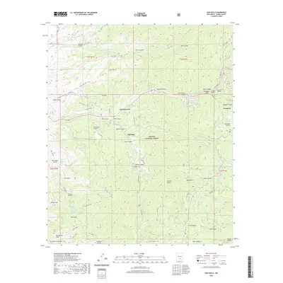
(12)- 2004 Map of High Rolls, 2006 Print
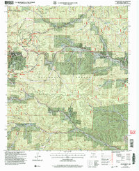
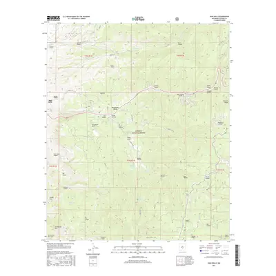
 2004 High Rolls2006 Print · USGSThe mountain communities of High Rolls and Mountain Park are captured at the start of the 21st century as they transition between agricultural roots and modern forest life. Researchers can trace the layout of Russia, identify a hillside cemetery, and locate old resource sites like the Gravel Pit or mine.
 - 2004 Map of Cloudcroft, 2006 Print
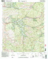
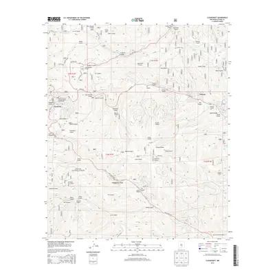
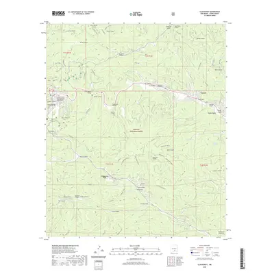
 2004 Cloudcroft2006 Print · USGSCloudcroft and its surrounding mountain canyons are shown here in the early 2000s as a thriving center for recreation and forestry. Researchers can locate the Bass Cem, trace the trails around the Ski Cloudcroft Ski Area, or find landmarks like Wofford Lookout Tower.
 - 2011 Map of High Rolls, 2011 Print
 2011 High Rolls2011 Print · USGSCovers Cloudcroft, including High Rolls, Mountain Park, and other nearby areas
 - 2011 Map of Cloudcroft, 2011 Print
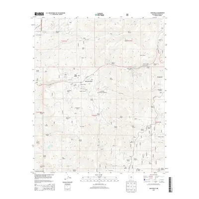
 2011 Cloudcroft2011 Print · USGSCovers Cloudcroft, including Chippeway Park, Wimsatt, and other nearby areas
 - 2013 Map of Cloudcroft, 2013 Print
 2013 Cloudcroft2013 Print · USGSCovers Cloudcroft, including Chippeway Park, Wimsatt, and other nearby areas
 - 2013 Map of High Rolls, 2013 Print
 2013 High Rolls2013 Print · USGSCovers Cloudcroft, including High Rolls, Mountain Park, and other nearby areas
 - 2017 Map of High Rolls, 2017 Print
 2017 High Rolls2017 Print · USGSCovers Cloudcroft, including High Rolls, Mountain Park, and other nearby areas
 - 2017 Map of Cloudcroft, 2017 Print
 2017 Cloudcroft2017 Print · USGSCovers Cloudcroft, including Chippeway Park, Wimsatt, and other nearby areas
 - 2020 Map of High Rolls, 2020 Print
 2020 High Rolls2020 Print · USGSCovers Cloudcroft, including High Rolls, Mountain Park, and other nearby areas
 - 2020 Map of Cloudcroft, 2020 Print
 2020 Cloudcroft2020 Print · USGSCovers Cloudcroft, including Chippeway Park, Wimsatt, and other nearby areas
 - 2023 Map of High Rolls, 2023 Print
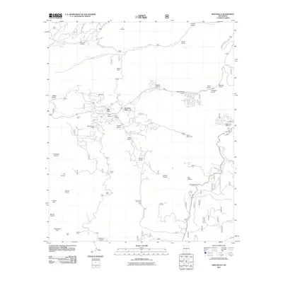
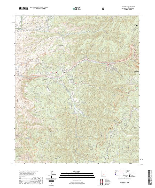 2023 High Rolls2023 Print · USGSThe Sacramento Mountains of southern New Mexico are shown here at a high level of detail in the early 2020s. Researchers can trace old transportation routes and water sources like Old Railroad Rd, Goat Ranch Spring, and Courtney Mine Trl.
 - 2023 Map of Cloudcroft, 2023 Print
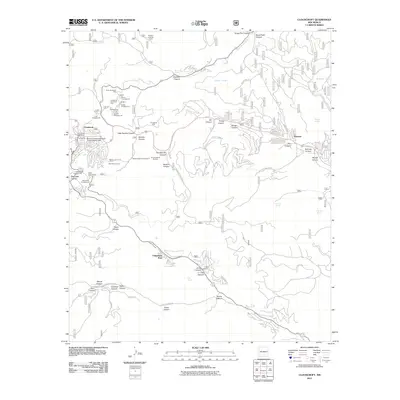
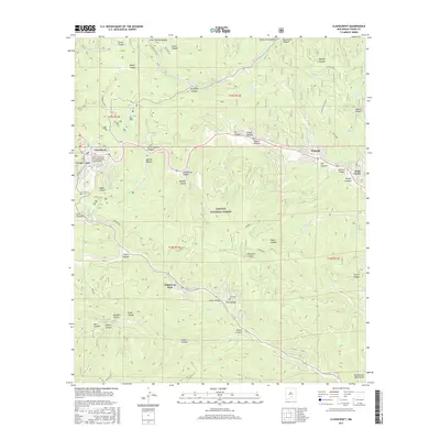
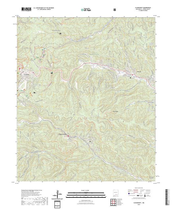 2023 Cloudcroft2023 Print · USGSThe mountain village of Cloudcroft is the centerpiece of this contemporary study of the Sacramento Mountains in Otero County. Researchers can trace the legacy of high-altitude settlement through features like Baird Cem, the Chippeway Park community, and Silver Springs.
End of results
Showing maps 1-12 of 12
Top cities near Cloudcroft
Frequently asked questions
- What are the different types of historical maps available for Cloudcroft?
- What is the oldest map of Cloudcroft?
- Where can I purchase historical maps of Cloudcroft for my home or office?
- Where can I download high-res historical maps of Cloudcroft?
- Are there historical topographic maps available for Cloudcroft?
- Is there historical aerial imagery available for Cloudcroft?
- Where are historical maps of Cloudcroft sourced from?