2000s (21st Century) Maps of Las Vegas, New Mexico
Explore 16 historic maps of Las Vegas from the 2000s (21st Century). These maps offer a rare glimpse into what life looked like during the 2000s — showing old roads, neighborhoods, homes, and landmarks that have changed or disappeared over time.
Whether you're researching your family's past, planning a metal detecting trip, or studying how Las Vegas's landscape evolved across the 2000s, these high-resolution maps are a powerful tool for exploring the history of this region.
- Focus on a specific era: All maps on this page are from the 2000s, giving you a focused view of this time period.
- See what’s changed: Compare century-old streets, trails, and buildings to today's modern landscape using overlays and satellite layers.
- Research with precision: Use these maps for genealogy, historical research, land use analysis, or educational projects.
- View, download, or print: Maps are fully viewable online in high resolution, and can be downloaded or printed for your own records.
Start exploring Las Vegas's history through authentic maps from the 2000s. This is your window into the past.
Las Vegas, NM maps
(16)- 2002 Map of Ojitos Frios, 2003 Print
 2002 Ojitos Frios2003 Print · USGSSan Miguel County ranching culture and high-desert terrain are mapped here at the turn of the millennium. Researchers can locate the Ojitos Frios post office, the Santo Niño Church at La Manga, and the historic Box Ranch.
 - 2010 Map of Las Vegas NW, 2010 Print
 2010 Las Vegas NW2010 Print · USGSCovers Las Vegas, including Ruby Ranch, Emplazado, and other nearby areas
 - 2010 Map of Ojitos Frios, 2010 Print
 2010 Ojitos Frios2010 Print · USGSCovers Las Vegas, including Agua Zarca, Lagunas, and other nearby areas
 - 2010 Map of Las Vegas, 2010 Print
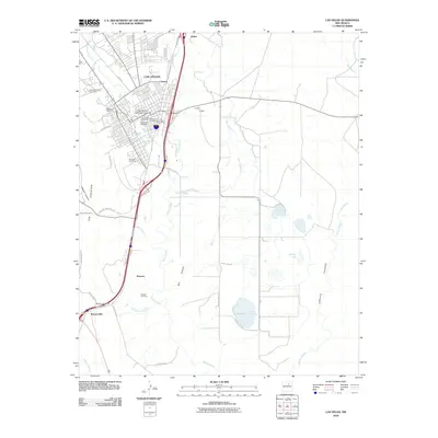 2010 Las Vegas2010 Print · USGSCovers Las Vegas, including Romeroville, Arriba, and other nearby areas
 - 2013 Map of Las Vegas NW, 2013 Print
 2013 Las Vegas NW2013 Print · USGSCovers Las Vegas, including Ruby Ranch, Emplazado, and other nearby areas
 - 2013 Map of Ojitos Frios, 2013 Print
 2013 Ojitos Frios2013 Print · USGSCovers Las Vegas, including Agua Zarca, Lagunas, and other nearby areas
 - 2013 Map of Las Vegas, 2013 Print
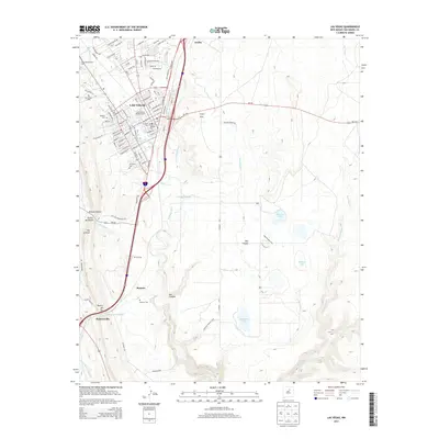 2013 Las Vegas2013 Print · USGSCovers Las Vegas, including Romeroville, Arriba, and other nearby areas
 - 2017 Map of Ojitos Frios, 2017 Print
 2017 Ojitos Frios2017 Print · USGSCovers Las Vegas, including Agua Zarca, Lagunas, and other nearby areas
 - 2017 Map of Las Vegas NW, 2017 Print
 2017 Las Vegas NW2017 Print · USGSCovers Las Vegas, including Ruby Ranch, Emplazado, and other nearby areas
 - 2017 Map of Las Vegas, 2017 Print
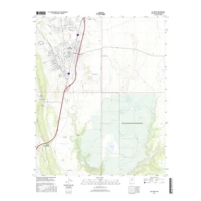 2017 Las Vegas2017 Print · USGSCovers Las Vegas, including Romeroville, Arriba, and other nearby areas
 - 2020 Map of Las Vegas, 2020 Print
 2020 Las Vegas2020 Print · USGSCovers Las Vegas, including Romeroville, Arriba, and other nearby areas
 - 2020 Map of Ojitos Frios, 2020 Print
 2020 Ojitos Frios2020 Print · USGSCovers Las Vegas, including Agua Zarca, Lagunas, and other nearby areas
 - 2020 Map of Las Vegas NW, 2020 Print
 2020 Las Vegas NW2020 Print · USGSCovers Las Vegas, including Ruby Ranch, Emplazado, and other nearby areas
 - 2023 Map of Las Vegas NW, 2023 Print
 2023 Las Vegas NW2023 Print · USGSThe northwestern edge of Las Vegas and its surrounding highlands are captured in this 2023 survey. Historians and residents can trace the development near Las Vegas and Arriba, or follow the water rights and drainage of the Storrie Lake Canal and Sapello River.
 - 2023 Map of Las Vegas, 2023 Print
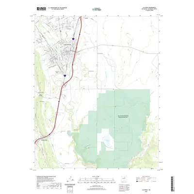
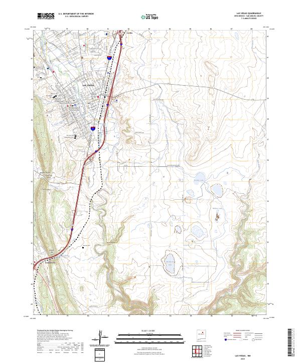 2023 Las Vegas2023 Print · USGSLas Vegas and the High Plains of San Miguel County are captured here in the early twenty-first century as the city’s historic core meets the open range. Researchers can trace local lineage through a dozen community sites like Montefiore Cem, Romero Cem, and New Mexico Highlands University.
 - 2023 Map of Ojitos Frios, 2023 Print
 2023 Ojitos Frios2023 Print · USGSSan Miguel County's high-desert canyons and small ranching communities are captured here in the early 2020s. Genealogists can trace the La Manga Cem and the settlement at Ojitos Frios, while hikers can locate Tecolote Peak and the unique ridge of The Creston.
End of results
Showing maps 1-16 of 16
Frequently asked questions
- What are the different types of historical maps available for Las Vegas?
- What is the oldest map of Las Vegas?
- Where can I purchase historical maps of Las Vegas for my home or office?
- Where can I download high-res historical maps of Las Vegas?
- Are there historical topographic maps available for Las Vegas?
- Is there historical aerial imagery available for Las Vegas?
- Where are historical maps of Las Vegas sourced from?