Old Maps of Las Vegas, New Mexico for Academic Research
Study the evolution of Las Vegas with 25 high-resolution historic maps. Whether you're teaching, researching, or modeling changes in land use, these maps provide essential visual documentation of urban, environmental, and geographic change.
- Analyze long-term change: Track patterns in development, transportation, and natural features.
- Ideal for environmental or urban studies: Support academic projects with primary historical map data.
- Use in the classroom or lab: Educators and researchers rely on these maps to bring historical context to life.
These maps are a powerful tool for teaching, research, and visualizing how Las Vegas has changed over the decades.
Las Vegas, NM maps
(25)- 1889 Map of Las Vegas, 1953 Print
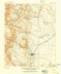 1889 Las Vegas1953 Print · USGSNorthern New Mexico in the late nineteenth century is documented here as the railroad brought new life to the high plains. Researchers can trace the early layout of Las Vegas, find the strategic site of Fort Union, and locate vanished plazas like Loma Parda.
 - 1891 Map of Las Vegas
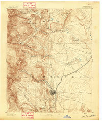
 1891 Las Vegas1891 Print · USGSNorthern New Mexico's transition from frontier outposts to a rail-connected territory is visible in this survey from the late nineteenth century. Genealogists and historians can trace the foundations of Las Vegas and its connection to Fort Union and Hot Springs.
 - 1893 Map of Las Vegas
 1893 Las Vegas1893 Print · USGSSan Miguel and Mora counties are captured here in the final decade of the nineteenth century as the railroad transformed the territory. Trace early travel routes through Las Vegas and locate historic outposts like Fort Union and La Cueva.5 unique versions available
 - 1954 Map of Santa Fe, 1963 Print
 1954 Santa Fe1963 Print · USGSNew Mexico's high mountains and eastern plains meet in the mid-fifties, showing a landscape defined by the Sangre de Cristo Mountains and the Pecos River. Trace family roots and local history through San Christobal Church, Sena School, and the historic Las Vegas rail corridor.4 unique versions available
 - 1958 Map of Santa Fe
 1958 Santa Fe1958 Print · USGSThe Sangre De Cristo Mountains meet the high plains in the late 1950s, showing a landscape defined by rail corridors and ranching. Genealogists can trace family-named sites like Upton Ranch or visit the Fort Union (Ruins) and Tuloso School.
 - 1961 Map of Ojitos Frios, 1966 Print
 1961 Ojitos Frios1966 Print · USGSSan Miguel County is captured here in the early sixties, showing the rural ranching life and early settlements southwest of Las Vegas. Researchers can trace the grounds of Ojitos Frios, locate the Santo Niño Ch, and follow the ridge of The Creston.
 - 1963 Map of Las Vegas, 1965 Print
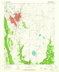 1963 Las Vegas1965 Print · USGSLas Vegas, New Mexico, serves as a bustling rail and trail hub in the early sixties. Genealogists and historians can trace family sites from Romeroville to the campus of Highlands University and along the historic Santa Fe Trail.
 - 1963 Map of Las Vegas NW, 1965 Print
 1963 Las Vegas NW1965 Print · USGSNorth of the city in the early sixties, this area shows the historic intersection of the Old Santa Fe Trail and the high-altitude irrigation of the Storrie Lake project. Researchers can locate St Anthonys Cemetery, the Santo Nino Ch, and early aviation at the Las Vegas Municipal Airport.
 - 1983 Map of Santa Fe, 1984 Print
 1983 Santa Fe1984 Print · USGSThe high Sangre de Cristo Mountains and the growing state capital define this early 1980s landscape during a period of expanding infrastructure. Researchers can trace historic land patterns and transit routes from Nambe Pueblo and Glorieta Pass to the Atchison Topeka and Santa Fe RR line.
 - 2002 Map of Ojitos Frios, 2003 Print
 2002 Ojitos Frios2003 Print · USGSSan Miguel County ranching culture and high-desert terrain are mapped here at the turn of the millennium. Researchers can locate the Ojitos Frios post office, the Santo Niño Church at La Manga, and the historic Box Ranch.
 - 2010 Map of Las Vegas NW, 2010 Print
 2010 Las Vegas NW2010 Print · USGSCovers Las Vegas, including Ruby Ranch, Emplazado, and other nearby areas
 - 2010 Map of Ojitos Frios, 2010 Print
 2010 Ojitos Frios2010 Print · USGSCovers Las Vegas, including Agua Zarca, Lagunas, and other nearby areas
 - 2010 Map of Las Vegas, 2010 Print
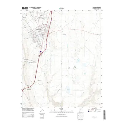
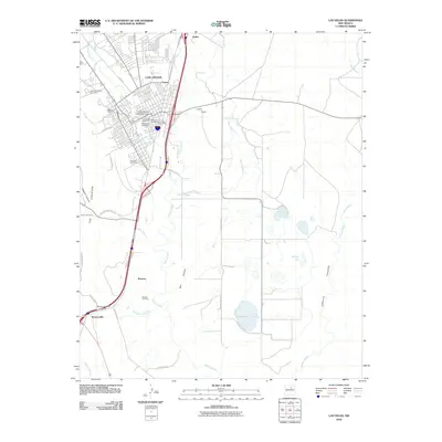 2010 Las Vegas2010 Print · USGSCovers Las Vegas, including Romeroville, Arriba, and other nearby areas
 - 2013 Map of Las Vegas NW, 2013 Print
 2013 Las Vegas NW2013 Print · USGSCovers Las Vegas, including Ruby Ranch, Emplazado, and other nearby areas
 - 2013 Map of Ojitos Frios, 2013 Print
 2013 Ojitos Frios2013 Print · USGSCovers Las Vegas, including Agua Zarca, Lagunas, and other nearby areas
 - 2013 Map of Las Vegas, 2013 Print
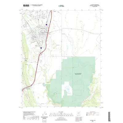
 2013 Las Vegas2013 Print · USGSCovers Las Vegas, including Romeroville, Arriba, and other nearby areas
 - 2017 Map of Ojitos Frios, 2017 Print
 2017 Ojitos Frios2017 Print · USGSCovers Las Vegas, including Agua Zarca, Lagunas, and other nearby areas
 - 2017 Map of Las Vegas NW, 2017 Print
 2017 Las Vegas NW2017 Print · USGSCovers Las Vegas, including Ruby Ranch, Emplazado, and other nearby areas
 - 2017 Map of Las Vegas, 2017 Print
 2017 Las Vegas2017 Print · USGSCovers Las Vegas, including Romeroville, Arriba, and other nearby areas
 - 2020 Map of Las Vegas, 2020 Print
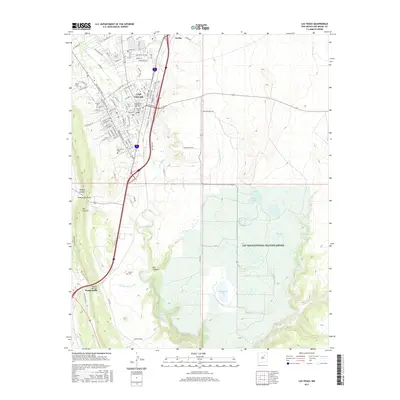
 2020 Las Vegas2020 Print · USGSCovers Las Vegas, including Romeroville, Arriba, and other nearby areas
 - 2020 Map of Ojitos Frios, 2020 Print
 2020 Ojitos Frios2020 Print · USGSCovers Las Vegas, including Agua Zarca, Lagunas, and other nearby areas
 - 2020 Map of Las Vegas NW, 2020 Print
 2020 Las Vegas NW2020 Print · USGSCovers Las Vegas, including Ruby Ranch, Emplazado, and other nearby areas
 - 2023 Map of Las Vegas NW, 2023 Print
 2023 Las Vegas NW2023 Print · USGSThe northwestern edge of Las Vegas and its surrounding highlands are captured in this 2023 survey. Historians and residents can trace the development near Las Vegas and Arriba, or follow the water rights and drainage of the Storrie Lake Canal and Sapello River.
 - 2023 Map of Las Vegas, 2023 Print
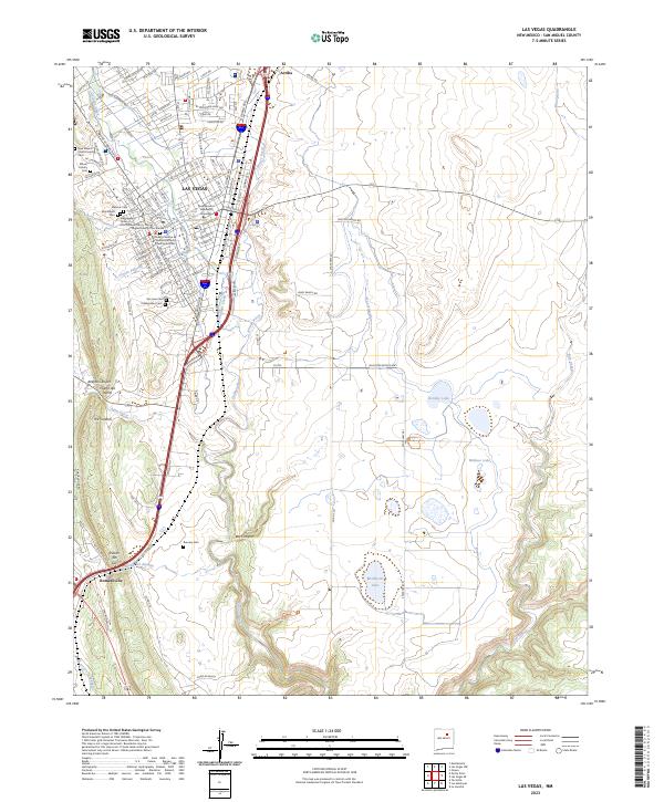 2023 Las Vegas2023 Print · USGSLas Vegas and the High Plains of San Miguel County are captured here in the early twenty-first century as the city’s historic core meets the open range. Researchers can trace local lineage through a dozen community sites like Montefiore Cem, Romero Cem, and New Mexico Highlands University.
 - 2023 Map of Ojitos Frios, 2023 Print
 2023 Ojitos Frios2023 Print · USGSSan Miguel County's high-desert canyons and small ranching communities are captured here in the early 2020s. Genealogists can trace the La Manga Cem and the settlement at Ojitos Frios, while hikers can locate Tecolote Peak and the unique ridge of The Creston.
End of results
Showing maps 1-25 of 25
Frequently asked questions
- What are the different types of historical maps available for Las Vegas?
- What is the oldest map of Las Vegas?
- Where can I purchase historical maps of Las Vegas for my home or office?
- Where can I download high-res historical maps of Las Vegas?
- Are there historical topographic maps available for Las Vegas?
- Is there historical aerial imagery available for Las Vegas?
- Where are historical maps of Las Vegas sourced from?