Old Maps of Rio Rancho, New Mexico for Academic Research
Study the evolution of Rio Rancho with 61 high-resolution historic maps. Whether you're teaching, researching, or modeling changes in land use, these maps provide essential visual documentation of urban, environmental, and geographic change.
- Analyze long-term change: Track patterns in development, transportation, and natural features.
- Ideal for environmental or urban studies: Support academic projects with primary historical map data.
- Use in the classroom or lab: Educators and researchers rely on these maps to bring historical context to life.
These maps are a powerful tool for teaching, research, and visualizing how Rio Rancho has changed over the decades.
Rio Rancho, NM maps
(61)- 1888 Map of Bernalillo, 1951 Print
 1888 Bernalillo1951 Print · USGSThe Middle Rio Grande valley appears here in the late nineteenth century, just as the railroad began to reshape the high desert. Genealogists and historians can trace the early footprints of Albuquerque, Bernalillo, and traditional communities like Atrisco and Santa Ana.
 - 1889 Map of Albuquerque
 1889 Albuquerque1889 Print · USGSAlbuquerque and the Rio Grande Valley appear here during the expansion of the territorial railroad system. Local historians can trace the early rail corridor of the Atchison Topeka and Santa Fe Railroad and find early river settlements like Bernalillo, Alameda, and Artisco.
 - 1893 Map of Albuquerque
 1893 Albuquerque1893 Print · USGSThe Rio Grande valley in the late nineteenth century is a study in river-fronting settlements and the emerging rail economy. Genealogists can trace the early footprints of Albuquerque, Bernalillo, and the traditional community at Artisco.5 unique versions available
 - 1934 Map of Griegos
 1934 Griegos1934 Print · USGSThe Rio Grande valley north of Albuquerque is shown here in the mid-thirties as a landscape of historic land grants and complex irrigation. Genealogists and historians can trace the early rail-and-road network near Hahn Station and the Alameda Bridge.
 - 1938 Map of Albuquerque
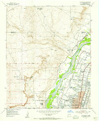
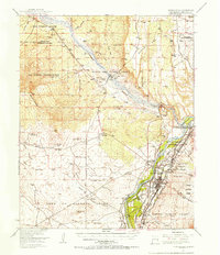
 1938 Albuquerque1938 Print · USGSAlbuquerque and the Rio Grande Valley are shown in the late 1930s, when irrigation ditches still defined the rural landscape between the river and the mountains. Researchers can trace ancestral lands through the Town of Atrisco Grant or locate landmarks like the U S Indian School and Old Albuquerque.
 - 1953 Map of Bernalillo NW, 1955 Print
 1953 Bernalillo NW1955 Print · USGSNative American lands in Sandoval County are captured here in the early fifties, showcasing the vast Zia Indian Reservation. Researchers can trace the path of an Old Railroad Grade and find remote landmarks like the Jemez Windmill and Ojito.2 unique versions available
 - 1954 Map of Volcano Ranch, 1955 Print
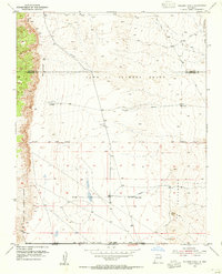 1954 Volcano Ranch1955 Print · USGSNew Mexico's high desert west of the Rio Grande is captured here in the mid-fifties, showing a landscape still defined by historic land grants. Genealogists and historians can trace old ranching outposts like Volcano Ranch and Black Ranch near the prominent peaks of The Volcanoes.4 unique versions available
 - 1954 Map of Loma Machete, 1955 Print
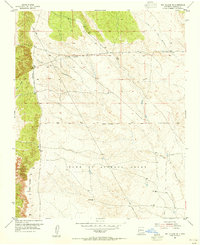
 1954 Loma Machete1955 Print · USGSSandoval County's arid high-desert landscape is captured here in the mid-1950s, highlighting the expansive historical boundaries of the Town of Alameda Grant. Researchers can trace old arroyos and land markers like Picuda Peak, Loma Barbon, and the AQUEDUCT route.3 unique versions available
 - 1954 Map of Sky Village SE, 1955 Print
 1954 Sky Village SE1955 Print · USGSSandoval County's arid ranchlands and historical land grants are captured here in the mid-1950s. You can trace the infrastructure of the high desert, from the Aqueduct to family-named sites like Mentira Well and the Town of Alameda Grant.2 unique versions available
 - 1954 Map of Los Griegos, 1955 Print
 1954 Los Griegos1955 Print · USGSNorth of Albuquerque in the mid-fifties, the Rio Grande valley is a patchwork of historic land grants and expanding neighborhoods. Trace family sites near Los Griegos or follow old irrigation routes like the Albuquerque Main Canal and Corrales Lateral.
 - 1954 Map of Bernalillo, 1955 Print
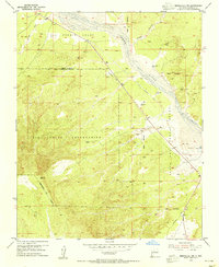
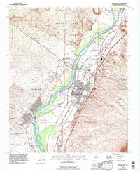
 1954 Bernalillo1955 Print · USGSThe Rio Grande valley in the mid-fifties reveals a landscape of ancient land grants and complex irrigation networks. Genealogists and local historians can trace family-named sites and historic settlements like El Llanito, the Pilgrim Indian Mission Sch, and the Bernalillo Cem.3 unique versions available
 - 1954 Map of Bernalillo, 1957 Print
 1954 Bernalillo1957 Print · USGSThe Rio Grande valley in the mid-1950s reveals a complex landscape of ancestral pueblo grants and historic irrigation acequias. Researchers can trace the path of El Camino Real, locate the Pilgrim Indian Mission Sch, and find family-named landmarks like Loma Barbon.
 - 1958 Map of Albuquerque
 1958 Albuquerque1958 Print · USGSAlbuquerque and the surrounding high desert are captured here during a period of massive federal expansion and postwar growth. Researchers can trace the development of Kirtland Air Force Base, find ancestral homes in Pueblo de Santa Ana, or locate industrial sites like the Jackpile Mine.
 - 1960 Map of Los Griegos
 1960 Los Griegos1960 Print · USGSThe Rio Grande valley north of Albuquerque is captured here during a period of suburban growth into traditional grant lands. Researchers can trace the extensive irrigation network and find sites like St Joseph College, Los Poblanos Ranch, and the A T & S F RR.3 unique versions available
 - 1960 Map of Sky Village NE, 1963 Print
 1960 Sky Village NE1963 Print · USGSHigh desert ranching and tribal lands in New Mexico come to life in this early 1960s survey. Researchers can trace the drainage of Arroyo Ojito and locate historic points like Tenorio Ranch and the waters of Laguna de Baca.2 unique versions available
 - 1962 Map of Albuquerque
 1962 Albuquerque1962 Print · USGSAlbuquerque and the surrounding high desert are captured here in the early 1960s during a period of intense mineral and military growth. Genealogists and historians can locate early schools like the Pueblo Pintado School, major industrial sites like the Jackpile Mine, and the sprawling Kirtland Air Force Base.
 - 1963 Map of Albuquerque, 1965 Print
 1963 Albuquerque1965 Print · USGSMid-century New Mexico unfolds across this map, showcasing the intersection of ancient pueblos, modern military bases, and historic mining districts. Trace family roots and local history through the Ortiz Mine, Seven Lakes Trading Post, and Alameda.3 unique versions available
 - 1978 Map of Albuquerque, 1986 Print
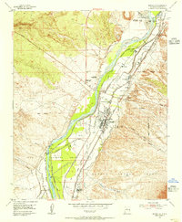
 1978 Albuquerque1986 Print · USGSGreater Albuquerque and the Rio Grande valley are captured here during a period of significant suburban expansion in the late seventies. Researchers can trace the early Subdivision Road Pattern near Rio Rancho and the historic footprints of Santa Ana Pueblo and Bernalillo.
 - 1983 Map of Albuquerque, 1984 Print
 1983 Albuquerque1984 Print · USGSCentral New Mexico in the early eighties shows a landscape where ancient pueblos and modern aerospace hubs meet. Trace the routes of the Atchison Topeka and Santa Fe RR or locate landmarks like Kirtland Air Force Base, Madrid, and the Sandia Mountains.
 - 1990 Map of Los Griegos, 1996 Print
 1990 Los Griegos1996 Print · USGSThe Middle Rio Grande Valley in the early nineties shows a landscape of rapid suburban expansion meeting ancient heritage. Researchers can trace historic landmarks like Los Poblanos Ranch and the cultural sites of Petroglyph National Monument.
 - 1990 Map of The Volcanoes, 1996 Print
 1990 The Volcanoes1996 Print · USGSThe West Mesa of Albuquerque comes into focus during the 1990s, showcasing the distinct cinder cones and ancient land grants of the high desert. Researchers can trace the volcanic chain from Vulcan Volcano to J A Volcano and locate early 20th-century remnants like Black Ranch.
 - 1990 Map of Arroyo De Las Calabacillas, 1996 Print
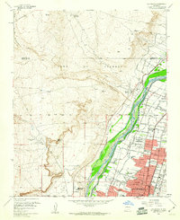
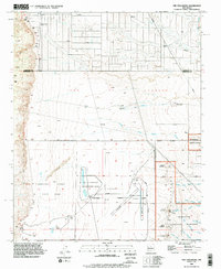
 1990 Arroyo De Las Calabacillas1996 Print · USGSSandoval County during the early nineties shows the desert landscape north of Albuquerque as modern infrastructure met historic land grants. Trace the Grant Boundary and the winding Arroyo de las Calabacillas near the rising community of Rio Rancho.
 - 1990 Map of Bernalillo, 1996 Print
 1990 Bernalillo1996 Print · USGSBernalillo and the Rio Grande valley are captured here in the early nineties during a period of suburban expansion alongside ancient pueblo lands. Trace irrigation history through the Bernalillo No 1 Lateral and find local landmarks like Carroll Sch or Sandia Pueblo.
 - 1990 Map of Loma Machete, 1996 Print
 1990 Loma Machete1996 Print · USGSSandoval County during a period of rapid suburban expansion shows the desert landscape being reshaped by new residential development. Trace the early street grids of Rio Rancho and Corrales alongside topographic landmarks like Picuda Peak and the Santa Ana Indian Reservation.
 - 1990 Map of Bernalillo NW, 1996 Print
 1990 Bernalillo NW1996 Print · USGSTribal lands in Sandoval County are captured here in the 1990s as the high desert landscape meets the Jemez River. Researchers can trace the path of an Old Railroad Grade and locate water landmarks like the Jemez Windmill.
Showing maps 1-25 of 61
Top cities near Rio Rancho
- Albuquerque historical maps
- Bernalillo historical maps
- Corrales historical maps
- Los Ranchos de Albuquerque historical maps
- Paradise Hills historical maps
Top neighborhoods of Rio Rancho
Frequently asked questions
- What are the different types of historical maps available for Rio Rancho?
- What is the oldest map of Rio Rancho?
- Where can I purchase historical maps of Rio Rancho for my home or office?
- Where can I download high-res historical maps of Rio Rancho?
- Are there historical topographic maps available for Rio Rancho?
- Is there historical aerial imagery available for Rio Rancho?
- Where are historical maps of Rio Rancho sourced from?