2020s Maps of Allegany County, New York
Explore 35 historic maps of Allegany County from the 2020s. These maps offer a rare glimpse into what life looked like during the 2020s — showing old roads, neighborhoods, homes, and landmarks that have changed or disappeared over time.
Whether you're researching your family's past, planning a metal detecting trip, or studying how Allegany County's landscape evolved across the 2020s, these high-resolution maps are a powerful tool for exploring the history of this region.
- Focus on a specific era: All maps on this page are from the 2020s, giving you a focused view of this time period.
- See what’s changed: Compare century-old streets, trails, and buildings to today's modern landscape using overlays and satellite layers.
- Research with precision: Use these maps for genealogy, historical research, land use analysis, or educational projects.
- View, download, or print: Maps are fully viewable online in high resolution, and can be downloaded or printed for your own records.
Start exploring Allegany County's history through authentic maps from the 2020s. This is your window into the past.
Allegany County, NY maps
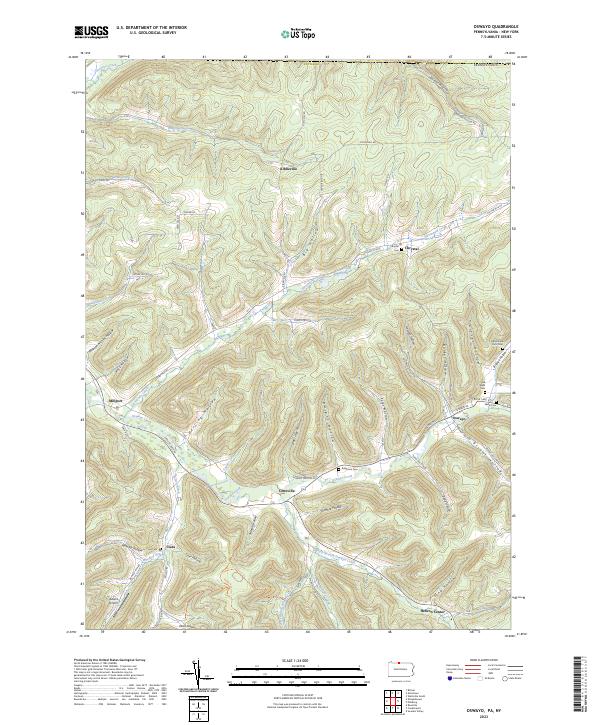
(35)- 2023 Map of Ellisburg, 2023 Print
 2023 Ellisburg2023 Print · USGSPotter County and the New York borderlands appear here in a landscape of deep hollows and rural crossroad communities. Researchers can trace family history through several landmark burial sites like Andrews Settlement Cem and explore small hamlets including Eleven Mile and Kinney.
 - 2023 Map of Harrison Valley, 2023 Print
 2023 Harrison Valley2023 Print · USGSHarrison Valley and the high ridges of Potter County are mapped here just south of the New York state line. Researchers can trace rural lineages through the English Family Cem, locate the small settlement of Mills, and follow the headwaters of the Genesee River.
 - 2023 Map of Ulysses, 2023 Print
 2023 Ulysses2023 Print · USGSPotter County hill country in the twenty-first century reveals a landscape of isolated villages and family burial grounds. Researchers can trace the rural layout of Ulysses, Newfield, and Bingham Center or locate the Old Lewisville Cem.
 - 2023 Map of Birdsall, 2023 Print
 2023 Birdsall2023 Print · USGSThe rural uplands of Allegany County are documented here in the early twenty-first century, showing a landscape shaped by high ridges and valley wetlands. Researchers can locate ancestral burial grounds like German Settlement Cem and trace old routes such as Dutch Settlement Rd near the waters of Jones Pond.
 - 2023 Map of Bliss, 2023 Print
 2023 Bliss2023 Print · USGSModern-day Wyoming County remains a landscape of high plateaus and creek headwaters, as seen here in the early twenty-first century. Genealogists and local historians can locate long-standing sites like Saint Mary's Cem, Cadwell Corners, and the settlement of Bliss.
 - 2023 Map of Belmont, 2023 Print
 2023 Belmont2023 Print · USGSWestern New York's river valleys and wooded ridges come alive in this contemporary record of Allegany County. Genealogists and historians can trace the rural landscape across Belmont and Friendship, locating family-named landmarks and sites like Norton Cem or Inavale.
 - 2023 Map of Angelica, 2023 Print
 2023 Angelica2023 Print · USGSAllegany County's river-valley settlements are captured here in the early twenty-first century, showing the enduring layout of the Genesee corridor. Researchers can trace local lineage through sites like Until the Day Dawn Cem or the historic Genesee Valley Canal.
 - 2023 Map of Alfred, 2023 Print
 2023 Alfred2023 Print · USGSAllegany County is centered here on the storied college town of Alfred as it appears in the early twenty-first century. Researchers can trace the layout of SUNY Alfred State College, find historic burials at Stillman Cem, or locate hamlets like Hiltonville and Tinkertown.
 - 2023 Map of Cuba, 2023 Print
 2023 Cuba2023 Print · USGSThe Cuba area in the twenty-first century maintains its character as a valley-centered network of crossroads and watercourses. Researchers can locate family landmarks like Bristol Cem or trace the early industrial significance of the Seneca Oil Spring.
 - 2023 Map of Bolivar, 2023 Print
 2023 Bolivar2023 Print · USGSAllegany County’s Southern Tier reveals its valley-settlement patterns and ridge topography in this recent survey. Researchers can trace family history through sites like Little Genesee Cem, Richburg, and the crossroads at Halls Crossroads.
 - 2023 Map of West Almond, 2023 Print
 2023 West Almond2023 Print · USGSAllegany County’s high country is captured here in the early twenty-first century, showing the rural crossroads of West Almond and Phillips Creek. Local researchers can locate family burial sites at Potters Field County Home Cem and trace the paths of Black Creek through the hamlets of Scholes and Bennetts.
 - 2023 Map of Black Creek, 2023 Print
 2023 Black Creek2023 Print · USGSAllegany County's rural hamlets and creek valleys are documented here in the early twenty-first century. Researchers can trace historical routes along the Genesee Valley Canal and locate family landmarks like Bellville Cem and the settlement of McGrawville.
 - 2023 Map of Friendship, 2023 Print
 2023 Friendship2023 Print · USGSAllegany County's rolling upland terrain and tight-knit valley settlements are captured here in the early twenty-first century. Researchers can locate ancestral sites at Sacred Heart Cem or trace old routes through Clarksville Notch and Nile.
 - 2023 Map of Freedom, 2023 Print
 2023 Freedom2023 Print · USGSIn the hills of western New York, this contemporary survey captures the enduring rural character of the county line. Researchers can locate historic family plots and landmarks like Old Burying Grounds, Farmersville Station, and Crystal Lake.
 - 2023 Map of Fillmore, 2023 Print
 2023 Fillmore2023 Print · USGSThe Genesee River valley and the surrounding hills of Allegany County are documented here in the early twenty-first century. Researchers can trace rural landmarks from Fillmore to Short Tract, including sites like Pine Grove Cem and Saint Pauls Lutheran Church Cem.
 - 2023 Map of Pike, 2023 Print
 2023 Pike2023 Print · USGSWestern New York's rural crossroads are mapped in detail here as they appeared in the early 2020s. Researchers can locate family sites and local landmarks like Lyonsburg Cem, the village of Bliss, and the waters of Wiscoy Creek.
 - 2023 Map of Oswayo, 2023 Print
 2023 Oswayo2023 Print · USGSPotter County's northern hills and valleys appear in great detail, showing the rural character of the region in the early twenty-first century. Researchers can locate family burial sites like Old Brizzee Farm Cem and trace the paths of Elevenmile Creek through Millport and Oswayo.
 - 2023 Map of Shinglehouse, 2023 Print
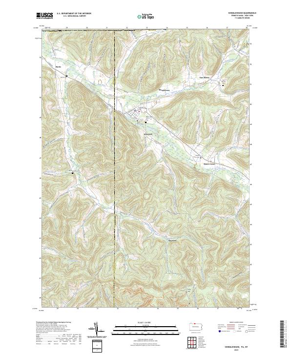 2023 Shinglehouse2023 Print · USGSPotter County near the New York border remains a landscape of deep valley hollows and small creek-side settlements. Trace family roots and local history through historic burial sites like Maple Grove Cem and rural hamlets such as Sunnyside and Shaytown.
 - 2023 Map of Bullis Mills, 2023 Print
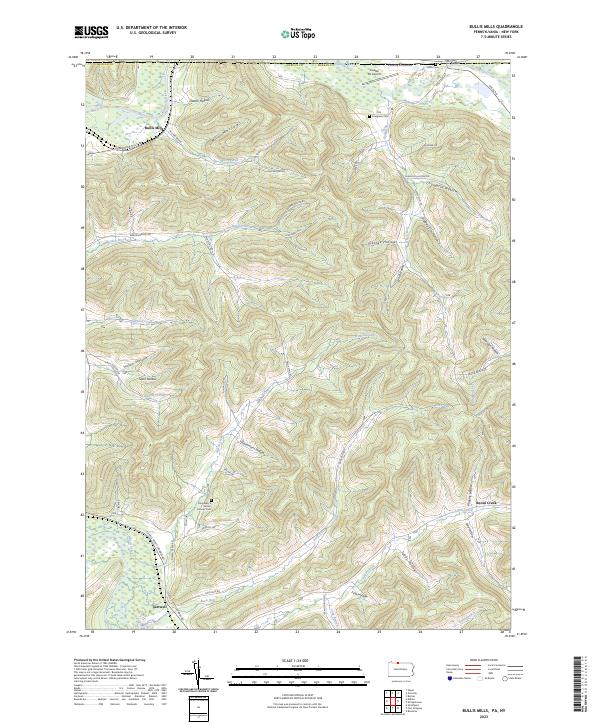 2023 Bullis Mills2023 Print · USGSMcKean County near the New York border is shown here in the 2020s, dominated by the winding Allegheny River and the small hamlet of Bullis Mills. Local historians can trace family-named sites like Saint Mary's Roman Catholic Cem and Ceres Cem.
 - 2023 Map of Rawson, 2023 Print
 2023 Rawson2023 Print · USGSThe Cattaraugus and Allegany county line divides this rural New York landscape as it appears today. Researchers can trace historic local routes like White Meeting House Rd and locate family burial sites at Hardys Corners Cem or Abbotts Cem.
 - 2023 Map of Portville, 2023 Print
 2023 Portville2023 Print · USGSThe Allegheny River valley comes into focus in this recent survey of the New York borderlands. Researchers can locate early family plots like West Genesee Cem and settlements such as Weston Mills, Portville, and Ceres.
 - 2023 Map of Ossian, 2023 Print
 2023 Ossian2023 Print · USGSThe rural highlands of Livingston County are documented here in the early twenty-first century, showcasing the area's agricultural roots and deep woods. Genealogists can locate family sites near Ossian Center Cem, Byersville, and along Sugar Creek.
 - 2023 Map of Arkport, 2023 Print
 2023 Arkport2023 Print · USGSSteuben County and the surrounding uplands are mapped here in the early twenty-first century, showing a landscape of deep hollows and high ridges. Genealogists can locate several historic burial sites, including Doty's Corners Cem, Burns Cem, and Oak Hill Cem.
 - 2023 Map of Nunda, 2023 Print
 2023 Nunda2023 Print · USGSLivingston County's rural character and small-town settlements are documented here in the early twenty-first century. Genealogists can trace family burial sites like Seager Cem and Oakland Cem along the waters of Keshequa Creek.
 - 2023 Map of Hornell, 2023 Print
 2023 Hornell2023 Print · USGSModern Hornell and its surrounding valleys are captured here in the early 2020s, showing the settled corridor along the Canisteo River. Researchers can trace family history through a high density of burial sites like Amos White Cem and Rural Cem.
Showing maps 1-25 of 35
Top cities of Allegany County
- Wellsville historical maps
- Alfred historical maps
- Cuba historical maps
- Caneadea historical maps
- Amity historical maps
- Hume historical maps
See more
Frequently asked questions
- What are the different types of historical maps available for Allegany County?
- What is the oldest map of Allegany County?
- Where can I purchase historical maps of Allegany County for my home or office?
- Where can I download high-res historical maps of Allegany County?
- Are there historical topographic maps available for Allegany County?
- Is there historical aerial imagery available for Allegany County?
- Where are historical maps of Allegany County sourced from?