2020s Maps of Vestal, New York
Explore 4 historic maps of Vestal from the 2020s. These maps offer a rare glimpse into what life looked like during the 2020s — showing old roads, neighborhoods, homes, and landmarks that have changed or disappeared over time.
Whether you're researching your family's past, planning a metal detecting trip, or studying how Vestal's landscape evolved across the 2020s, these high-resolution maps are a powerful tool for exploring the history of this region.
- Focus on a specific era: All maps on this page are from the 2020s, giving you a focused view of this time period.
- See what’s changed: Compare century-old streets, trails, and buildings to today's modern landscape using overlays and satellite layers.
- Research with precision: Use these maps for genealogy, historical research, land use analysis, or educational projects.
- View, download, or print: Maps are fully viewable online in high resolution, and can be downloaded or printed for your own records.
Start exploring Vestal's history through authentic maps from the 2020s. This is your window into the past.
Vestal, NY maps
(4)- 2023 Map of Friendsville, 2023 Print
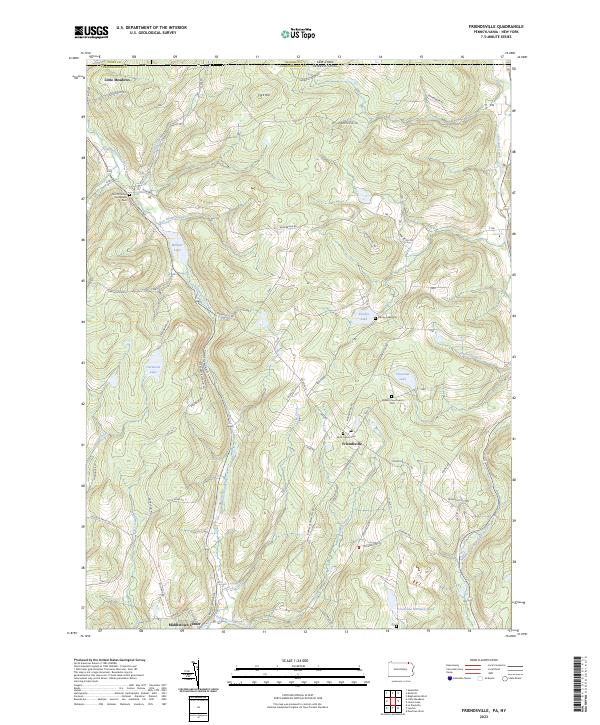 2023 Friendsville2023 Print · USGSSusquehanna County at the New York border remains a landscape of high ridges and quiet lake basins in the early twenty-first century. Researchers can locate family burial grounds and old crossroads at Quaker Churchyard Cem, Little Meadows, and Stanley Lake.
 - 2023 Map of Endicott, 2023 Print
 2023 Endicott2023 Print · USGSThe Susquehanna River valley near the New York and Pennsylvania border shows a landscape of established river towns and climbing hill country. Researchers can trace family history through several burial grounds like Riverside Cem and find landmarks such as the Tri-Cities Airport or Basket Lake.
 - 2023 Map of Laurel Lake, 2023 Print
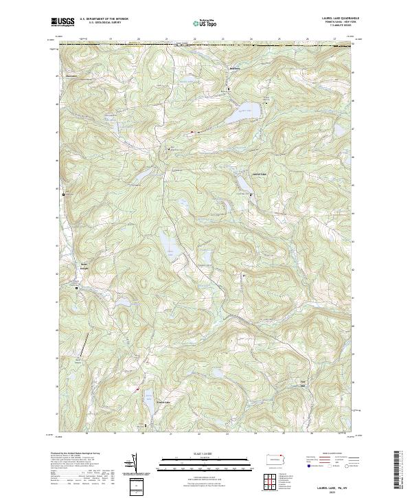 2023 Laurel Lake2023 Print · USGSThe Pennsylvania and New York border country comes alive in this 2023 survey of northern Susquehanna County. Researchers can trace rural lineages through sites like John Locke Cem, the community of Brackney, and the Saint Josephs Catholic Church.
 - 2023 Map of Binghamton West, 2023 Print
 2023 Binghamton West2023 Print · USGSThe Tri-Cities area of New York is shown in detail during its modern era, where the urban riverfront meets southern tier ridges. Researchers can trace institutional footprints at Binghamton University and locate historic burial grounds like Spring Forest Cem and Floral Park Cem.
End of results
Showing maps 1-4 of 4
Top cities near Vestal
- Union historical maps
- Binghamton historical maps
- Owego historical maps
- Johnson City historical maps
- Endicott historical maps
- Endwell historical maps
See more
Top neighborhoods of Vestal
- Willow Point historical maps
- Ross Corners historical maps
- Tracy Creek historical maps
- Twin Orchard historical maps
- South Vestal historical maps
- Tracy Creek historical maps
See more
Frequently asked questions
- What are the different types of historical maps available for Vestal?
- What is the oldest map of Vestal?
- Where can I purchase historical maps of Vestal for my home or office?
- Where can I download high-res historical maps of Vestal?
- Are there historical topographic maps available for Vestal?
- Is there historical aerial imagery available for Vestal?
- Where are historical maps of Vestal sourced from?