1960s Maps of Cattaraugus County, New York
Explore 36 historic maps of Cattaraugus County from the 1960s. These maps offer a rare glimpse into what life looked like during the 1960s — showing old roads, neighborhoods, homes, and landmarks that have changed or disappeared over time.
Whether you're researching your family's past, planning a metal detecting trip, or studying how Cattaraugus County's landscape evolved across the 1960s, these high-resolution maps are a powerful tool for exploring the history of this region.
- Focus on a specific era: All maps on this page are from the 1960s, giving you a focused view of this time period.
- See what’s changed: Compare century-old streets, trails, and buildings to today's modern landscape using overlays and satellite layers.
- Research with precision: Use these maps for genealogy, historical research, land use analysis, or educational projects.
- View, download, or print: Maps are fully viewable online in high resolution, and can be downloaded or printed for your own records.
Start exploring Cattaraugus County's history through authentic maps from the 1960s. This is your window into the past.
Cattaraugus County, NY maps
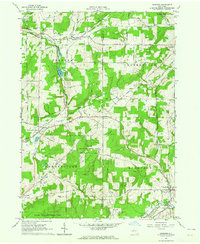
(36)- 1960 Map of Buffalo
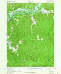
 1960 Buffalo1960 Print · USGSWestern New York and the Niagara Peninsula thrive during the mid-twentieth century industrial peak. Genealogists and historians can trace family-named points and early settlements from Dunkirk Light to the Allegany Indian Reservation.
 - 1960 Map of North Collins, 1962 Print
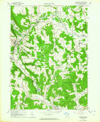
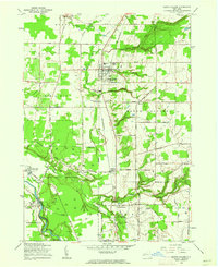 1960 North Collins1962 Print · USGSWestern New York at the start of the sixties shows a landscape of deep creek gulfs, active rail lines, and Seneca territory. Genealogists can locate the Friends Meetinghouse Burial Grounds, Cattaraugus Long House Ch, and the Gowanda State Hospital Annex.2 unique versions available
 - 1960 Map of Farnham, 1963 Print
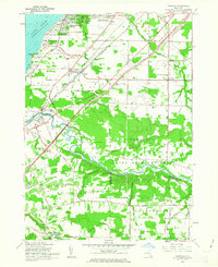 1960 Farnham1963 Print · USGSCoastal Erie County and the northern reaches of Chautauqua County are captured here in the early sixties, showing the intersection of new expressways and established lakeside communities. Researchers can trace family history through sites like St Anthonys Ch and the Rathburn Cem or explore the boundaries of the Cattaraugus Indian Reservation.2 unique versions available
 - 1961 Map of Olean, 1962 Print
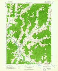
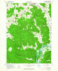
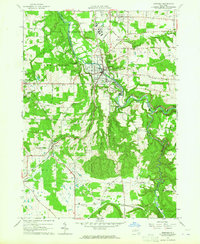
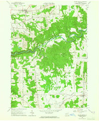
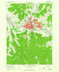 1961 Olean1962 Print · USGSOlean and Allegany are shown in the early sixties as bustling rail and river hubs near the Pennsylvania border. Genealogists and local historians can trace the grounds of St Bonaventure University, Mt View Cemetery, and the local oil field.3 unique versions available
 - 1961 Map of Salamanca, 1963 Print
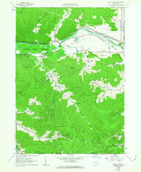
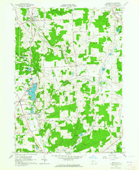
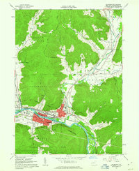 1961 Salamanca1963 Print · USGSSalamanca and the Allegheny River valley are shown here in the early sixties, a landscape defined by industrial rail lines and the surrounding reservation. Genealogists and historians can trace local landmarks like Wildwood Cem, School No 1, and the Whig St Ch.3 unique versions available
 - 1961 Map of Hinsdale, 1963 Print
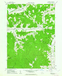
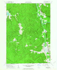
 1961 Hinsdale1963 Print · USGSCattaraugus County in the early 1960s shows a landscape of deep valleys defined by the meeting of Ischua Creek and Oil Creek. Genealogists and historians can trace rail history along the Erie Lackawanna Railroad or locate local landmarks like Maplehurst, Hinsdale Cem, and Union Valley Ch.
 - 1961 Map of Portville, 1963 Print
 1961 Portville1963 Print · USGSThe river valleys of southern New York come alive in this early 1960s survey of the Portville and Ceres area. Researchers can trace the Pennsylvania Railroad through Mill Grove or locate family roots at Chestnut Hill Cem and the West Genesee Ch.3 unique versions available
 - 1961 Map of Knapp Creek, 1963 Print
 1961 Knapp Creek1963 Print · USGSCattaraugus County in the early sixties reveals a landscape shaped by the Bradford Oil Field and the winding Allegheny River. Genealogists and local historians can trace the rural road networks and settlements of Vandalia, Chipmunk, and Knapp Creek alongside numerous oil and gas wells.2 unique versions available
 - 1961 Map of Humphrey, 1963 Print
 1961 Humphrey1963 Print · USGSThe hills of Cattaraugus County in the early sixties reveal a landscape of secluded hollows and small-scale oil extraction. Genealogists and historians can trace old homesteads and landmarks like St Pacificus Ch, Sugartown, and the Fivemile Cem.4 unique versions available
 - 1961 Map of Cuba, 1963 Print
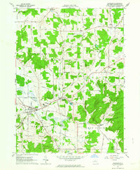
 1961 Cuba1963 Print · USGSCattaraugus and Allegany counties were defined by the intersection of rail transport and rural agriculture in the early sixties. Researchers can trace the path of the Pennsylvania railroad, identify the boundaries of the Oil Spring Indian Reservation, and locate family sites near Union Hill Cem.4 unique versions available
 - 1961 Map of Limestone, 1963 Print
 1961 Limestone1963 Print · USGSThe Cattaraugus County borderlands in the early sixties reveal a landscape of deep river valleys and intensive timber and mineral extraction. Genealogists and historians can locate Limestone and Irvine Mills, or trace the rail lines through Riverside Junction and Bradford Junction.4 unique versions available
 - 1962 Map of Randolph, 1964 Print
 1962 Randolph1964 Print · USGSCattaraugus County in the early sixties reveals a landscape of ridge-top farms and valley rail towns like Randolph. Researchers can trace old family roots at Axeville Cem, locate the Childrens Home, or follow the Erie-Lackawanna Railroad line.2 unique versions available
 - 1962 Map of Little Valley, 1964 Print
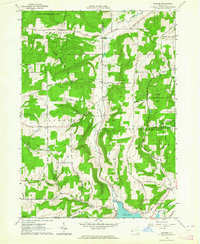
 1962 Little Valley1964 Print · USGSCattaraugus County is shown in the early 1960s as the Allegheny Reservoir began to alter the river valley. Genealogists and researchers can trace the Allegany Indian Reservation boundary, locate the Jimmersontown Ch, and follow the Erie-Lackawanna rail lines.5 unique versions available
 - 1962 Map of Steamburg, 1964 Print
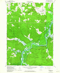 1962 Steamburg1964 Print · USGSThe Allegheny River valley is shown here in the early sixties just as the landscape was being reshaped by the rising Allegheny Reservoir. Local historians can trace soon-to-be-submerged settlements like Onoville and Oldtown, along with the Erie-Lackawanna rail corridor and rural schools like Cold Spring Sch No 3.3 unique versions available
 - 1962 Map of Red House, 1964 Print
 1962 Red House1964 Print · USGSCattaraugus County is shown here in the early sixties during the significant transition of the Allegheny River valley. Genealogists and local historians can trace family-named hollows and sites like the Red House Chapel, Seneca Ch, and the high ridges of Blacksnake Mountain.4 unique versions available
 - 1962 Map of Buffalo, 1980 Print
 1962 Buffalo1980 Print · USGSThe Niagara Frontier and Western New York are captured here in the early sixties, showing the vital industrial and maritime nexus between the U.S. and Canada. Researchers can trace the path of the Welland Canal, locate the Allegany Indian Reservation, or find family sites near Chautauqua Lake.2 unique versions available
 - 1963 Map of Cattaraugus, 1964 Print
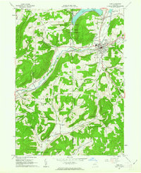
 1963 Cattaraugus1964 Print · USGSCattaraugus County in the early sixties shows a landscape of upland ridges and deep hollows connected by the Erie-Lackawanna railroad. Local historians can trace family land across Potter Hill Road, find the West Hill Cem, or locate the old Fairgrounds.3 unique versions available
 - 1963 Map of Franklinville, 1964 Print
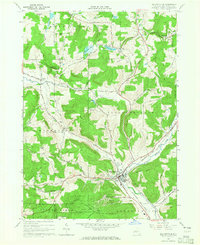
 1963 Franklinville1964 Print · USGSThe Ischua Creek valley in the early sixties remained a vital corridor for the Pennsylvania railroad and the hill towns of Cattaraugus County. Genealogists can locate family sites at Ten Broeck Cem, while industrial historians can trace the Coal Chutes near Cadiz.2 unique versions available
 - 1963 Map of Gowanda, 1964 Print
 1963 Gowanda1964 Print · USGSThe Erie and Cattaraugus county line comes alive in the early 1960s, showing the bustling village of Gowanda and the Erie-Lackawanna rail corridor. Trace family roots at Pine Grove Cem, the Pine Woods Ch, and the Gowanda State Hospital grounds.2 unique versions available
 - 1963 Map of New Albion, 1964 Print
 1963 New Albion1964 Print · USGSCattaraugus County in the early sixties is shown here as a landscape of crossroads hamlets and highland hollows. Trace family roots and local history through New Albion, the Erie-Lackawanna RR, and sites like Tug Hill Cem.2 unique versions available
 - 1963 Map of Delevan, 1964 Print
 1963 Delevan1964 Print · USGSCattaraugus County in the early sixties reveals a landscape defined by the intersection of the Pennsylvania Railroad and the Ischua Valley. Researchers can trace local genealogy through several burial sites like Maplehurst Cem and identify historical landmarks like the County Infirmary.3 unique versions available
 - 1963 Map of Freedom, 1964 Print
 1963 Freedom1964 Print · USGSCattaraugus and Allegany counties appear in the early sixties as a network of rail-linked hamlets and reforestation lands. Genealogists and historians can trace the Baltimore and Ohio Railroad through Freedom or locate the Old Burying Grounds and Salem Cem.3 unique versions available
 - 1963 Map of Rawson, 1964 Print
 1963 Rawson1964 Print · USGSThe rural borderlands of Cattaraugus and Allegany counties are shown here in the early sixties, highlighting the intersection of farming and state-managed conservation. Researchers can trace family homesteads along White Meetinghouse Road and locate sites like the Rawson Ch or the Erie-Lackawanna Railroad.2 unique versions available
 - 1963 Map of Collins Center, 1965 Print
 1963 Collins Center1965 Print · USGSThe rural borderlands of Erie and Cattaraugus Counties are documented here in the early sixties. Researchers can trace family sites near Knight Cem, navigate the roads to Zoar, or locate old energy infrastructure like the scattered Gas Wells.3 unique versions available
 - 1964 Map of Ellicottville, 1965 Print
 1964 Ellicottville1965 Print · USGSEllicottville and its surrounding hills are shown here just as the area was emerging as a premier winter recreation destination. Researchers can trace the mid-century footprint of the Holimont Ski Club and Holiday Valley Ski Club alongside the older Baltimore and Ohio rail line and quiet rural hamlets like Dublin and Orlando.2 unique versions available
Showing maps 1-25 of 36
Top cities of Cattaraugus County
- Olean historical maps
- Allegany historical maps
- Salamanca historical maps
- Yorkshire historical maps
- Portville historical maps
- Franklinville historical maps
See more
Frequently asked questions
- What are the different types of historical maps available for Cattaraugus County?
- What is the oldest map of Cattaraugus County?
- Where can I purchase historical maps of Cattaraugus County for my home or office?
- Where can I download high-res historical maps of Cattaraugus County?
- Are there historical topographic maps available for Cattaraugus County?
- Is there historical aerial imagery available for Cattaraugus County?
- Where are historical maps of Cattaraugus County sourced from?