Old Maps of Cayuga County, New York for Genealogy
Trace your family roots with 219 historic maps of Cayuga County. These high-res maps reveal old neighborhoods, homesites, landmarks, and streets — helping you uncover where your ancestors lived and how the area evolved over time.
- Explore historic neighborhoods: Identify where your relatives may have lived in the 1800s or 1900s.
- Compare maps over time: Trace the changes in streets, buildings, and landmarks for multi-generational research.
- Perfect for genealogy & ancestry research: Used by family historians and researchers to map out lineage and migration.
These maps are an incredible resource for exploring your personal connection to Cayuga County's past.
Cayuga County, NY maps
(219)- 1898 Map of Moravia
 1898 Moravia1898 Print · USGSCentral New York at the close of the nineteenth century is captured here as a landscape of valley railroads and hilltop hamlets. You can trace the Lehigh Valley line through Moravia, find family land near Benson Corners, or locate Morse Mill and Lake Como.
 - 1899 Map of Auburn
 1899 Auburn1899 Print · USGSThe Finger Lakes region thrived at the close of the nineteenth century as a hub of rail and water transport. Genealogists can trace family names at Coonley Corners or locate early industrial sites like Howard Mill and the State Dam.
 - 1899 Map of Skaneateles
 1899 Skaneateles1899 Print · USGSThe Finger Lakes at the end of the nineteenth century reveal a landscape of lakeside steamboat landings and bustling mill towns. Follow the Steamboat Route from Skaneateles to Glen Haven, or trace the rural roads connecting Marysville, Borodino, and Marcellus.
 - 1900 Map of Baldwinsville
 1900 Baldwinsville1900 Print · USGSOnondaga and Oswego counties are seen here at the close of the nineteenth century, when the Erie Canal still drove local commerce. Genealogists can trace family roots through canal towns like Jordan and river hubs like Baldwinsville and Phoenix.9 unique versions available
 - 1900 Map of Oswego
 1900 Oswego1900 Print · USGSThe Lake Ontario shoreline in Oswego and Cayuga Counties at the turn of the century is a hub of maritime and rail commerce. Genealogists and historians can trace the paths of four major railroads serving lakefront communities like North Fairhaven and the historic grounds of Fort Ontario.8 unique versions available
 - 1900 Map of Fulton
 1900 Fulton1900 Print · USGSOswego County at the turn of the century shows a bustling corridor of industry and agriculture along the Oswego River. Researchers can trace the legacy of vanished depots and hamlets like Bundy Crossing, Gilbert Mills, and Seneca Hill during the height of the steam-rail era.7 unique versions available
 - 1902 Map of Skaneateles
 1902 Skaneateles1902 Print · USGSOnondaga and Cayuga counties come alive in the Victorian era as a network of steamboats and short-line railroads connects lakeside hamlets. Trace ancestral roots and old transport routes through Mottville, the Skaneateles RR, and remote landings like Gregory Ldg.9 unique versions available
 - 1902 Map of Moravia
 1902 Moravia1902 Print · USGSThe rural landscapes of Cayuga and Tompkins counties are captured here at the start of the twentieth century, when small hamlets thrived along the rail lines. Genealogists can trace family names and vanished post offices at Goosetree, Morse Mill, and Grotto.7 unique versions available
 - 1902 Map of Genoa
 1902 Genoa1902 Print · USGSThe Finger Lakes region thrived on water and rail transport at the turn of the century, centered on the transit hub of Cayuga Lake. Genealogists and historians can trace the early Steamboat Route and find historic sites like Wells College and Taughannic Falls.8 unique versions available
 - 1902 Map of Weedsport
 1902 Weedsport1902 Print · USGSCentral New York at the turn of the century reveals a landscape shaped by the Erie Canal and a dense network of early railroads. Genealogists and historians can trace the foundations of Weedsport and Port Byron, or locate landmarks like the Brick Church and the Canal Basin at Montezuma.10 unique versions available
 - 1902 Map of Auburn
 1902 Auburn1902 Print · USGSThe Finger Lakes region thrived at the turn of the century as a hub of rail lines and canal traffic. Genealogists and historians can trace old homesteads and landings from Union Springs to Throopsville, including the complex rail junctions at Cayuga Junction and Aurelius Sta.9 unique versions available
 - 1942 Map of Ludlowville, 1956 Print
 1942 Ludlowville1956 Print · USGSCayuga Lake and its dramatic ravines are captured here in the early 1940s, showing the intersection of lakeside industry and rural life. Researchers can trace the Lehigh Valley rail line past the Salt Works or find family roots near Ludlowville and German Cem.3 unique versions available
 - 1942 Map of Groton, 1956 Print
 1942 Groton1956 Print · USGSTompkins County rural life is captured here during the early war years, showing a landscape defined by small hamlets and a remarkable number of local schools. Trace the old Lehigh Valley rail line and locate landmarks like the George Junior Republic or Red Mills.2 unique versions available
 - 1942 Map of Sheldrake, 1960 Print
 1942 Sheldrake1960 Print · USGSThe shores of Cayuga Lake are captured here during the early 1940s, showcasing a rural landscape of crossroads hamlets and lakeside points. Genealogists can locate family landmarks like Parker Cem, Wells College, and the rail depot at King Ferry Sta.
 - 1942 Map of Genoa, 1960 Print
 1942 Genoa1960 Print · USGSSouthern Cayuga County during the early years of the war was a landscape of tightly-knit crossroad hamlets and rural school districts. Genealogists can trace family footprints across Poplar Ridge, Little Hollow, and multiple burial grounds like Maplewood Cem.
 - 1942 Map of Trumansburg, 1960 Print
 1942 Trumansburg1960 Print · USGSThe western shore of Cayuga Lake during the early years of the war shows a landscape of busy rail lines and lakeside landings. Researchers can trace family roots at Grove Cemetery or explore the rural layout of Trumansburg, Podunk, and Halseyville.
 - 1943 Map of Moravia
 1943 Moravia1943 Print · USGSSouthern Cayuga County's valley farms and steep ravines are captured here in the early 1940s, centered on the village of Moravia. Genealogists can trace family connections through numerous landmarks like Baker Cem, Wilson Corners, and a dozen district schools including School No 9.3 unique versions available
 - 1943 Map of Ludlowville
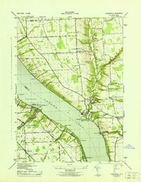 1943 Ludlowville1943 Print · USGSThe Finger Lakes region during the early war years reveals a landscape of industrial lakeside sites and quiet upland farm districts. Genealogists and researchers can trace local roots through numerous landmarks like Pine Grove Cem, Jacksonville, and the Salt Works at Myers.
 - 1943 Map of Jordan
 1943 Jordan1943 Print · USGSJordan and Elbridge are centers of industry and transit during the mid-forties, where the old canal system meets the modern rail era. Trace the path of the ERIE CANAL, locate family roots at MAPLE GROVE CEM, or find old schoolhouses like School No 11 and School No 12.
 - 1943 Map of Lysander
 1943 Lysander1943 Print · USGSThe Seneca River valley in the early 1940s is shown here as a landscape of thriving rural hamlets and extensive canal infrastructure. Trace the network of old schoolhouses and cemeteries from Lysander to Plainville, or locate the family lands at Baird Corners.
 - 1943 Map of West Groton
 1943 West Groton1943 Print · USGSTompkins County was a landscape of close-knit farming hamlets and rural school districts in the years before mid-century. Genealogists can trace family names through landmarks like Munson Corner, the North Lansing Cem, and the path of the Lehigh Valley RR.3 unique versions available
 - 1943 Map of Montezuma
 1943 Montezuma1943 Print · USGSThe Cayuga County marshlands are captured here during the Second World War as the region’s massive river and canal systems were being managed for conservation. You can trace the early path of the Erie Canal (Abandoned) or find family sites near Port Byron and Murray Cem.
 - 1943 Map of Genoa
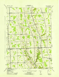 1943 Genoa1943 Print · USGSSouthern Cayuga County appears as a network of rural hamlets and creek valleys in the early 1940s. Genealogists can trace family roots through numerous district schools and landmarks like King Ferry, Five Corners, and the Maplewood Cem.
 - 1943 Map of Oswego West
 1943 Oswego West1943 Print · USGSOswego and its harbor front on Lake Ontario during the early years of the war, showing a landscape defined by schools, chapels, and the historic Fort Ontario. Genealogists can trace early homesteads and communities near Fruit Valley, Irish Settlement Cem, and School No 10.
 - 1943 Map of Trumansburg
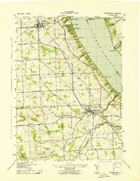 1943 Trumansburg1943 Print · USGSThe western shores of Cayuga Lake come alive in this wartime survey, showing the agricultural heartland between Seneca and Tompkins Counties. Genealogists and local historians can trace family roots through sites like St James Cem, School No 24, and the lakeside landings at Bergen Beach.
Showing maps 1-25 of 219
Top cities of Cayuga County
- Auburn historical maps
- Brutus historical maps
- Owasco historical maps
- Moravia historical maps
- Sennett historical maps
- Sterling historical maps
See more
Frequently asked questions
- What are the different types of historical maps available for Cayuga County?
- What is the oldest map of Cayuga County?
- Where can I purchase historical maps of Cayuga County for my home or office?
- Where can I download high-res historical maps of Cayuga County?
- Are there historical topographic maps available for Cayuga County?
- Is there historical aerial imagery available for Cayuga County?
- Where are historical maps of Cayuga County sourced from?