Old Maps of Ellenburg, New York for Academic Research
Study the evolution of Ellenburg with 52 high-resolution historic maps. Whether you're teaching, researching, or modeling changes in land use, these maps provide essential visual documentation of urban, environmental, and geographic change.
- Analyze long-term change: Track patterns in development, transportation, and natural features.
- Ideal for environmental or urban studies: Support academic projects with primary historical map data.
- Use in the classroom or lab: Educators and researchers rely on these maps to bring historical context to life.
These maps are a powerful tool for teaching, research, and visualizing how Ellenburg has changed over the decades.
Ellenburg, NY maps
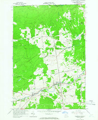
(52)- 1915 Map of Churubusco
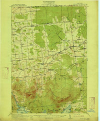 1915 Churubusco1915 Print · USGSNorthern Clinton County is documented here in the early twentieth century, showing a landscape of boundary settlements and mountain lakes. Genealogists can trace family footprints through numerous rural schoolhouses and junctions like Harrigan Corners, Churubusco, and the Halfway House.7 unique versions available
 - 1915 Map of Chateaugay
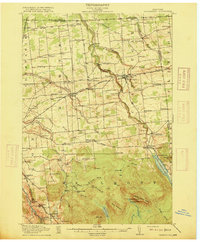 1915 Chateaugay1915 Print · USGSNorthern Franklin County appears here during the height of its rail-and-mill era, bordering the international boundary with Canada. Genealogists can trace family footprints through dozens of numbered schoolhouses, the White Church, and industrial sites like Cooks Mill or The Forge.4 unique versions available
 - 1943 Map of Churubusco
 1943 Churubusco1943 Print · USGSClinton County during the early war years remains a landscape of high summits and rural schoolhouses. Family historians can trace ancestral sites near Churubusco or locate properties along the Rutland line and the Great Chazy River.
 - 1943 Map of Chateaugay
 1943 Chateaugay1943 Print · USGSFranklin County sits at the international border during the early years of the war, showing a landscape of small dairy farms and rail-dependent hamlets. Researchers can trace the path of the Rutland Railroad through Chateaugay and find local landmarks like Cooks Mill and Brainardsville.
 - 1948 Map of Ogdensburg, 1973 Print
 1948 Ogdensburg1973 Print · USGSThe international border along the St Lawrence River comes to life in the late 1940s, showing the vital rail and water connections between New York and Ontario. Researchers can trace the grounds of St Lawrence University, the massive Camp Drum military reservation, and the historic Rideau River and Canal.2 unique versions available
 - 1950 Map of Lake Champlain
 1950 Lake Champlain1950 Print · USGSThe Lake Champlain valley and its surrounding peaks are captured in detail during the late 1940s, showing the vital rail and road connections between New York and Vermont. Researchers can trace the routes of the Central Vermont Railway or locate old industrial centers like Mineville and Witherbee.2 unique versions available
 - 1951 Map of Ogdensburg
 1951 Ogdensburg1951 Print · USGSThe St. Lawrence frontier and the North Country are captured here during the post-war era, from the river ports to the high Adirondacks. Genealogists and historians can trace the rail-and-river economy through Ogdensburg, the Rutland rail lines, and Potsdam.
 - 1953 Map of Ogdensburg
 1953 Ogdensburg1953 Print · USGSThe North Country and St. Lawrence Valley are shown here in the early fifties, just as the region’s rail-and-river economy remained in full swing. Genealogists and historians can trace family-named corners and rural hubs along the Rutland railroad or locate heritage sites near Ogdensburg, Potsdam, and the St Regis Indian Reservation.
 - 1958 Map of Lake Champlain
 1958 Lake Champlain1958 Print · USGSThe Champlain Valley and surrounding high peaks are captured here in the late fifties, showcasing the cross-border region from the Adirondacks to the Green Mountains. Researchers can trace historic rail routes like the Rutland Railway or locate old valley settlements such as Keeseville and Vergennes.2 unique versions available
 - 1961 Map of Ogdensburg
 1961 Ogdensburg1961 Print · USGSThe St. Lawrence valley and the Adirondack high country meet in this early sixties survey during a peak era for rail and river commerce. Genealogists and historians can trace the paths of the New York Central railroad through remote settlements like Wanakena, Conifer, and Piercefield.
 - 1962 Map of Lake Champlain, 1975 Print
 1962 Lake Champlain1975 Print · USGSLake Champlain and the high peaks of the Adirondacks and Green Mountains are captured here during the mid-twentieth century. Researchers can trace the industrial legacy of the Lyon Mountain Mine and the rail corridors of the Central Vermont RR and Delaware & Hudson RR.3 unique versions available
 - 1964 Map of Chateaugay, 1965 Print
 1964 Chateaugay1965 Print · USGSUpper New York State meets the Canadian border in the mid-1960s, a landscape defined by the Chateaugay River and its deep gorges. Genealogists can locate family-named roads and several burial sites including Evergreen Cem and Brayton Hollow Cem.3 unique versions available
 - 1964 Map of Churubusco, 1965 Print
 1964 Churubusco1965 Print · USGSUpper Clinton County sits right on the Canadian border in the mid-1960s, showing a landscape shaped by timber, stone, and the international line. Genealogists can trace family holdings along Santamore Road or Looby Road, while historians can locate the Old RR Grade Abandoned near Clinton Mills.2 unique versions available
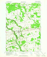
 - 1964 Map of Ellenburg Center, 1966 Print
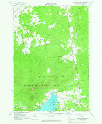
 1964 Ellenburg Center1966 Print · USGSNorthern Clinton County in the 1960s was a landscape where the Adirondack wilderness met the farming communities of the Chazy River valley. Researchers can trace family homesteads near Ellenburg Center and Harrigan, or locate lakefront sites at Merrill and Moffitt Island.
 - 1964 Map of Ellenburg Depot, 1966 Print
 1964 Ellenburg Depot1966 Print · USGSClinton County’s northern borderlands are captured here in the mid-1960s as a landscape of rural hamlets and state timberlands. Researchers can locate family sites near Ellenburg Depot, St Edmunds Cem, and along the historic Military Turnpike.2 unique versions available
 - 1964 Map of Ellenburg Mountain, 1966 Print
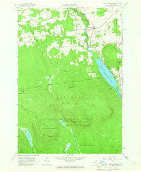
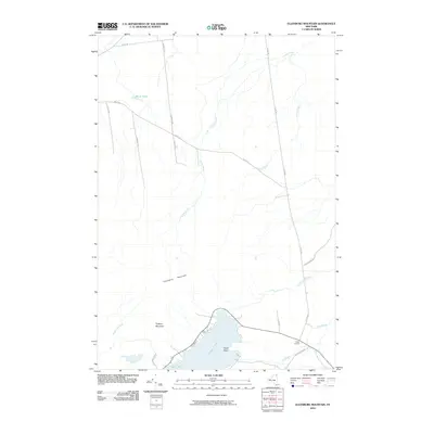
 1964 Ellenburg Mountain1966 Print · USGSClinton County's high country is captured here in the mid-1960s, showing a landscape defined by the expansive Adirondack wilderness and deep blue waters. Genealogists and hikers can trace the old corridors of Plank Road, locate the settlement at Ledger Corners, or find family landmarks like Eagle Point on Chazy Lake.2 unique versions available
 - 1964 Map of Brainardsville, 1966 Print
 1964 Brainardsville1966 Print · USGSFranklin and Clinton counties meet here in the mid-sixties, where the northern Adirondack wilderness transitions into the Chateaugay River valley. Researchers can locate remote burial grounds like Bunker Hill Cem, industrial remnants at Blairs Kiln, and the shoreline of Lower Chateaugay Lake.2 unique versions available
 - 1977 Map of Cannon Corners Station, 1978 Print
 1977 Cannon Corners Station1978 Print · USGSThe northern borderlands of New York and Quebec are captured here in the late seventies, showing the remote roads and customs points of the era. Genealogists and local historians can trace family-named routes and small settlements like Geraldine, Havelock, and the Blueberry Farm Trail.
 - 1985 Map of Massena
 1985 Massena1985 Print · USGSNorthern New York at the mid-eighties shows a landscape of river-driven industry and high mountain wilderness along the Canadian border. Researchers can trace the legacy of iron working and milling in Brasher Iron Works or follow the Raquette River through Massena and Potsdam.
 - 1986 Map of Lake Champlain North
 1986 Lake Champlain North1986 Print · USGSThe Lake Champlain borderlands in the mid-1980s show a mix of mountain villages and busy island shorelines. Researchers can trace the Delaware and Hudson RR through Plattsburgh or locate old rural sites like Mooers Forks and St Josephs Cem.2 unique versions available
 - 1993 Map of Chateaugay, 1995 Print
 1993 Chateaugay1995 Print · USGSAlong the Canadian border in the early nineties, this northern New York frontier landscape centers on the river-carved Chateaugay Chasm. Researchers can locate several burial grounds like Brayton Hollow Cem and landmarks such as the CHATEAUGAY STATE FISH HATCHERY and St Patricks Ch.
 - 1994 Map of Massena
 1994 Massena1994 Print · USGSThe St. Lawrence River valley and northern Adirondacks meet in the mid-1990s, revealing a landscape of international shipping, rail corridors, and dense state forests. Genealogists and historians can trace the foundations of Massena, the St Regis Indian Reservation, and small hamlets like Brasher Iron Works.
 - 2010 Map of Ellenburg Center, 2010 Print
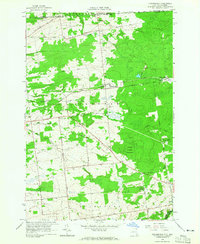
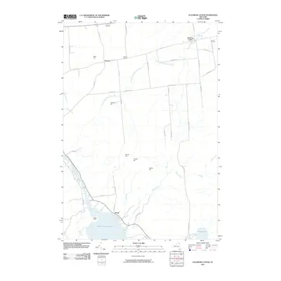 2010 Ellenburg Center2010 Print · USGSCovers Ellenburg, including Dannemora, Bellmont, and other nearby areas
 - 2010 Map of Brainardsville, 2010 Print
 2010 Brainardsville2010 Print · USGSCovers Ellenburg, including Chateaugay, Burke, and other nearby areas
 - 2010 Map of Ellenburg Mountain, 2010 Print
 2010 Ellenburg Mountain2010 Print · USGSCovers Ellenburg, including Dannemora, Altona, and other nearby areas
Showing maps 1-25 of 52
Top cities near Ellenburg
- Plattsburgh historical maps
- Beekmantown historical maps
- Schuyler Falls historical maps
- Dannemora historical maps
- Saranac historical maps
- Mooers historical maps
See more
Top neighborhoods of Ellenburg
- Ellenburg Center historical maps
- Merrill historical maps
- Ellenburg Depot historical maps
- Harrigan historical maps
Frequently asked questions
- What are the different types of historical maps available for Ellenburg?
- What is the oldest map of Ellenburg?
- Where can I purchase historical maps of Ellenburg for my home or office?
- Where can I download high-res historical maps of Ellenburg?
- Are there historical topographic maps available for Ellenburg?
- Is there historical aerial imagery available for Ellenburg?
- Where are historical maps of Ellenburg sourced from?