Old Maps of Mooers, New York for Metal Detecting
Plan your next treasure hunt with 47 historic maps of Mooers. Find old homesites, ghost towns, trails, and gathering spots that may be lost to time — perfect for identifying promising metal detecting locations.
- Locate forgotten sites: Uncover places like long-lost settlements, abandoned rail lines, or gathering spots.
- Plan better hunts: Use map overlays combined with LiDAR or satellite views to narrow in on historically rich areas.
- Made for detectorists: Thousands of hobbyists use these maps to discover relics, coins, and hidden history.
Use these historic maps to boost your research and find new opportunities beneath the surface of Mooers.
Mooers, NY maps
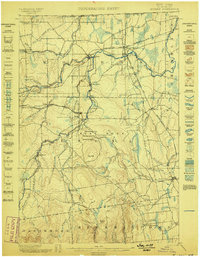
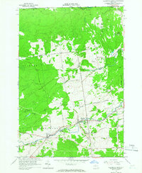
(47)- 1895 Map of Mooers
 1895 Mooers1895 Print · USGSClinton County in the 1890s was a landscape of timber and rail where the Central Vermont RR crossed the northern frontier. Genealogists and researchers can trace the old footprints of Mooers Junction, Purdy Mill, and the many hamlets along the Chazy River.
 - 1899 Map of Mooers
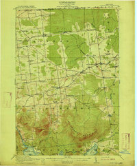
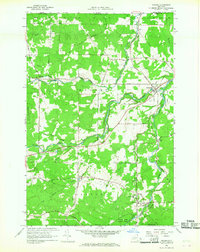
 1899 Mooers1899 Print · USGSNorthern Clinton County was a bustling intersection of rail and river commerce at the end of the nineteenth century. Researchers can trace the old rail alignments through Mooers Junction or locate family landmarks like Purdy Mill and Wood Falls.6 unique versions available
 - 1915 Map of Churubusco
 1915 Churubusco1915 Print · USGSNorthern Clinton County is documented here in the early twentieth century, showing a landscape of boundary settlements and mountain lakes. Genealogists can trace family footprints through numerous rural schoolhouses and junctions like Harrigan Corners, Churubusco, and the Halfway House.7 unique versions available
 - 1942 Map of Mooers, 1956 Print
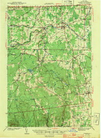
 1942 Mooers1956 Print · USGSClinton County's northern borderlands are captured here during the early 1940s, from the international line down to the slopes of the Adirondack foothills. Researchers can locate early district schoolhouses like Alder Bend Sch, tracing the rural rail connections of the RUTLAND and DELAWARE AND HUDSON lines.
 - 1943 Map of Churubusco
 1943 Churubusco1943 Print · USGSClinton County during the early war years remains a landscape of high summits and rural schoolhouses. Family historians can trace ancestral sites near Churubusco or locate properties along the Rutland line and the Great Chazy River.
 - 1943 Map of Mooers
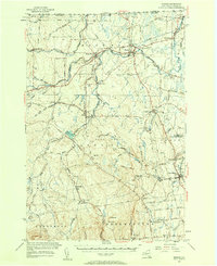
 1943 Mooers1943 Print · USGSNorthern Clinton County at the height of the rail era shows a landscape of interconnected hamlets and river-powered industry along the Canadian border. Genealogists and local historians can trace family-named sites like Purdy Mill and Witherill Sch, or follow the path of the Rutland RR through Mooers and Altona.2 unique versions available
 - 1950 Map of Lake Champlain
 1950 Lake Champlain1950 Print · USGSThe Lake Champlain valley and its surrounding peaks are captured in detail during the late 1940s, showing the vital rail and road connections between New York and Vermont. Researchers can trace the routes of the Central Vermont Railway or locate old industrial centers like Mineville and Witherbee.2 unique versions available
 - 1956 Map of Mooers, 1958 Print
 1956 Mooers1958 Print · USGSClinton County's borderlands are captured here in the mid-1950s, showing a landscape defined by international crossings and historic rail lines. Researchers can trace family roots through sites like Union Cemetery or follow the early industrial sites at Woods Falls and Purdy Mill.3 unique versions available
 - 1958 Map of Lake Champlain
 1958 Lake Champlain1958 Print · USGSThe Champlain Valley and surrounding high peaks are captured here in the late fifties, showcasing the cross-border region from the Adirondacks to the Green Mountains. Researchers can trace historic rail routes like the Rutland Railway or locate old valley settlements such as Keeseville and Vergennes.2 unique versions available
 - 1962 Map of Lake Champlain, 1975 Print
 1962 Lake Champlain1975 Print · USGSLake Champlain and the high peaks of the Adirondacks and Green Mountains are captured here during the mid-twentieth century. Researchers can trace the industrial legacy of the Lyon Mountain Mine and the rail corridors of the Central Vermont RR and Delaware & Hudson RR.3 unique versions available
 - 1964 Map of Ellenburg Depot, 1966 Print
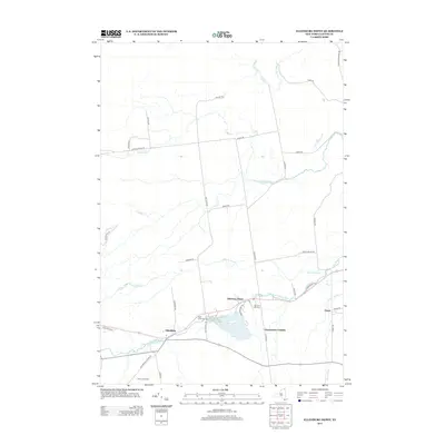
 1964 Ellenburg Depot1966 Print · USGSClinton County’s northern borderlands are captured here in the mid-1960s as a landscape of rural hamlets and state timberlands. Researchers can locate family sites near Ellenburg Depot, St Edmunds Cem, and along the historic Military Turnpike.2 unique versions available
 - 1966 Map of Altona, 1968 Print
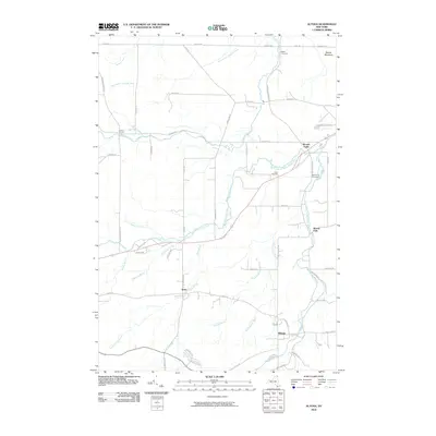
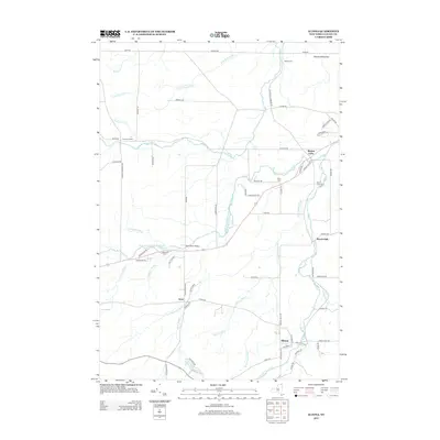
 1966 Altona1968 Print · USGSIn the mid-1960s, this Clinton County borderland shows the international line meeting rural New York hamlets. Genealogists and local historians can trace family sites at Walker Cem, follow the Old Railroad Grade, and locate landmarks like the U S Customs post.2 unique versions available
 - 1966 Map of Mooers, 1968 Print
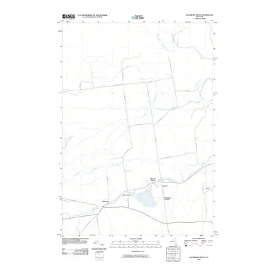
 1966 Mooers1968 Print · USGSClinton County’s northern borderlands come into focus in the mid-1960s, showing the rural communities along the river just south of Quebec. Genealogists can locate family names on local routes and trace history at St Josephs Cem, Perry Mills, or the Mooers Camp Meeting Association.
 - 1977 Map of Cannon Corners Station, 1978 Print
 1977 Cannon Corners Station1978 Print · USGSThe northern borderlands of New York and Quebec are captured here in the late seventies, showing the remote roads and customs points of the era. Genealogists and local historians can trace family-named routes and small settlements like Geraldine, Havelock, and the Blueberry Farm Trail.
 - 1977 Map of East of Cannon Corners Station, 1978 Print
 1977 East of Cannon Corners Station1978 Print · USGSThe international borderlands of northern New York are seen here in the late 1970s, as the landscape transitions from the Canadian boundary down to the Great Chazy River. Local historians can trace old homestead sites near Walker Cem or follow the path of the Old Railroad Grade near Mooers Forks.
 - 1977 Map of Mooers Station, 1978 Print
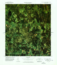
 1977 Mooers Station1978 Print · USGSClinton County and the Quebec borderland are captured in this infrared study from the late seventies. Genealogists and local historians can trace family-named routes like Garrand Road and locate the crossing at Mooers Station U. S. Customs.
 - 1986 Map of Lake Champlain North
 1986 Lake Champlain North1986 Print · USGSThe Lake Champlain borderlands in the mid-1980s show a mix of mountain villages and busy island shorelines. Researchers can trace the Delaware and Hudson RR through Plattsburgh or locate old rural sites like Mooers Forks and St Josephs Cem.2 unique versions available
 - 2010 Map of Mooers, 2010 Print
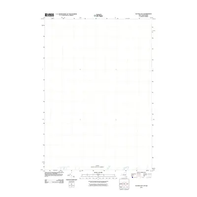
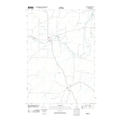 2010 Mooers2010 Print · USGSCovers Mooers, including Champlain, Chazy, and other nearby areas
 - 2010 Map of Ellenburg Depot, 2010 Print
 2010 Ellenburg Depot2010 Print · USGSCovers Mooers, including Altona, Ellenburg, and other nearby areas
 - 2010 Map of Altona, 2010 Print
 2010 Altona2010 Print · USGSCovers Mooers, including Altona, Altona, and other nearby areas
 - 2010 Map of Mooers OE N, 2010 Print
 2010 Mooers OE N2010 Print · USGSCovers Mooers, including Champlain, Saint-Bernard-de-Lacolle, and other nearby areas
 - 2011 Map of Ellenburg Depot OE N, 2011 Print
 2011 Ellenburg Depot OE N2011 Print · USGSCovers Mooers, including Ormstown, Clinton, and other nearby areas
 - 2011 Map of Altona OE N, 2011 Print
 2011 Altona OE N2011 Print · USGSCovers Mooers, including Hemmingford (canton), The Fort, and other nearby areas
 - 2013 Map of Ellenburg Depot, 2013 Print
 2013 Ellenburg Depot2013 Print · USGSCovers Mooers, including Altona, Ellenburg, and other nearby areas
 - 2013 Map of Altona, 2013 Print
 2013 Altona2013 Print · USGSCovers Mooers, including Altona, Altona, and other nearby areas
Showing maps 1-25 of 47
Top cities near Mooers
- Plattsburgh historical maps
- Champlain historical maps
- Beekmantown historical maps
- Chazy historical maps
- Dannemora historical maps
- Altona historical maps
See more
Top neighborhoods of Mooers
Frequently asked questions
- What are the different types of historical maps available for Mooers?
- What is the oldest map of Mooers?
- Where can I purchase historical maps of Mooers for my home or office?
- Where can I download high-res historical maps of Mooers?
- Are there historical topographic maps available for Mooers?
- Is there historical aerial imagery available for Mooers?
- Where are historical maps of Mooers sourced from?