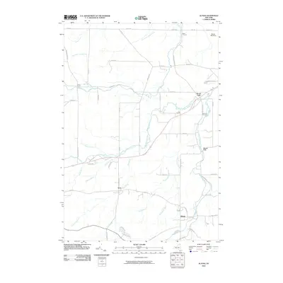
2010 Map of Altona
USGS Topo · Published 2010About this map
The Great Chazy River and its numerous tributaries define the drainage and settlement patterns of this northern New York landscape. Several distinct hamlets are documented across the terrain, including Altona, Irona, and Mooers Forks, each situated near the watercourses that historically powered local industry. The map captures a transition between the more developed southern corridor and the wooded northern reaches toward Beaver Meadows.
Find a feature on this map
58 named features on this map. Tap any name to fly to it.
Don’t see what you’re looking for? This feature index may not catch every label — zoom into the map to look around manually.
Map Details
Editions of this 2010 Altona Map
This is the sole edition of this map. No revisions or reprints were ever made.
Other maps of this area

1895 · Mooers
USGS Topo · 1:62,500

1899 · Mooers
USGS Topo · 1:62,500

1915 · Churubusco
USGS Topo · 1:62,500

1942 · Mooers
USGS Topo · 1:62,500

1943 · Churubusco
USGS Topo · 1:62,500

1943 · Mooers
USGS Topo · 1:62,500

1950 · Lake Champlain
USGS Topo · 1:250,000
1956 · Mooers
USGS Topo · 1:62,500

1958 · Lake Champlain
USGS Topo · 1:250,000

1962 · Lake Champlain
USGS Topo · 1:250,000