Old Maps of Saint Armand, New York for Metal Detecting
Plan your next treasure hunt with 53 historic maps of Saint Armand. Find old homesites, ghost towns, trails, and gathering spots that may be lost to time — perfect for identifying promising metal detecting locations.
- Locate forgotten sites: Uncover places like long-lost settlements, abandoned rail lines, or gathering spots.
- Plan better hunts: Use map overlays combined with LiDAR or satellite views to narrow in on historically rich areas.
- Made for detectorists: Thousands of hobbyists use these maps to discover relics, coins, and hidden history.
Use these historic maps to boost your research and find new opportunities beneath the surface of Saint Armand.
Saint Armand, NY maps
(53)- 1896 Map of Lake Placid
 1896 Lake Placid1896 Print · USGSThe High Peaks wilderness of the 1890s reveals a landscape of early iron industry and burgeoning mountain tourism. Genealogists and hikers can trace the original paths around John Browns Grave, the industry at West Kilns, and the early buildings at Undercliff.
 - 1898 Map of Lake Placid
 1898 Lake Placid1898 Print · USGSThe Adirondack High Peaks are captured here in the late nineteenth century as the region evolved into a premier destination for hikers and historians. Trace the early settlement of Lake Placid, the industrial sites at West Kilns, and the landmark John Browns Grave.12 unique versions available
 - 1902 Map of Saranac, 1953 Print
 1902 Saranac1953 Print · USGSThe Adirondack High Peaks region comes alive in this survey from the early 1900s, showcasing the expansion of rail and water-based commerce. Researchers can trace the development of Saranac Lake, locate early industrial sites like Ames Mills, and follow the path of the Adirondack Division railroad.
 - 1904 Map of Saranac
 1904 Saranac1904 Print · USGSSaranac Lake and the northern Adirondacks are captured here during the height of the early railroad era. Genealogists and historians can trace the paths of the Adirondack Division and Chateaugay Branch through settlements like Bloomingdale, Gabriels, and Onchiota.10 unique versions available
 - 1948 Map of Ogdensburg, 1973 Print
 1948 Ogdensburg1973 Print · USGSThe international border along the St Lawrence River comes to life in the late 1940s, showing the vital rail and water connections between New York and Ontario. Researchers can trace the grounds of St Lawrence University, the massive Camp Drum military reservation, and the historic Rideau River and Canal.2 unique versions available
 - 1950 Map of Lake Champlain
 1950 Lake Champlain1950 Print · USGSThe Lake Champlain valley and its surrounding peaks are captured in detail during the late 1940s, showing the vital rail and road connections between New York and Vermont. Researchers can trace the routes of the Central Vermont Railway or locate old industrial centers like Mineville and Witherbee.2 unique versions available
 - 1951 Map of Ogdensburg
 1951 Ogdensburg1951 Print · USGSThe St. Lawrence frontier and the North Country are captured here during the post-war era, from the river ports to the high Adirondacks. Genealogists and historians can trace the rail-and-river economy through Ogdensburg, the Rutland rail lines, and Potsdam.
 - 1953 Map of Ogdensburg
 1953 Ogdensburg1953 Print · USGSThe North Country and St. Lawrence Valley are shown here in the early fifties, just as the region’s rail-and-river economy remained in full swing. Genealogists and historians can trace family-named corners and rural hubs along the Rutland railroad or locate heritage sites near Ogdensburg, Potsdam, and the St Regis Indian Reservation.
 - 1953 Map of Lake Placid, 1957 Print
 1953 Lake Placid1957 Print · USGSThe High Peaks region during the mid-fifties shows a landscape defined by mountain hamlets and early Adirondack tourism. Genealogists and historians can trace family sites at Quaker Cem, the John Browns Grave historic site, and early industrial landmarks like West Kilns.4 unique versions available
 - 1955 Map of Saranac Lake, 1957 Print
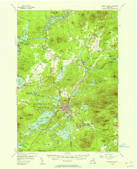 1955 Saranac Lake1957 Print · USGSSaranac Lake and its surrounding mountain communities were flourishing hubs of the Adirondacks during the mid-fifties. Researchers can trace family history through sites like St Pauls Cem, rural landmarks like Eight Square Sch, and the rail infrastructure at Lake Clear Junction.5 unique versions available
 - 1958 Map of Lake Champlain
 1958 Lake Champlain1958 Print · USGSThe Champlain Valley and surrounding high peaks are captured here in the late fifties, showcasing the cross-border region from the Adirondacks to the Green Mountains. Researchers can trace historic rail routes like the Rutland Railway or locate old valley settlements such as Keeseville and Vergennes.2 unique versions available
 - 1961 Map of Ogdensburg
 1961 Ogdensburg1961 Print · USGSThe St. Lawrence valley and the Adirondack high country meet in this early sixties survey during a peak era for rail and river commerce. Genealogists and historians can trace the paths of the New York Central railroad through remote settlements like Wanakena, Conifer, and Piercefield.
 - 1962 Map of Lake Champlain, 1975 Print
 1962 Lake Champlain1975 Print · USGSLake Champlain and the high peaks of the Adirondacks and Green Mountains are captured here during the mid-twentieth century. Researchers can trace the industrial legacy of the Lyon Mountain Mine and the rail corridors of the Central Vermont RR and Delaware & Hudson RR.3 unique versions available
 - 1978 Map of Bloomingdale
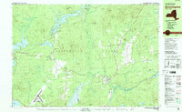 1978 Bloomingdale1978 Print · USGSThe Adirondack High Peaks region during the late 1970s shows a landscape of mountain hamlets and sprawling lakes. Local researchers can trace family names and institutions from Paul Smiths College to quiet burial grounds like Mountain View Cemetery and St Johns Cem.
 - 1978 Map of Saranac Lake
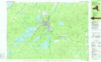 1978 Saranac Lake1978 Print · USGSSaranac Lake and its surrounding mountain wilderness are captured in the late seventies as a hub of health, education, and recreation. Researchers can trace local history at St Bernards Cem, the settlement of Trudeau, and the Correctional Institution at Ray Brook.
 - 1978 Map of Wilmington, 1979 Print
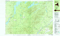 1978 Wilmington1979 Print · USGSThe Adirondacks near Wilmington in the 1970s reveal a landscape defined by high peaks and mountain industries. Genealogists and hikers can trace the Memorial Highway up Whiteface Mountain or locate old sites like Middle Kilns and Haselton Cem.
 - 1979 Map of Saranac Lake
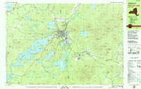 1979 Saranac Lake1979 Print · USGSSaranac Lake and the surrounding Adirondack wilderness appear here in the late seventies as the region prepared for international athletics. Researchers can trace the Adirondack rail line or locate landmarks like Pine Ridge Cem and the Olympic Village.2 unique versions available
 - 1979 Map of Lake Placid
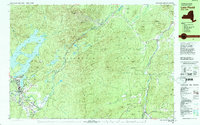 1979 Lake Placid1979 Print · USGSThe Lake Placid region in the late seventies reveals a landscape on the verge of the Winter Games. Trace the development of Olympic venues like the Olympic Arena and 90-meter Tower alongside local landmarks like John Browns Grave.
 - 1985 Map of Tupper Lake, 1986 Print
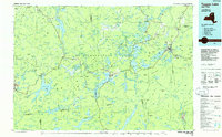 1985 Tupper Lake1986 Print · USGSThe Adirondacks in the mid-1980s reveal a network of mountain villages and timber-connected outposts. Researchers can trace the Adirondack RR through Saranac Lake or locate old industrial hamlets like Newton Falls and Gleasons Mill.2 unique versions available
 - 1986 Map of Lake Champlain South
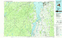 1986 Lake Champlain South1986 Print · USGSIn the mid-1980s, the shores of Lake Champlain linked the Adirondack high peaks with the Vermont valley. Genealogists and researchers can trace the rail lines of the Delaware & Hudson RR or locate historic settlements like Mineville and Au Sable Forks.2 unique versions available
 - 1999 Map of Lake Placid, 2001 Print
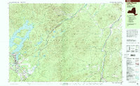 1999 Lake Placid2001 Print · USGSLake Placid at the end of the twentieth century shows a landscape defined by Olympic legacy and abolitionist history. Trace the grounds of the John Brown Farm or locate athletic landmarks like the Olympic Ski Jumps and Olympic Arena.
 - 1999 Map of Saranac Lake, 2001 Print
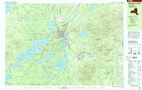 1999 Saranac Lake2001 Print · USGSThe Adirondacks at the close of the twentieth century show a landscape of high-peaks recreation and deep-seated village life. Researchers can trace the layout of Saranac Lake, finding sites like Pine Ridge Cem, Petrova High Sch, and the Olympic Village at Ray Brook.
 - 1999 Map of Bloomingdale, 2001 Print
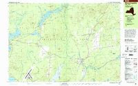 1999 Bloomingdale2001 Print · USGSThe northern Adirondack high country is shown in the late 1990s, centering on the communities of Bloomingdale and Vermontville. Trace local history at Paul Smiths College or find family roots at Mountain View Cemetery and St Pauls Cem.
 - 2010 Map of Bloomingdale, 2010 Print
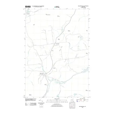 2010 Bloomingdale2010 Print · USGSAdirondack parklands and river valleys are captured here in the early twenty-first century as the landscape began its modern digital record. Genealogists can trace family roots at Brookside Cemetery and Saint Pauls Cemetery or follow the winding Saranac River through Bloomingdale.
 - 2010 Map of Gabriels, 2010 Print
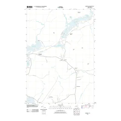 2010 Gabriels2010 Print · USGSThe Adirondack lake country around Gabriels and Paul Smiths is captured here in the early twenty-first century. Researchers can trace the legacy of Great Camps and mountain settlements through sites like White Pine Camp, Mountain View Cemetery, and the Adirondack Regional Airport.
Showing maps 1-25 of 53
Top cities near Saint Armand
- North Elba historical maps
- Harrietstown historical maps
- Saranac Lake historical maps
- Saranac historical maps
- Jay historical maps
- Lake Placid historical maps
See more
Top neighborhoods of Saint Armand
Frequently asked questions
- What are the different types of historical maps available for Saint Armand?
- What is the oldest map of Saint Armand?
- Where can I purchase historical maps of Saint Armand for my home or office?
- Where can I download high-res historical maps of Saint Armand?
- Are there historical topographic maps available for Saint Armand?
- Is there historical aerial imagery available for Saint Armand?
- Where are historical maps of Saint Armand sourced from?