1970s Maps of Franklin County, New York
Explore 17 historic maps of Franklin County from the 1970s. These maps offer a rare glimpse into what life looked like during the 1970s — showing old roads, neighborhoods, homes, and landmarks that have changed or disappeared over time.
Whether you're researching your family's past, planning a metal detecting trip, or studying how Franklin County's landscape evolved across the 1970s, these high-resolution maps are a powerful tool for exploring the history of this region.
- Focus on a specific era: All maps on this page are from the 1970s, giving you a focused view of this time period.
- See what’s changed: Compare century-old streets, trails, and buildings to today's modern landscape using overlays and satellite layers.
- Research with precision: Use these maps for genealogy, historical research, land use analysis, or educational projects.
- View, download, or print: Maps are fully viewable online in high resolution, and can be downloaded or printed for your own records.
Start exploring Franklin County's history through authentic maps from the 1970s. This is your window into the past.
Franklin County, NY maps
(17)- 1970 Map of Augerhole Falls, 1972 Print
 1970 Augerhole Falls1972 Print · USGSCovers Franklin County, including Tupper Lake, Hopkinton, and other nearby areas
 - 1977 Map of Chateaugay Port of Entry, 1978 Print
 1977 Chateaugay Port of Entry1978 Print · USGSCovers Franklin County, including Ormstown, Chateaugay, and other nearby areas
 - 1977 Map of Fort Covington Port of Entry, 1978 Print
 1977 Fort Covington Port of Entry1978 Print · USGSCovers Franklin County, including South Glengarry, Fort Covington, and other nearby areas
 - 1977 Map of Trout River Port of Entry, 1978 Print
 1977 Trout River Port of Entry1978 Print · USGSCovers Franklin County, including Westville, Constable, and other nearby areas
 - 1977 Map of Massena Port of Entry, 1978 Print
 1977 Massena Port of Entry1978 Print · USGSCovers Franklin County, including Cornwall, South Glengarry, and other nearby areas
 - 1977 Map of East of Fort Covington Port of Entry, 1978 Print
 1977 East of Fort Covington Port of Entry1978 Print · USGSCovers Franklin County, including Westville, Fort Covington, and other nearby areas
 - 1977 Map of Jamiesons Line Station, 1978 Print
 1977 Jamiesons Line Station1978 Print · USGSCovers Franklin County, including Chateaugay, Constable, and other nearby areas
 - 1978 Map of Bloomingdale
 1978 Bloomingdale1978 Print · USGSCovers Franklin County, including Harrietstown, Saint Armand, and other nearby areas
 - 1978 Map of Saranac Lake
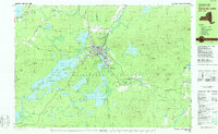 1978 Saranac Lake1978 Print · USGSCovers Franklin County, including North Elba, Harrietstown, and other nearby areas
 - 1978 Map of Ampersand Lake, 1979 Print
 1978 Ampersand Lake1979 Print · USGSCovers Franklin County, including North Elba, Harrietstown, and other nearby areas2 unique versions available
 - 1978 Map of Wilmington, 1979 Print
 1978 Wilmington1979 Print · USGSCovers Franklin County, including Jay, Black Brook, and other nearby areas
 - 1979 Map of Kempshall Mtn
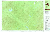
 1979 Kempshall Mtn1979 Print · USGSCovers Franklin County, including Harrietstown, Tupper Lake, and other nearby areas2 unique versions available
 - 1979 Map of Saranac Lake
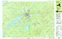 1979 Saranac Lake1979 Print · USGSCovers Franklin County, including North Elba, Harrietstown, and other nearby areas2 unique versions available
 - 1979 Map of Tupper Lake
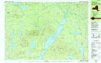
 1979 Tupper Lake1979 Print · USGSCovers Franklin County, including Harrietstown, Tupper Lake, and other nearby areas2 unique versions available
 - 1979 Map of Saint Regis Mtn
 1979 Saint Regis Mtn1979 Print · USGSCovers Franklin County, including Harrietstown, Tupper Lake, and other nearby areas2 unique versions available
 - 1979 Map of Santanoni Peak
 1979 Santanoni Peak1979 Print · USGSCovers Franklin County, including Harrietstown, Newcomb, and other nearby areas
 - 1979 Map of Upper Saranac Lake
 1979 Upper Saranac Lake1979 Print · USGSCovers Franklin County, including Harrietstown, Tupper Lake, and other nearby areas
End of results
Showing maps 1-17 of 17
Top cities of Franklin County
- Malone historical maps
- Harrietstown historical maps
- Tupper Lake historical maps
- Moira historical maps
- Bangor historical maps
- Westville historical maps
See more
Frequently asked questions
- What are the different types of historical maps available for Franklin County?
- What is the oldest map of Franklin County?
- Where can I purchase historical maps of Franklin County for my home or office?
- Where can I download high-res historical maps of Franklin County?
- Are there historical topographic maps available for Franklin County?
- Is there historical aerial imagery available for Franklin County?
- Where are historical maps of Franklin County sourced from?