Old Maps of Franklin County, New York for Academic Research
Study the evolution of Franklin County with 152 high-resolution historic maps. Whether you're teaching, researching, or modeling changes in land use, these maps provide essential visual documentation of urban, environmental, and geographic change.
- Analyze long-term change: Track patterns in development, transportation, and natural features.
- Ideal for environmental or urban studies: Support academic projects with primary historical map data.
- Use in the classroom or lab: Educators and researchers rely on these maps to bring historical context to life.
These maps are a powerful tool for teaching, research, and visualizing how Franklin County has changed over the decades.
Franklin County, NY maps
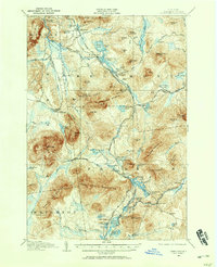
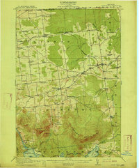
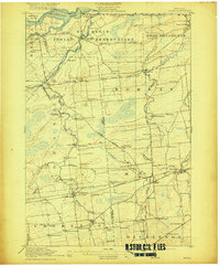
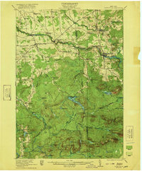
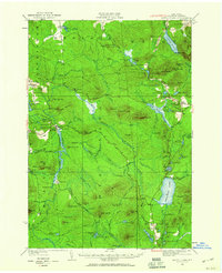
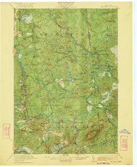
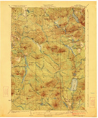
(152)- 1896 Map of Lake Placid
 1896 Lake Placid1896 Print · USGSCovers Franklin County, including North Elba, Jay, and other nearby areas
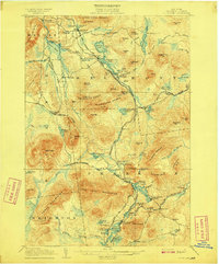
 - 1898 Map of Lake Placid
 1898 Lake Placid1898 Print · USGSCovers Franklin County, including North Elba, Jay, and other nearby areas12 unique versions available
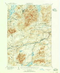
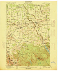
 - 1902 Map of Saranac, 1953 Print
 1902 Saranac1953 Print · USGSCovers Franklin County, including North Elba, Harrietstown, and other nearby areas
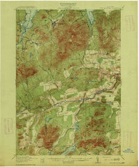
 - 1904 Map of Saranac
 1904 Saranac1904 Print · USGSCovers Franklin County, including North Elba, Harrietstown, and other nearby areas10 unique versions available
 - 1904 Map of Santanoni
 1904 Santanoni1904 Print · USGSCovers Franklin County, including North Elba, Harrietstown, and other nearby areas10 unique versions available
 - 1904 Map of Long Lake
 1904 Long Lake1904 Print · USGSCovers Franklin County, including Harrietstown, Tupper Lake, and other nearby areas10 unique versions available
 - 1905 Map of Saint Regis
 1905 Saint Regis1905 Print · USGSCovers Franklin County, including Harrietstown, Tupper Lake, and other nearby areas9 unique versions available
 - 1906 Map of Loon Lake, 1958 Print
 1906 Loon Lake1958 Print · USGSCovers Franklin County, including Malone, Bellmont, and other nearby areas2 unique versions available
 - 1907 Map of Tupper Lake
 1907 Tupper Lake1907 Print · USGSCovers Franklin County, including Tupper Lake, Colton, and other nearby areas8 unique versions available
 - 1908 Map of Loon Lake
 1908 Loon Lake1908 Print · USGSCovers Franklin County, including Malone, Bellmont, and other nearby areas6 unique versions available
 - 1911 Map of Lyon Mountain, 1956 Print
 1911 Lyon Mountain1956 Print · USGSCovers Franklin County, including Dannemora, Saranac, and other nearby areas2 unique versions available
 - 1913 Map of Lyon Mountain
 1913 Lyon Mountain1913 Print · USGSCovers Franklin County, including Dannemora, Saranac, and other nearby areas5 unique versions available
 - 1915 Map of Churubusco
 1915 Churubusco1915 Print · USGSCovers Franklin County, including Dannemora, Mooers, and other nearby areas7 unique versions available
 - 1915 Map of Chateaugay
 1915 Chateaugay1915 Print · USGSCovers Franklin County, including Malone, Ellenburg, and other nearby areas4 unique versions available
 - 1915 Map of Malone, 1957 Print
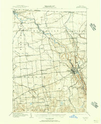 1915 Malone1957 Print · USGSCovers Franklin County, including Malone, Malone, and other nearby areas2 unique versions available
 - 1915 Map of Moira, 1957 Print
 1915 Moira1957 Print · USGSCovers Franklin County, including Massena, Stockholm, and other nearby areas
 - 1917 Map of Malone
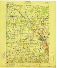 1917 Malone1917 Print · USGSCovers Franklin County, including Malone, Malone, and other nearby areas5 unique versions available
 - 1917 Map of Moira
 1917 Moira1917 Print · USGSCovers Franklin County, including Massena, Stockholm, and other nearby areas4 unique versions available
 - 1919 Map of Nicholville, 1958 Print
 1919 Nicholville1958 Print · USGSCovers Franklin County, including Stockholm, Parishville, and other nearby areas2 unique versions available
 - 1920 Map of Childwold, 1954 Print
 1920 Childwold1954 Print · USGSCovers Franklin County, including Tupper Lake, Parishville, and other nearby areas2 unique versions available
 - 1921 Map of Childwold
 1921 Childwold1921 Print · USGSCovers Franklin County, including Tupper Lake, Parishville, and other nearby areas
 - 1921 Map of Nicholville
 1921 Nicholville1921 Print · USGSCovers Franklin County, including Stockholm, Parishville, and other nearby areas4 unique versions available
 - 1921 Map of Santa Clara, 1960 Print
 1921 Santa Clara1960 Print · USGSCovers Franklin County, including Malone, Brighton, and other nearby areas2 unique versions available
 - 1922 Map of Childwold
 1922 Childwold1922 Print · USGSCovers Franklin County, including Tupper Lake, Parishville, and other nearby areas4 unique versions available
 - 1923 Map of Santa Clara
 1923 Santa Clara1923 Print · USGSCovers Franklin County, including Malone, Brighton, and other nearby areas5 unique versions available
Showing maps 1-25 of 152
Top cities of Franklin County
- Malone historical maps
- Harrietstown historical maps
- Tupper Lake historical maps
- Moira historical maps
- Bangor historical maps
- Westville historical maps
See more
Frequently asked questions
- What are the different types of historical maps available for Franklin County?
- What is the oldest map of Franklin County?
- Where can I purchase historical maps of Franklin County for my home or office?
- Where can I download high-res historical maps of Franklin County?
- Are there historical topographic maps available for Franklin County?
- Is there historical aerial imagery available for Franklin County?
- Where are historical maps of Franklin County sourced from?