Old Maps of Fort Covington, New York for Hiking & Exploration
Hike through history with 26 historic maps of Fort Covington. Explore old trails, ghost towns, and forgotten backroads — perfect for outdoor adventurers and local explorers.
- Rediscover forgotten places: Map out old mining camps, roads, and footpaths that no longer exist on modern maps.
- Layer with modern tools: Combine with LiDAR or satellite views to plan hikes through historical terrain.
- Made for exploration: Popular among hikers, overlanders, and local history lovers.
Use these maps to find adventure and explore the hidden past of Fort Covington.
Fort Covington, NY maps
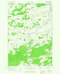
(26)- 1915 Map of Malone, 1957 Print
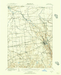 1915 Malone1957 Print · USGSFranklin County at the onset of the Great War reveals a landscape defined by industrial rail junctions and a dense network of district schools. Genealogists can trace family roots through numerous rural school sites and landmarks like the County Almshouse, Malone Junction, and Fort Covington.2 unique versions available
 - 1915 Map of Moira, 1957 Print
 1915 Moira1957 Print · USGSNorthern New York's borderlands are captured here in the early twentieth century, showing the intersection of tribal lands and rail-driven commerce. Genealogists can trace family names and early rural life through Brasher Iron Works, Potter School, and Irish Corners.
 - 1917 Map of Malone
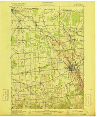 1917 Malone1917 Print · USGSNorthern New York's borderlands are captured here during the height of the steam-rail era, centered on the busy junction at Malone. Genealogists and local historians can trace family locations near dozens of rural schoolhouses or along the Rutland RR and Salmon River.5 unique versions available
 - 1917 Map of Moira
 1917 Moira1917 Print · USGSNorthern New York's borderlands come alive in the years before the Great War, showing a landscape defined by the St Regis Indian Reservation and busy rail lines. Researchers can trace family landmarks like Laverys Corner, the Brasher Iron Works, and early industrial sites like Wagstaff Factory.4 unique versions available
 - 1944 Map of Moira
 1944 Moira1944 Print · USGSNorthern New York at the height of the war years reveals a landscape defined by the St Regis Indian Reservation and the Rutland railroad. Genealogists can locate family landmarks like Taylors Corner and dozens of numbered country schoolhouses.
 - 1948 Map of Ogdensburg, 1973 Print
 1948 Ogdensburg1973 Print · USGSThe international border along the St Lawrence River comes to life in the late 1940s, showing the vital rail and water connections between New York and Ontario. Researchers can trace the grounds of St Lawrence University, the massive Camp Drum military reservation, and the historic Rideau River and Canal.2 unique versions available
 - 1951 Map of Ogdensburg
 1951 Ogdensburg1951 Print · USGSThe St. Lawrence frontier and the North Country are captured here during the post-war era, from the river ports to the high Adirondacks. Genealogists and historians can trace the rail-and-river economy through Ogdensburg, the Rutland rail lines, and Potsdam.
 - 1953 Map of Ogdensburg
 1953 Ogdensburg1953 Print · USGSThe North Country and St. Lawrence Valley are shown here in the early fifties, just as the region’s rail-and-river economy remained in full swing. Genealogists and historians can trace family-named corners and rural hubs along the Rutland railroad or locate heritage sites near Ogdensburg, Potsdam, and the St Regis Indian Reservation.
 - 1961 Map of Ogdensburg
 1961 Ogdensburg1961 Print · USGSThe St. Lawrence valley and the Adirondack high country meet in this early sixties survey during a peak era for rail and river commerce. Genealogists and historians can trace the paths of the New York Central railroad through remote settlements like Wanakena, Conifer, and Piercefield.
 - 1964 Map of Ft. Covington, 1965 Print
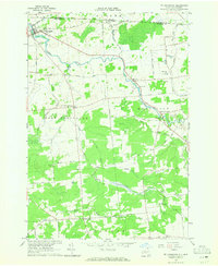 1964 Ft. Covington1965 Print · USGSNear the international border in the mid-1960s, this area of Franklin County shows a landscape of river-bend settlements and rural townships. Researchers can trace family roots through numerous burial sites like Elmwood Cem and Coal Hill Cem, or locate old homesteads near Cooks Corners.2 unique versions available
 - 1964 Map of Bombay, 1966 Print
 1964 Bombay1966 Print · USGSNorthern New York at the Canadian border comes into focus in the mid-1960s, showing the intersection of tribal lands and rail-river commerce. Trace ancestral roots at St Josephs Cem or follow the Grand Trunk Railroad through Bombay and South Bombay.2 unique versions available
 - 1977 Map of Fort Covington Port of Entry, 1978 Print
 1977 Fort Covington Port of Entry1978 Print · USGSThe northern New York borderlands near the St. Lawrence River appear in sharp detail during the late 1970s. Researchers can trace the rural landscape around Fort Covington, identifying family-named routes like Mc Donald Rd and the Salmon River Sch.
 - 1977 Map of East of Fort Covington Port of Entry, 1978 Print
 1977 East of Fort Covington Port of Entry1978 Print · USGSThe international border at the northern edge of New York is shown here in the late 1970s, where farmland spans two nations. Researchers can trace historic homesteads and crossings near Fort Covington, Westville, and the Canadian National rail line.
 - 1985 Map of Massena
 1985 Massena1985 Print · USGSNorthern New York at the mid-eighties shows a landscape of river-driven industry and high mountain wilderness along the Canadian border. Researchers can trace the legacy of iron working and milling in Brasher Iron Works or follow the Raquette River through Massena and Potsdam.
 - 1993 Map of Fort Covington, 1995 Print
 1993 Fort Covington1995 Print · USGSFranklin County's northern borderlands are shown here in the 1990s as the river-fed communities of Ft Covington and Westville continue their long history. Genealogists can trace family sites at Maple Hill Cem, Wylie Cem, and along Cushman Road.
 - 1994 Map of Massena
 1994 Massena1994 Print · USGSThe St. Lawrence River valley and northern Adirondacks meet in the mid-1990s, revealing a landscape of international shipping, rail corridors, and dense state forests. Genealogists and historians can trace the foundations of Massena, the St Regis Indian Reservation, and small hamlets like Brasher Iron Works.
 - 2010 Map of Fort Covington, 2010 Print
 2010 Fort Covington2010 Print · USGSCovers Fort Covington, including Moira, Bangor, and other nearby areas
 - 2010 Map of Bombay, 2010 Print
 2010 Bombay2010 Print · USGSCovers Fort Covington, including Moira, Bombay, and other nearby areas
 - 2013 Map of Fort Covington, 2013 Print
 2013 Fort Covington2013 Print · USGSCovers Fort Covington, including Moira, Bangor, and other nearby areas
 - 2013 Map of Bombay, 2013 Print
 2013 Bombay2013 Print · USGSCovers Fort Covington, including Moira, Bombay, and other nearby areas
 - 2016 Map of Bombay, 2016 Print
 2016 Bombay2016 Print · USGSCovers Fort Covington, including Moira, Bombay, and other nearby areas
 - 2016 Map of Fort Covington, 2016 Print
 2016 Fort Covington2016 Print · USGSCovers Fort Covington, including Moira, Bangor, and other nearby areas
 - 2019 Map of Bombay, 2019 Print
 2019 Bombay2019 Print · USGSCovers Fort Covington, including Moira, Bombay, and other nearby areas
 - 2019 Map of Fort Covington, 2019 Print
 2019 Fort Covington2019 Print · USGSCovers Fort Covington, including Moira, Bangor, and other nearby areas
 - 2023 Map of Bombay, 2023 Print
 2023 Bombay2023 Print · USGSFranklin County's northern borderlands are shown in this recent survey, centered on the community of Bombay and the Akwesasne area. Researchers can trace local heritage through landmarks like Saint Josephs Cem, Hillside Rest Cem, and the path of the Little Salmon River.
Showing maps 1-25 of 26
Top cities near Fort Covington
- Malone historical maps
- Massena historical maps
- Malone historical maps
- Stockholm historical maps
- Moira historical maps
- Brasher historical maps
See more
Top neighborhoods of Fort Covington
Frequently asked questions
- What are the different types of historical maps available for Fort Covington?
- What is the oldest map of Fort Covington?
- Where can I purchase historical maps of Fort Covington for my home or office?
- Where can I download high-res historical maps of Fort Covington?
- Are there historical topographic maps available for Fort Covington?
- Is there historical aerial imagery available for Fort Covington?
- Where are historical maps of Fort Covington sourced from?