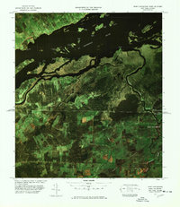
1977 Map of Fort Covington Port of Entry
USGS Topo · Published 1978About this map
The international border between Canada and the United States bisects this landscape, marked by the prominent Fort Covington Port of Entry and Dundee Canadian Customs. This color image map reveals a patchwork of agricultural fields and riverine wetlands at the northern edge of New York. The St Lawrence River dominates the northern portion of the sheet, dotted with numerous islands such as Stanley Island, Clark Island, and St Regis Island.
Find a feature on this map
45 named features on this map. Tap any name to fly to it.
Don’t see what you’re looking for? This feature index may not catch every label — zoom into the map to look around manually.
Map Details
Editions of this 1977 Fort Covington Port of Entry Map
This is the sole edition of this map. No revisions or reprints were ever made.
Other maps of this area

1915 · Malone
USGS Topo · 1:62,500

1915 · Moira
USGS Topo · 1:62,500

1917 · Malone
USGS Topo · 1:62,500

1917 · Moira
USGS Topo · 1:62,500

1944 · Moira
USGS Topo · 1:62,500

1948 · Ogdensburg
USGS Topo · 1:250,000

1951 · Ogdensburg
USGS Topo · 1:250,000

1953 · Ogdensburg
USGS Topo · 1:250,000

1961 · Ogdensburg
USGS Topo · 1:250,000
1964 · Ft. Covington
USGS Topo · 1:24,000