2020s Maps of Morehouse, New York
Explore 8 historic maps of Morehouse from the 2020s. These maps offer a rare glimpse into what life looked like during the 2020s — showing old roads, neighborhoods, homes, and landmarks that have changed or disappeared over time.
Whether you're researching your family's past, planning a metal detecting trip, or studying how Morehouse's landscape evolved across the 2020s, these high-resolution maps are a powerful tool for exploring the history of this region.
- Focus on a specific era: All maps on this page are from the 2020s, giving you a focused view of this time period.
- See what’s changed: Compare century-old streets, trails, and buildings to today's modern landscape using overlays and satellite layers.
- Research with precision: Use these maps for genealogy, historical research, land use analysis, or educational projects.
- View, download, or print: Maps are fully viewable online in high resolution, and can be downloaded or printed for your own records.
Start exploring Morehouse's history through authentic maps from the 2020s. This is your window into the past.
Morehouse, NY maps
(8)- 2023 Map of Morehouse Lake, 2023 Print
 2023 Morehouse Lake2023 Print · USGSThe tri-county boundary of Hamilton, Herkimer, and Fulton counties comes together in this remote high-country landscape during the 2020s. Researchers can trace the settlement at Oregon and find numerous named peaks and waters like Jerseyfield Mountain and Morehouse Lake.
 - 2023 Map of Spruce Lake Mountain, 2023 Print
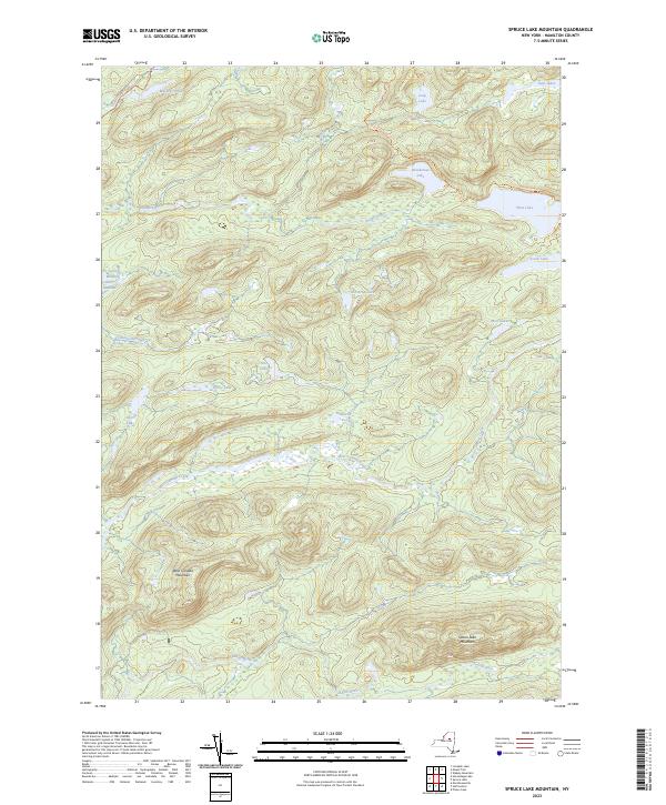 2023 Spruce Lake Mountain2023 Print · USGSThe Adirondack wilderness of Hamilton County remains a landscape of high peaks and secluded waters in the twenty-first century. Hikers and researchers can trace the primitive routes of the Indian Lake Trl to remote landmarks like Carter Mudhole and Spruce Lake Mountain.
 - 2023 Map of Morehouseville, 2023 Print
 2023 Morehouseville2023 Print · USGSIn the southern Adirondack wilderness during the early twenty-first century, this area shows a landscape of mountain peaks and remote clearings. Genealogists and hikers can trace old routes like Haskell Rd to settlements at Nobleboro and Morehouseville.
 - 2023 Map of Mount Tom, 2023 Print
 2023 Mount Tom2023 Print · USGSHamilton County's backcountry is captured here in recent years, showing a landscape defined by its network of trails and remote water bodies. Researchers can trace the paths of the Seventh Lake Mountain Multiple-Use Trl or locate the quiet reaches of The Plains and Beaver Lake.
 - 2023 Map of Limekiln Lake, 2023 Print
 2023 Limekiln Lake2023 Print · USGSThe Adirondack wilderness of Herkimer and Hamilton counties is captured here in modern detail. Researchers can trace the trails and waterways of this high-country landscape, from the Fulton Chain Lakes to landmarks like Mount Tom and Limekiln Lake.
 - 2023 Map of Honnedaga Lake, 2023 Print
 2023 Honnedaga Lake2023 Print · USGSThe Adirondack wilderness along the Herkimer and Hamilton county line is mapped here in the modern era, showing a landscape of high-altitude lakes and peaks. Researchers can trace the remote reaches of Honnedaga Lake, the winding Horn Lake Trl, and family-named landmarks like Jones Mountain.
 - 2023 Map of Hoffmeister, 2023 Print
 2023 Hoffmeister2023 Print · USGSHoffmeister and the surrounding Hamilton County wilderness are shown here in recent detail, dominated by the peaks and interior waterways of the Adirondacks. Researchers can trace remote trails and landmarks like Spruce Hill Cem, the Metcalf Chain of Lakes, and Wilmurt Lake.
 - 2023 Map of Jerseyfield Lake, 2023 Print
 2023 Jerseyfield Lake2023 Print · USGSThe Herkimer and Hamilton county line runs through this wetland-rich Adirondack landscape in the early twenty-first century. Researchers can trace remote clearings like California Clearing or navigate the network of trails around Jerseyfield Lake and Mud Lake.
End of results
Showing maps 1-8 of 8
Top cities near Morehouse
- Salisbury historical maps
- Webb historical maps
- Indian Lake historical maps
- Ohio historical maps
- Lake Pleasant historical maps
- Norway historical maps
See more
Top neighborhoods of Morehouse
Frequently asked questions
- What are the different types of historical maps available for Morehouse?
- What is the oldest map of Morehouse?
- Where can I purchase historical maps of Morehouse for my home or office?
- Where can I download high-res historical maps of Morehouse?
- Are there historical topographic maps available for Morehouse?
- Is there historical aerial imagery available for Morehouse?
- Where are historical maps of Morehouse sourced from?