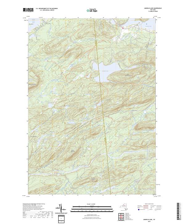
2023 Map of Limekiln Lake
USGS Topo · Published 2023About this map
Adirondack Park land dominates this landscape, where the boundary between Herkimer and Hamilton counties bisects the central waters of Limekiln Lake. This terrain is defined by a dense network of high-elevation ponds and peaks, including Mount Tom and Higley Mountain. The northern reaches include portions of the Fulton Chain Lakes, specifically Fifth Lake, Sixth Lake, and Seventh Lake, the latter featuring Big Island.
Find a feature on this map
65 named features on this map. Tap any name to fly to it.
Don’t see what you’re looking for? This feature index may not catch every label — zoom into the map to look around manually.
Map Details
Editions of this 2023 Limekiln Lake Map
This is the sole edition of this map. No revisions or reprints were ever made.
Other maps of this area

1900 · Canada Lake
USGS Topo · 1:62,500

1901 · Old Forge
USGS Topo · 1:62,500

1903 · Big Moose
USGS Topo · 1:62,500

1903 · West Canada Lakes
USGS Topo · 1:62,500

1903 · Raquette Lake
USGS Topo · 1:62,500

1950 · Utica
USGS Topo · 1:250,000

1954 · Old Forge
USGS Topo · 1:62,500

1954 · West Canada Lakes
USGS Topo · 1:62,500
1954 · Raquette Lake
USGS Topo · 1:62,500

1954 · Big Moose
USGS Topo · 1:62,500