1980s Maps of Herkimer County, New York
Explore 22 historic maps of Herkimer County from the 1980s. These maps offer a rare glimpse into what life looked like during the 1980s — showing old roads, neighborhoods, homes, and landmarks that have changed or disappeared over time.
Whether you're researching your family's past, planning a metal detecting trip, or studying how Herkimer County's landscape evolved across the 1980s, these high-resolution maps are a powerful tool for exploring the history of this region.
- Focus on a specific era: All maps on this page are from the 1980s, giving you a focused view of this time period.
- See what’s changed: Compare century-old streets, trails, and buildings to today's modern landscape using overlays and satellite layers.
- Research with precision: Use these maps for genealogy, historical research, land use analysis, or educational projects.
- View, download, or print: Maps are fully viewable online in high resolution, and can be downloaded or printed for your own records.
Start exploring Herkimer County's history through authentic maps from the 1980s. This is your window into the past.
Herkimer County, NY maps
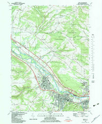
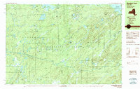
(22)- 1982 Map of Newport, 1983 Print
 1982 Newport1983 Print · USGSCovers Herkimer County, including Herkimer, Deerfield, and other nearby areas
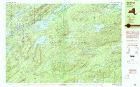
 - 1982 Map of Ilion, 1983 Print
 1982 Ilion1983 Print · USGSCovers Herkimer County, including German Flatts, Herkimer, and other nearby areas
 - 1983 Map of Utica East
 1983 Utica East1983 Print · USGSCovers Herkimer County, including Utica, New Hartford, and other nearby areas
 - 1983 Map of South Trenton
 1983 South Trenton1983 Print · USGSCovers Herkimer County, including Utica, Marcy, and other nearby areas
 - 1985 Map of Gouverneur
 1985 Gouverneur1985 Print · USGSCovers Herkimer County, including Le Ray, Canton, and other nearby areas2 unique versions available
 - 1985 Map of Tupper Lake, 1986 Print
 1985 Tupper Lake1986 Print · USGSCovers Herkimer County, including North Elba, Harrietstown, and other nearby areas2 unique versions available
 - 1985 Map of Gloversville, 1986 Print
 1985 Gloversville1986 Print · USGSCovers Herkimer County, including Gloversville, German Flatts, and other nearby areas2 unique versions available
 - 1985 Map of Watertown, 1986 Print
 1985 Watertown1986 Print · USGSCovers Herkimer County, including Le Ray, Watertown, and other nearby areas2 unique versions available
 - 1985 Map of Amsterdam, 1986 Print
 1985 Amsterdam1986 Print · USGSCovers Herkimer County, including Guilderland, Rotterdam, and other nearby areas2 unique versions available
 - 1985 Map of Raquette Lake, 1986 Print
 1985 Raquette Lake1986 Print · USGSCovers Herkimer County, including Chester, Johnsburg, and other nearby areas2 unique versions available
 - 1985 Map of Utica, 1986 Print
 1985 Utica1986 Print · USGSCovers Herkimer County, including Utica, Manlius, and other nearby areas2 unique versions available
 - 1986 Map of Norwich
 1986 Norwich1986 Print · USGSCovers Herkimer County, including Manlius, German Flatts, and other nearby areas2 unique versions available
 - 1989 Map of Honnedaga Lake
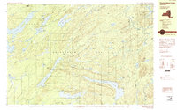 1989 Honnedaga Lake1989 Print · USGSCovers Herkimer County, including Webb, Ohio, and other nearby areas2 unique versions available
 - 1989 Map of Morehouseville
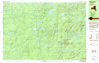
 1989 Morehouseville1989 Print · USGSCovers Herkimer County, including Ohio, Morehouse, and other nearby areas2 unique versions available
 - 1989 Map of Ohio
 1989 Ohio1989 Print · USGSCovers Herkimer County, including Salisbury, Ohio, and other nearby areas
 - 1989 Map of Stillwater
 1989 Stillwater1989 Print · USGSCovers Herkimer County, including Croghan, New Bremen, and other nearby areas
 - 1989 Map of Thendara
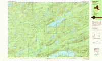
 1989 Thendara1989 Print · USGSCovers Herkimer County, including Webb, Greig, and other nearby areas2 unique versions available
 - 1989 Map of Eagle Bay
 1989 Eagle Bay1989 Print · USGSCovers Herkimer County, including Webb, Long Lake, and other nearby areas2 unique versions available
 - 1989 Map of Mc Keever
 1989 Mc Keever1989 Print · USGSCovers Herkimer County, including Boonville, Webb, and other nearby areas
 - 1989 Map of Number Four
 1989 Number Four1989 Print · USGSCovers Herkimer County, including Watson, Webb, and other nearby areas2 unique versions available
 - 1989 Map of Beavers River
 1989 Beavers River1989 Print · USGSCovers Herkimer County, including Webb, Long Lake, and other nearby areas2 unique versions available
 - 1989 Map of Old Forge, 1990 Print
 1989 Old Forge1990 Print · USGSCovers Herkimer County, including Webb, Ohio, and other nearby areas
End of results
Showing maps 1-22 of 22
Top cities of Herkimer County
- German Flatts historical maps
- Herkimer historical maps
- Frankfort historical maps
- Little Falls historical maps
- Schuyler historical maps
- Manheim historical maps
See more
Frequently asked questions
- What are the different types of historical maps available for Herkimer County?
- What is the oldest map of Herkimer County?
- Where can I purchase historical maps of Herkimer County for my home or office?
- Where can I download high-res historical maps of Herkimer County?
- Are there historical topographic maps available for Herkimer County?
- Is there historical aerial imagery available for Herkimer County?
- Where are historical maps of Herkimer County sourced from?