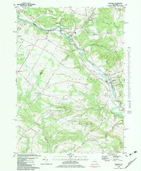
1982 Map of Newport
USGS Topo · Published 1983About this map
The winding West Canada Creek forms the central spine of this landscape, carving through the hills of Herkimer County where the villages of Poland and Newport are situated. The 1980s terrain is marked by a mix of agricultural valley floors and higher elevations like Honey Hill and Bell Hill. Local genealogy is well-supported by numerous burial grounds, including Tanner Hill Cem and Bromley Cem, alongside early crossroads settlements such as North Gage, Walker Corners, and Irish Settlement.
Find a feature on this map
83 named features on this map. Tap any name to fly to it.
Don’t see what you’re looking for? This feature index may not catch every label — zoom into the map to look around manually.
Map Details
Editions of this 1982 Newport Map
This is the sole edition of this map. No revisions or reprints were ever made.
Other maps of this area

1897 · Remsen
USGS Topo · 1:62,500

1898 · Utica
USGS Topo · 1:62,500

1900 · Little Falls
USGS Topo · 1:62,500

1900 · Utica
USGS Topo · 1:62,500

1900 · Remsen
USGS Topo · 1:62,500

1900 · Wilmurt
USGS Topo · 1:62,500

1902 · Wilmurt
USGS Topo · 1:62,500

1903 · Little Falls
USGS Topo · 1:62,500

1939 · Little Falls
USGS Topo · 1:62,500

1943 · Newport
USGS Topo · 1:24,000