1980s Maps of Ohio, New York
Explore 9 historic maps of Ohio from the 1980s. These maps offer a rare glimpse into what life looked like during the 1980s — showing old roads, neighborhoods, homes, and landmarks that have changed or disappeared over time.
Whether you're researching your family's past, planning a metal detecting trip, or studying how Ohio's landscape evolved across the 1980s, these high-resolution maps are a powerful tool for exploring the history of this region.
- Focus on a specific era: All maps on this page are from the 1980s, giving you a focused view of this time period.
- See what’s changed: Compare century-old streets, trails, and buildings to today's modern landscape using overlays and satellite layers.
- Research with precision: Use these maps for genealogy, historical research, land use analysis, or educational projects.
- View, download, or print: Maps are fully viewable online in high resolution, and can be downloaded or printed for your own records.
Start exploring Ohio's history through authentic maps from the 1980s. This is your window into the past.
Ohio, NY maps
(9)- 1985 Map of Gloversville, 1986 Print
 1985 Gloversville1986 Print · USGSThe southern Adirondacks meet the Mohawk Valley industrial corridor during the mid-eighties, showcasing a landscape of high-country lakes and riverside manufacturing towns. Trace the historical alignment of the Erie Canal and Conrail lines or locate landmarks like the Herkimer Home State Historic Site.2 unique versions available
 - 1985 Map of Watertown, 1986 Print
 1985 Watertown1986 Print · USGSThe Black River Valley and the western Adirondacks are captured here in the mid-1980s, from the urban streets of Watertown to the remote Stillwater Reservoir. Researchers can trace the Conrail lines through Carthage or locate family landmarks in Lowville, Boonville, and Old Forge.2 unique versions available
 - 1985 Map of Raquette Lake, 1986 Print
 1985 Raquette Lake1986 Print · USGSThe central Adirondacks are documented here in the mid-1980s, showcasing the complex lake systems and early rail routes that defined the region. Researchers can trace historic landmarks like Sagamore, isolated stops along the Adirondack RR, and the remote layout of Old Forge.2 unique versions available
 - 1985 Map of Utica, 1986 Print
 1985 Utica1986 Print · USGSThe Mohawk Valley in the mid-eighties shows a landscape of industrial river cities and high-tech military hubs before the post-Cold War transition. Trace the development of Rome and Utica, the operations at Griffiss Air Force Base, and the lakeside activity at Oneida Lake.2 unique versions available
 - 1989 Map of Honnedaga Lake
 1989 Honnedaga Lake1989 Print · USGSThe Adirondack wilderness in the late 1980s was a landscape of vast watersheds and isolated forest camps. Trace the intricate shoreline of Honnedaga Lake or locate old backcountry landmarks like Atwell, Bisby Lodge, and Herkimer Landing.2 unique versions available
 - 1989 Map of Morehouseville
 1989 Morehouseville1989 Print · USGSThe remote Adirondack wilderness near the Herkimer and Hamilton county line comes into focus in the late eighties. Researchers can trace small mountain settlements like Morehouseville and Nobleboro alongside family-named peaks such as McCauley Mountain.2 unique versions available
 - 1989 Map of Ohio
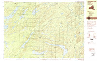
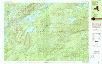
 1989 Ohio1989 Print · USGSThe Herkimer County wilderness and the hamlet of Ohio are documented here in the late eighties during a period of transition for the Adirondacks. Local historians can trace the creek-side settlements at Wilmurt Corners and Gray, alongside forest landmarks like Maurice E Luther Memorial Park and Late Hall Clearing.
 - 1989 Map of Mc Keever
 1989 Mc Keever1989 Print · USGSThe southwestern Adirondack wilderness is captured here in the late twentieth century, showing a landscape of summer camps and deep forests. Researchers can trace the layouts of Masonic Home Camp, Camp Nazareth, and the remote Wolf Lake Landing along Woodhull Lake.
 - 1989 Map of Old Forge, 1990 Print
 1989 Old Forge1990 Print · USGSThe Adirondack wilderness around Herkimer County is captured here in the late eighties, centered on the historic mountain gateway of Old Forge. Outdoor researchers can trace the intricate trails and waters from Little Moose Lake to the summits of Bald Mtn and McCauley Mtn.
End of results
Showing maps 1-9 of 9
Top cities near Ohio
- Trenton historical maps
- Russia historical maps
- Salisbury historical maps
- Webb historical maps
- Remsen historical maps
- Forestport historical maps
See more
Top neighborhoods of Ohio
- Gray historical maps
- Bull Hill historical maps
- Nobleboro historical maps
- North Wilmurt historical maps
- Atwell historical maps
- Herkimer Landing historical maps
Frequently asked questions
- What are the different types of historical maps available for Ohio?
- What is the oldest map of Ohio?
- Where can I purchase historical maps of Ohio for my home or office?
- Where can I download high-res historical maps of Ohio?
- Are there historical topographic maps available for Ohio?
- Is there historical aerial imagery available for Ohio?
- Where are historical maps of Ohio sourced from?