Old Maps of Herkimer Landing, Ohio for Genealogy
Trace your family roots with 14 historic maps of Herkimer Landing. These high-res maps reveal old neighborhoods, homesites, landmarks, and streets — helping you uncover where your ancestors lived and how the area evolved over time.
- Explore historic neighborhoods: Identify where your relatives may have lived in the 1800s or 1900s.
- Compare maps over time: Trace the changes in streets, buildings, and landmarks for multi-generational research.
- Perfect for genealogy & ancestry research: Used by family historians and researchers to map out lineage and migration.
These maps are an incredible resource for exploring your personal connection to Herkimer Landing's past.
Herkimer Landing, Ohio maps
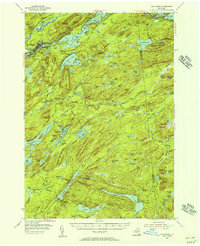
(14)- 1901 Map of Old Forge
 1901 Old Forge1901 Print · USGSIn the Adirondack wilderness at the turn of the century, this area shows a unique network of early camps and water routes. Researchers can trace the Steamboat Route through the Chain Lakes or locate historic outposts like Bishy Lodge and Atwell.10 unique versions available
 - 1950 Map of Utica, 1951 Print
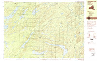
 1950 Utica1951 Print · USGSCentral New York in the post-war era showcases the industrial Mohawk Valley and the pristine Adirondack interior. Researchers can trace transportation networks like the New York Central Railroad and find early Cold War sites such as Griffiss Air Force Base.
 - 1954 Map of Old Forge, 1956 Print
 1954 Old Forge1956 Print · USGSThe Adirondack wilderness around Old Forge is shown in the mid-1950s, detailing a landscape of mountain lodges and interior lakes. Genealogists and historians can trace remote outposts like Bisby Lodge, Atwell, and the Riverside Cem along the Fulton Chain Lakes.4 unique versions available
 - 1957 Map of Utica
 1957 Utica1957 Print · USGSCentral New York and the Adirondack foothills are captured here in the mid-fifties, showing a landscape defined by the Mohawk River corridor and the growing highway system. Genealogists and researchers can trace the rail lines of the New York Central and locate communities from Lowville to Gloversville.
 - 1962 Map of Utica
 1962 Utica1962 Print · USGSCentral New York and the Adirondack wilderness are captured here during the mid-century era of highway and industrial expansion. Genealogists and historians can trace the development of the New York State Thruway and local rail lines connecting Utica, Rome, and Gloversville.3 unique versions available
 - 1964 Map of Utica
 1964 Utica1964 Print · USGSCentral New York and the high wilderness of the Adirondacks are captured here during the post-war era of infrastructure expansion. Researchers can trace the development of the New York State Thruway alongside historic corridors like the Oneida Lake (Barge Canal Route) and the N. Y. Central railroad.
 - 1967 Map of Utica
 1967 Utica1967 Print · USGSCentral New York's industrial Mohawk Valley meets the Adirondack wilderness in the 1960s, showing the region's transition from manufacturing hubs to state-managed parklands. Trace historic settlements and sites like Griffiss Air Force Base, Colgate University, and the Lyons Falls Paper Mill.
 - 1985 Map of Raquette Lake, 1986 Print
 1985 Raquette Lake1986 Print · USGSThe central Adirondacks are documented here in the mid-1980s, showcasing the complex lake systems and early rail routes that defined the region. Researchers can trace historic landmarks like Sagamore, isolated stops along the Adirondack RR, and the remote layout of Old Forge.2 unique versions available
 - 1989 Map of Honnedaga Lake
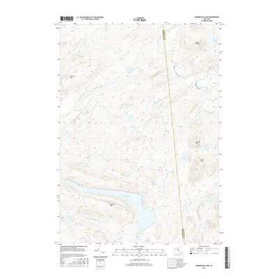
 1989 Honnedaga Lake1989 Print · USGSThe Adirondack wilderness in the late 1980s was a landscape of vast watersheds and isolated forest camps. Trace the intricate shoreline of Honnedaga Lake or locate old backcountry landmarks like Atwell, Bisby Lodge, and Herkimer Landing.2 unique versions available
 - 2010 Map of Honnedaga Lake, 2010 Print
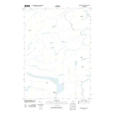 2010 Honnedaga Lake2010 Print · USGSCovers Herkimer Landing, including Ohio, Morehouse, and other nearby areas
 - 2013 Map of Honnedaga Lake, 2013 Print
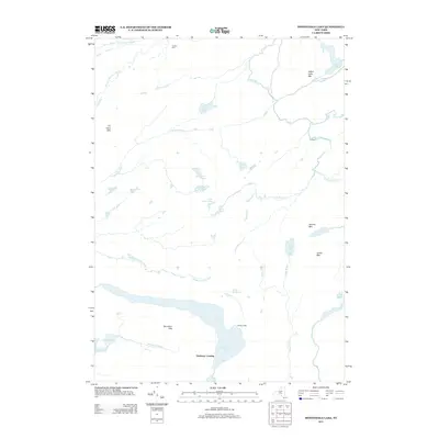 2013 Honnedaga Lake2013 Print · USGSCovers Herkimer Landing, including Ohio, Morehouse, and other nearby areas
 - 2016 Map of Honnedaga Lake, 2016 Print
 2016 Honnedaga Lake2016 Print · USGSCovers Herkimer Landing, including Ohio, Morehouse, and other nearby areas
 - 2019 Map of Honnedaga Lake, 2019 Print
 2019 Honnedaga Lake2019 Print · USGSCovers Herkimer Landing, including Ohio, Morehouse, and other nearby areas
 - 2023 Map of Honnedaga Lake, 2023 Print
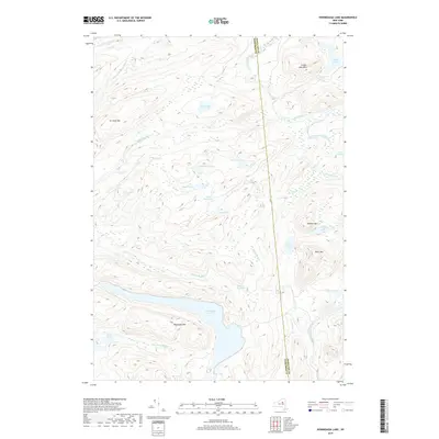
 2023 Honnedaga Lake2023 Print · USGSThe Adirondack wilderness along the Herkimer and Hamilton county line is mapped here in the modern era, showing a landscape of high-altitude lakes and peaks. Researchers can trace the remote reaches of Honnedaga Lake, the winding Horn Lake Trl, and family-named landmarks like Jones Mountain.
End of results
Showing maps 1-14 of 14
Top cities near Herkimer Landing
- Russia historical maps
- Salisbury historical maps
- Webb historical maps
- Ohio historical maps
- Long Lake historical maps
- Norway historical maps
See more
Frequently asked questions
- What are the different types of historical maps available for Herkimer Landing?
- What is the oldest map of Herkimer Landing?
- Where can I purchase historical maps of Herkimer Landing for my home or office?
- Where can I download high-res historical maps of Herkimer Landing?
- Are there historical topographic maps available for Herkimer Landing?
- Is there historical aerial imagery available for Herkimer Landing?
- Where are historical maps of Herkimer Landing sourced from?