2000s (21st Century) Maps of Leicester, New York
Explore 20 historic maps of Leicester from the 2000s (21st Century). These maps offer a rare glimpse into what life looked like during the 2000s — showing old roads, neighborhoods, homes, and landmarks that have changed or disappeared over time.
Whether you're researching your family's past, planning a metal detecting trip, or studying how Leicester's landscape evolved across the 2000s, these high-resolution maps are a powerful tool for exploring the history of this region.
- Focus on a specific era: All maps on this page are from the 2000s, giving you a focused view of this time period.
- See what’s changed: Compare century-old streets, trails, and buildings to today's modern landscape using overlays and satellite layers.
- Research with precision: Use these maps for genealogy, historical research, land use analysis, or educational projects.
- View, download, or print: Maps are fully viewable online in high resolution, and can be downloaded or printed for your own records.
Start exploring Leicester's history through authentic maps from the 2000s. This is your window into the past.
Leicester, NY maps
(20)- 2010 Map of Geneseo, 2010 Print
 2010 Geneseo2010 Print · USGSCovers Leicester, including Geneseo, Geneseo, and other nearby areas
 - 2010 Map of Leicester, 2010 Print
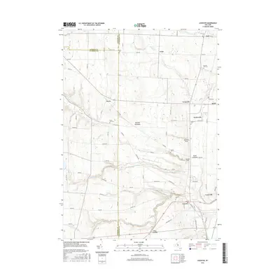
 2010 Leicester2010 Print · USGSCovers Leicester, including Perry, York, and other nearby areas
 - 2010 Map of Mount Morris, 2010 Print
 2010 Mount Morris2010 Print · USGSCovers Leicester, including Perry, Mount Morris, and other nearby areas
 - 2010 Map of Sonyea, 2010 Print
 2010 Sonyea2010 Print · USGSCovers Leicester, including Mount Morris, Mount Morris, and other nearby areas
 - 2013 Map of Geneseo, 2013 Print
 2013 Geneseo2013 Print · USGSCovers Leicester, including Geneseo, Geneseo, and other nearby areas
 - 2013 Map of Leicester, 2013 Print
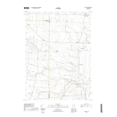
 2013 Leicester2013 Print · USGSCovers Leicester, including Perry, York, and other nearby areas
 - 2013 Map of Mount Morris, 2013 Print
 2013 Mount Morris2013 Print · USGSCovers Leicester, including Perry, Mount Morris, and other nearby areas
 - 2013 Map of Sonyea, 2013 Print
 2013 Sonyea2013 Print · USGSCovers Leicester, including Mount Morris, Mount Morris, and other nearby areas
 - 2016 Map of Geneseo, 2016 Print
 2016 Geneseo2016 Print · USGSCovers Leicester, including Geneseo, Geneseo, and other nearby areas
 - 2016 Map of Mount Morris, 2016 Print
 2016 Mount Morris2016 Print · USGSCovers Leicester, including Perry, Mount Morris, and other nearby areas
 - 2016 Map of Sonyea, 2016 Print
 2016 Sonyea2016 Print · USGSCovers Leicester, including Mount Morris, Mount Morris, and other nearby areas
 - 2016 Map of Leicester, 2016 Print
 2016 Leicester2016 Print · USGSCovers Leicester, including Perry, York, and other nearby areas
 - 2019 Map of Leicester, 2019 Print
 2019 Leicester2019 Print · USGSCovers Leicester, including Perry, York, and other nearby areas
 - 2019 Map of Sonyea, 2019 Print
 2019 Sonyea2019 Print · USGSCovers Leicester, including Mount Morris, Mount Morris, and other nearby areas
 - 2019 Map of Mount Morris, 2019 Print
 2019 Mount Morris2019 Print · USGSCovers Leicester, including Perry, Mount Morris, and other nearby areas
 - 2019 Map of Geneseo, 2019 Print
 2019 Geneseo2019 Print · USGSCovers Leicester, including Geneseo, Geneseo, and other nearby areas
 - 2023 Map of Leicester, 2023 Print
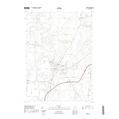
 2023 Leicester2023 Print · USGSLivingston County and the Genesee Valley region are shown in this contemporary study of rural New York. Genealogists can trace family landmarks and burial sites across Leicester, York, and Peoria, including Leicester Cem and the Mountain Ash Cem.
 - 2023 Map of Mount Morris, 2023 Print
 2023 Mount Morris2023 Print · USGSThe Genesee River valley in Livingston County reveals a landscape shaped by water and aviation in the early twenty-first century. Researchers can trace family history at Mount Morris Cem or locate local landmarks like Scott's Sky Ranch Airport and Brooks Grove.
 - 2023 Map of Sonyea, 2023 Print
 2023 Sonyea2023 Print · USGSLivingston County's river valleys and institutional grounds are documented here in the early twenty-first century. Genealogists can locate family sites at Williamsburg Cem, the Craig State School, and the hamlet of Kysorville.
 - 2023 Map of Geneseo, 2023 Print
 2023 Geneseo2023 Print · USGSThe Genesee River valley in the early 2020s remains a landscape defined by its winding waterways and the prominent university town of Geneseo. Researchers can trace the layout of SUNY Geneseo, locate the Livingston County Courthouse, or explore outlying hamlets like Cuylerville and Piffard.
End of results
Showing maps 1-20 of 20
Top cities near Leicester
- Geneseo historical maps
- LeRoy historical maps
- Geneseo historical maps
- Livonia historical maps
- Avon historical maps
- Perry historical maps
See more
Top neighborhoods of Leicester
- Teed Corners historical maps
- Pine Tavern historical maps
- Leicester historical maps
- Cuylerville historical maps
Frequently asked questions
- What are the different types of historical maps available for Leicester?
- What is the oldest map of Leicester?
- Where can I purchase historical maps of Leicester for my home or office?
- Where can I download high-res historical maps of Leicester?
- Are there historical topographic maps available for Leicester?
- Is there historical aerial imagery available for Leicester?
- Where are historical maps of Leicester sourced from?