1930s Maps of Webster, New York
Explore 5 historic maps of Webster from the 1930s. These maps offer a rare glimpse into what life looked like during the 1930s — showing old roads, neighborhoods, homes, and landmarks that have changed or disappeared over time.
Whether you're researching your family's past, planning a metal detecting trip, or studying how Webster's landscape evolved across the 1930s, these high-resolution maps are a powerful tool for exploring the history of this region.
- Focus on a specific era: All maps on this page are from the 1930s, giving you a focused view of this time period.
- See what’s changed: Compare century-old streets, trails, and buildings to today's modern landscape using overlays and satellite layers.
- Research with precision: Use these maps for genealogy, historical research, land use analysis, or educational projects.
- View, download, or print: Maps are fully viewable online in high resolution, and can be downloaded or printed for your own records.
Start exploring Webster's history through authentic maps from the 1930s. This is your window into the past.
Webster, NY maps
(5)- 1931 Map of Rochester East
 1931 Rochester East1931 Print · USGSMonroe County was undergoing a period of rapid residential expansion in the early thirties as the city reached toward the lake. Researchers can find old neighborhood landmarks like the Genesee Lighthouse, Claverhouse PO, and the Riverside Cemetery.
 - 1932 Map of Webster
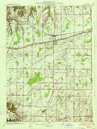
 1932 Webster1932 Print · USGSMonroe County settlements and rural school districts are captured here in the early 1930s. Genealogists can locate specific farm-to-market routes and historic landmarks like Thousand Acre Swamp, West Webster, and the New York Central RR.
 - 1934 Map of Ninemile Point
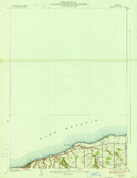 1934 Ninemile Point1934 Print · USGSCoastal Monroe County is captured here in the early thirties as the township of Webster developed along the lake. Genealogists and local researchers can locate Union Cem, School No 9, and old family routes like Salt Road.2 unique versions available
 - 1934 Map of Webster
 1934 Webster1934 Print · USGSMonroe County was a landscape of thriving orchards and rural school districts in the early thirties. Genealogists can locate family homesteads near Thousand Acre Swamp or trace the origins of West Webster and Penfield along the Ridge Road State Highway.3 unique versions available
 - 1935 Map of Rochester East
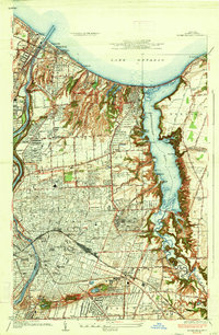 1935 Rochester East1935 Print · USGSRochester and its eastern suburbs are shown in high detail during the mid-1930s as the city expanded toward the lake. Genealogists can locate family homes near the University of Rochester or trace old lakeside communities like Sea Breeze and White City.3 unique versions available
End of results
Showing maps 1-5 of 5
Top cities near Webster
- Rochester historical maps
- Greece historical maps
- Irondequoit historical maps
- Perinton historical maps
- Henrietta historical maps
- Penfield historical maps
See more
Top neighborhoods of Webster
- Oklahoma Beach historical maps
- Forest Lawn historical maps
- West Webster historical maps
- Glen Edith historical maps
- Webster historical maps
Frequently asked questions
- What are the different types of historical maps available for Webster?
- What is the oldest map of Webster?
- Where can I purchase historical maps of Webster for my home or office?
- Where can I download high-res historical maps of Webster?
- Are there historical topographic maps available for Webster?
- Is there historical aerial imagery available for Webster?
- Where are historical maps of Webster sourced from?