Old Maps of Volney, New York for Genealogy
Trace your family roots with 34 historic maps of Volney. These high-res maps reveal old neighborhoods, homesites, landmarks, and streets — helping you uncover where your ancestors lived and how the area evolved over time.
- Explore historic neighborhoods: Identify where your relatives may have lived in the 1800s or 1900s.
- Compare maps over time: Trace the changes in streets, buildings, and landmarks for multi-generational research.
- Perfect for genealogy & ancestry research: Used by family historians and researchers to map out lineage and migration.
These maps are an incredible resource for exploring your personal connection to Volney's past.
Volney, NY maps
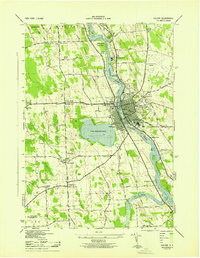
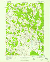
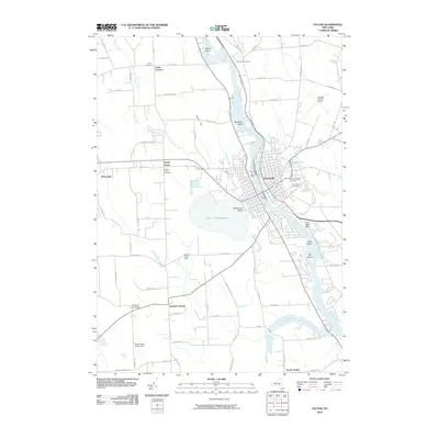
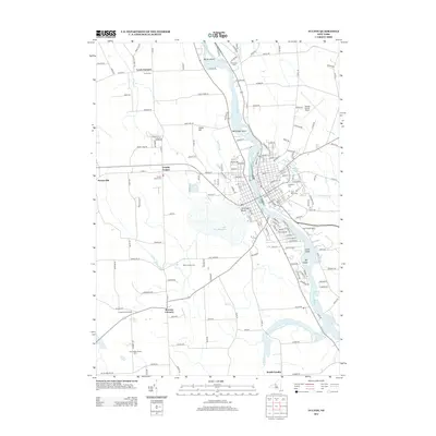
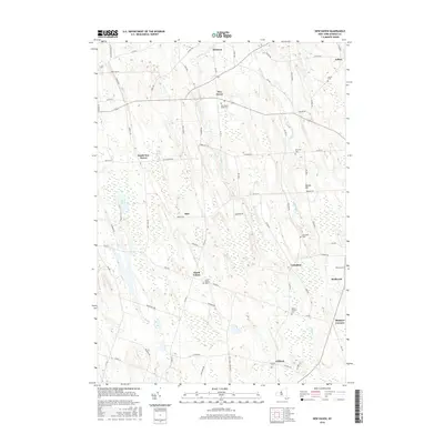
(34)- 1900 Map of Fulton
 1900 Fulton1900 Print · USGSOswego County at the turn of the century shows a bustling corridor of industry and agriculture along the Oswego River. Researchers can trace the legacy of vanished depots and hamlets like Bundy Crossing, Gilbert Mills, and Seneca Hill during the height of the steam-rail era.7 unique versions available
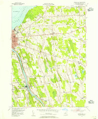
 - 1943 Map of Oswego East
 1943 Oswego East1943 Print · USGSCoastal Oswego County was a landscape of small hamlets and family farmsteads during the Second World War. Genealogists can trace rural schoolhouse locations and several community burial grounds, including Kingdom Cem, Seneca Hill, and Bundy Crossing.
 - 1943 Map of New Haven
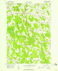
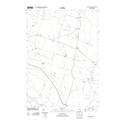
 1943 New Haven1943 Print · USGSOswego County agriculture and transit dominate the landscape in the early 1940s, as small hamlets and family-run farms define the region. Researchers can locate dozens of localized sites including Dempster Grove Camp Ground, Sayles Cem, and the tracks of the New York Central Railroad.
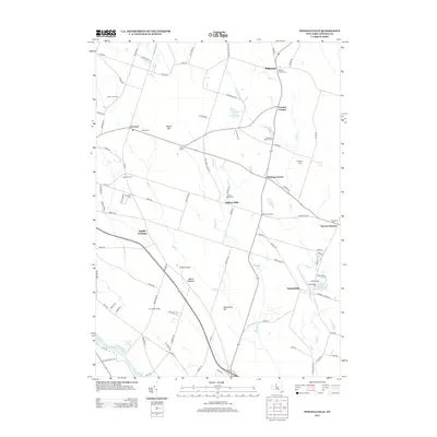
 - 1943 Map of Pennellville
 1943 Pennellville1943 Print · USGSOswego County is captured here during the Second World War, showing a rural landscape organized around the New York Ontario and Western Railroad. Genealogists can trace family names at Farley Corners and Bowen Corners, or locate long-gone schoolhouses like School No 5.
 - 1943 Map of Fulton
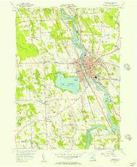
 1943 Fulton1943 Print · USGSFulton and the Oswego River valley are shown in detail during the early 1940s, highlighting a landscape where industry and rural life meet. Local historians can trace the paths of three railroads or find family sites near Mt Adnah Cem and Lewis Corners.
 - 1954 Map of Oswego East, 1956 Print
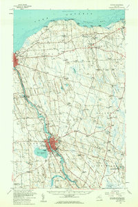
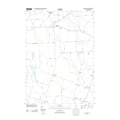
 1954 Oswego East1956 Print · USGSOswego and its rural surroundings are documented here in the mid-fifties, from the industrial Oswego River to the Lake Ontario shore. Researchers can trace numerous numbered schoolhouses and family burying grounds like Hillside Cem and Kingdom Cem.3 unique versions available
 - 1955 Map of Fulton, 1957 Print
 1955 Fulton1957 Print · USGSMid-century Fulton and the surrounding Oswego County countryside are captured here during a period of steady industrial and civic expansion. Researchers can trace historic family locations near Bowens Corners, old rural schoolhouses, and the rail corridors of the New York Central.4 unique versions available
 - 1956 Map of New Haven, 1958 Print
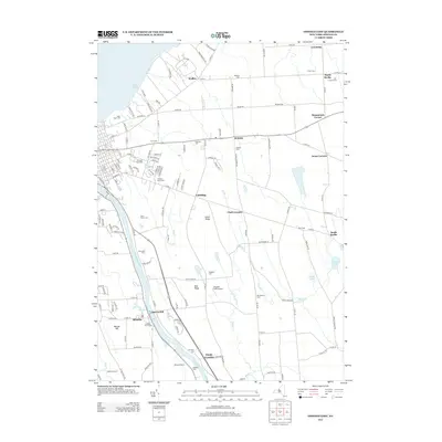
 1956 New Haven1958 Print · USGSOswego County in the mid-fifties is a landscape of quiet crossroads and rail-side hamlets centered around the New Haven township. Local historians can trace the community's layout through sites like the Demster Grove Camp Ground, Arthur Cem, and the New Haven Sta on the Central line.2 unique versions available
 - 1956 Map of Pennellville, 1958 Print
 1956 Pennellville1958 Print · USGSOswego County in the mid-fifties is seen here as a landscape of crossroads hamlets and vital transportation corridors. Researchers can trace the paths of the Oswego Canal, find family names at Volney Cem, and locate landmarks like Gilbert Mills and the Radar Tower.4 unique versions available
 - 1956 Map of Fulton, 1961 Print
 1956 Fulton1961 Print · USGSOswego County's industrial river corridor and lakeside hamlets are captured here during the mid-fifties. Researchers can trace the dual lines of the Erie Lackawanna Railroad and the New York Central Railroad past Lake Neatahwanta and through Fulton.2 unique versions available
 - 1960 Map of Rochester
 1960 Rochester1960 Print · USGSThe Lake Ontario shoreline in the late fifties was a bustling corridor of rail and water commerce. Genealogists and historians can trace the path of the New York Central through canal towns like Newark or explore the coastal landmarks around Sackets Harbor.2 unique versions available
 - 1961 Map of Rochester, 1973 Print
 1961 Rochester1973 Print · USGSThe Lake Ontario shoreline and Finger Lakes frontier are shown here at the height of the mid-century infrastructure boom. Genealogists and historians can trace the rail-and-road evolution from Sackets Harbor down to the New York State Thruway, passing through centers like Pulaski and Adams Center.3 unique versions available
 - 1965 Map of Rochester
 1965 Rochester1965 Print · USGSUpstate New York's industrial heartland is captured here during a period of significant growth between the Great Lakes and the Finger Lakes. Genealogists and historians can trace the evolution of canal towns and rail hubs from Rochester to Syracuse, noting features like the Erie Canal and the New York State Thruway.
 - 1985 Map of Syracuse
 1985 Syracuse1985 Print · USGSCentral New York in the mid-eighties shows a landscape of established canal towns and growing metropolitan suburbs linked by rail and water. Researchers can trace the path of the Erie Canal, find the boundaries of Montezuma Marsh, and locate regional landmarks like Oneida Lake and Chimney Bluffs.3 unique versions available
 - 2010 Map of Oswego East, 2010 Print
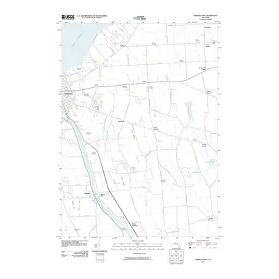 2010 Oswego East2010 Print · USGSCovers Volney, including Oswego, Oswego, and other nearby areas
 - 2010 Map of New Haven, 2010 Print
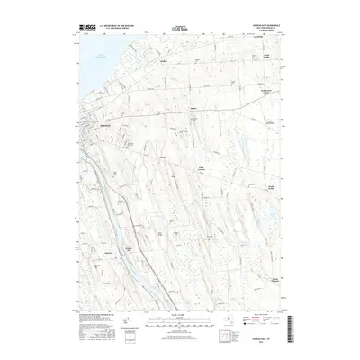
 2010 New Haven2010 Print · USGSCovers Volney, including Scriba, Palermo, and other nearby areas
 - 2010 Map of Fulton, 2010 Print
 2010 Fulton2010 Print · USGSCovers Volney, including Fulton, Oswego, and other nearby areas
 - 2010 Map of Pennellville, 2010 Print
 2010 Pennellville2010 Print · USGSCovers Volney, including Schroeppel, Granby, and other nearby areas
 - 2013 Map of Oswego East, 2013 Print
 2013 Oswego East2013 Print · USGSCovers Volney, including Oswego, Oswego, and other nearby areas
 - 2013 Map of New Haven, 2013 Print
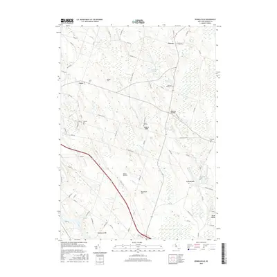
 2013 New Haven2013 Print · USGSCovers Volney, including Scriba, Palermo, and other nearby areas
 - 2013 Map of Fulton, 2013 Print
 2013 Fulton2013 Print · USGSCovers Volney, including Fulton, Oswego, and other nearby areas
 - 2013 Map of Pennellville, 2013 Print
 2013 Pennellville2013 Print · USGSCovers Volney, including Schroeppel, Granby, and other nearby areas
 - 2016 Map of Oswego East, 2016 Print
 2016 Oswego East2016 Print · USGSCovers Volney, including Oswego, Oswego, and other nearby areas
 - 2016 Map of Pennellville, 2016 Print
 2016 Pennellville2016 Print · USGSCovers Volney, including Schroeppel, Granby, and other nearby areas
 - 2016 Map of New Haven, 2016 Print
 2016 New Haven2016 Print · USGSCovers Volney, including Scriba, Palermo, and other nearby areas
Showing maps 1-25 of 34
Top cities near Volney
- Clay historical maps
- Salina historical maps
- Lysander historical maps
- Geddes historical maps
- Oswego historical maps
- Van Buren historical maps
See more
Top neighborhoods of Volney
- Bundy Crossing historical maps
- Mount Pleasant historical maps
- North Volney historical maps
- Ingalls Crossing historical maps
- Seneca Hill historical maps
- Drakes Corner historical maps
Frequently asked questions
- What are the different types of historical maps available for Volney?
- What is the oldest map of Volney?
- Where can I purchase historical maps of Volney for my home or office?
- Where can I download high-res historical maps of Volney?
- Are there historical topographic maps available for Volney?
- Is there historical aerial imagery available for Volney?
- Where are historical maps of Volney sourced from?