Old Maps of West Monroe, New York for Hiking & Exploration
Hike through history with 40 historic maps of West Monroe. Explore old trails, ghost towns, and forgotten backroads — perfect for outdoor adventurers and local explorers.
- Rediscover forgotten places: Map out old mining camps, roads, and footpaths that no longer exist on modern maps.
- Layer with modern tools: Combine with LiDAR or satellite views to plan hikes through historical terrain.
- Made for exploration: Popular among hikers, overlanders, and local history lovers.
Use these maps to find adventure and explore the hidden past of West Monroe.
West Monroe, NY maps
(40)- 1895 Map of Syracuse
 1895 Syracuse1895 Print · USGSSyracuse and the surrounding canal country are captured here in the late nineteenth century as the region thrived on salt production and rail traffic. Trace the vanished industrial Salt Sheds, the historic Erie Canal, and landmarks like the State Fair Grounds.
 - 1898 Map of Syracuse
 1898 Syracuse1898 Print · USGSSyracuse was a burgeoning railroad and canal junction at the end of the nineteenth century, surrounded by thriving villages and salt works. Genealogists and historians can trace family-named sites and vanished industrial works near the Salt Sheds, Cicero Swamp, and Fayetteville.10 unique versions available
 - 1905 Map of Mexico
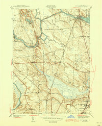
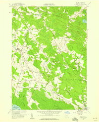
 1905 Mexico1905 Print · USGSOswego County at the turn of the century shows a landscape of busy crossroads and emerging rail junctions. Genealogists can trace family footprints through numerous named settlements like Colosse, Howardville, and Union Settlement or locate old industrial sites like Carleys Mills.6 unique versions available
 - 1940 Map of Brewerton
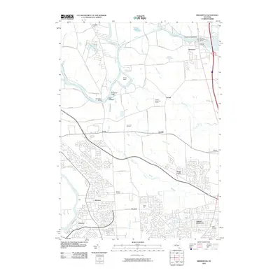
 1940 Brewerton1940 Print · USGSThe northern reaches of Onondaga County are captured here just before the war, centered on the historic Oneida River and canal systems. Researchers can trace the era's rural infrastructure through Woodard Sta, the Peat Swamp, and old landmarks like Morgan Ch.
 - 1940 Map of Cicero, 1957 Print
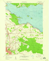
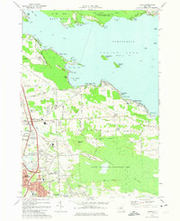
 1940 Cicero1957 Print · USGSOneida Lake’s southern shoreline was still largely rural and agricultural in the years before the war. Genealogists and local historians can trace family-named landmarks and early district schools like Van Anthrup Sch and the Cobblestone Sch.
 - 1943 Map of Mallory
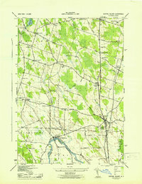
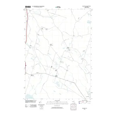
 1943 Mallory1943 Print · USGSOswego County in the early 1940s shows a landscape of rail-dependent hamlets and numbered school districts north of Oneida Lake. Genealogists can locate family names at Little France, Mud Settlement, and the Ingersoll Cem near the railroad.
 - 1943 Map of Brewerton
 1943 Brewerton1943 Print · USGSDuring the early 1940s, the rural landscape between Oneida Lake and North Syracuse was a network of small hamlets and water-based transit. Genealogists can trace family footprints at Dutch Settlement, find old schoolhouses like Baker Sch, or locate the Pine Plains Cem.2 unique versions available
 - 1943 Map of Central Square
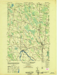
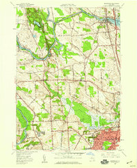
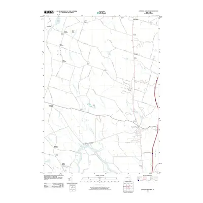
 1943 Central Square1943 Print · USGSOswego County's rural crossroads and riverfront communities are captured here in the early 1940s. Genealogists can trace family footprints through numerous numbered schools and local landmarks like Hillside Cem, Peat Corners, and Caughdenoy.
 - 1944 Map of Cicero
 1944 Cicero1944 Print · USGSOnondaga County in the early 1940s shows a landscape of lakeside retreats and rural schoolhouses along the southern shore of Oneida Lake. Genealogists can trace family footprints at Cicero Center Cem and locate vanished local landmarks like Stone Arabia Sch and Toad Harbor.2 unique versions available
 - 1949 Map of Central Square
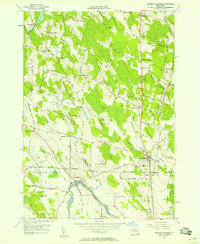
 1949 Central Square1949 Print · USGSCentral Square and the Oneida River valley appear here in the late 1940s as a landscape of rural crossroads and riverfront hamlets. Researchers can trace the legacy of local families and industry at Russes Mill, Peacock Corners, and the Hillside Cem.
 - 1956 Map of Central Square, 1958 Print
 1956 Central Square1958 Print · USGSCentral New York in the mid-1950s is defined here by a dense network of family-named crossroads and the river-and-rail corridors of southern Oswego County. Researchers can trace ancestral locations from Central Square to rural outposts like Mallory Station, Caughdenoy, and Russ Mills.5 unique versions available
 - 1957 Map of Mallory, 1959 Print
 1957 Mallory1959 Print · USGSThe northern shores of Oneida Lake appear in the late fifties as a landscape of sprawling wetlands and quiet agricultural crossroads. Researchers can find old family landmarks and civic centers like Little France Ch, Mud Settlement, and the Carleys Mills Cem.3 unique versions available
 - 1957 Map of Cicero, 1959 Print
 1957 Cicero1959 Print · USGSNorthern Onondaga County enters a period of rapid suburban growth in the late fifties as residential streets expand toward the lake. Researchers can trace family sites from North Syracuse to the rural Cicero Center, including the Cicero Center Cem and Thompson Rd Ch.2 unique versions available
 - 1957 Map of Brewerton, 1959 Print
 1957 Brewerton1959 Print · USGSCentral New York's river-and-canal landscape is captured here in the late fifties, showing the expanding settlements of Clay and North Syracuse. Researchers can trace old property boundaries and local landmarks like the Pine Plains Cem, Hayes Airfield, and the New York Central rail line.2 unique versions available
 - 1960 Map of Rochester
 1960 Rochester1960 Print · USGSThe Lake Ontario shoreline in the late fifties was a bustling corridor of rail and water commerce. Genealogists and historians can trace the path of the New York Central through canal towns like Newark or explore the coastal landmarks around Sackets Harbor.2 unique versions available
 - 1961 Map of Rochester, 1973 Print
 1961 Rochester1973 Print · USGSThe Lake Ontario shoreline and Finger Lakes frontier are shown here at the height of the mid-century infrastructure boom. Genealogists and historians can trace the rail-and-road evolution from Sackets Harbor down to the New York State Thruway, passing through centers like Pulaski and Adams Center.3 unique versions available
 - 1965 Map of Rochester
 1965 Rochester1965 Print · USGSUpstate New York's industrial heartland is captured here during a period of significant growth between the Great Lakes and the Finger Lakes. Genealogists and historians can trace the evolution of canal towns and rail hubs from Rochester to Syracuse, noting features like the Erie Canal and the New York State Thruway.
 - 1973 Map of Brewerton, 1974 Print
 1973 Brewerton1974 Print · USGSOneida Lake and the riverfront communities of Clay and Brewerton are captured here during a period of significant suburban expansion in the 1970s. Local researchers can trace the growth of North Syracuse, locate Pine Plains Cem, or find the grounds of Fort Brewerton State Park.2 unique versions available
 - 1973 Map of Cicero, 1975 Print
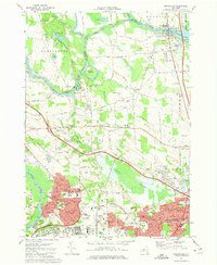
 1973 Cicero1975 Print · USGSOneida Lake's southern shore and the expanding suburbs north of Syracuse come into focus during the early 1970s. Researchers can trace the mid-century growth of Cicero alongside landmarks like Hancock Field US Air Force and the Cicero Center Cem.4 unique versions available
 - 1985 Map of Syracuse
 1985 Syracuse1985 Print · USGSCentral New York in the mid-eighties shows a landscape of established canal towns and growing metropolitan suburbs linked by rail and water. Researchers can trace the path of the Erie Canal, find the boundaries of Montezuma Marsh, and locate regional landmarks like Oneida Lake and Chimney Bluffs.3 unique versions available
 - 2010 Map of Mallory, 2010 Print
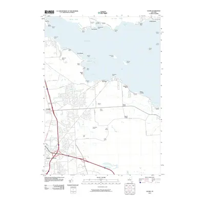
 2010 Mallory2010 Print · USGSCovers West Monroe, including Hastings, Constantia, and other nearby areas
 - 2010 Map of Brewerton, 2010 Print
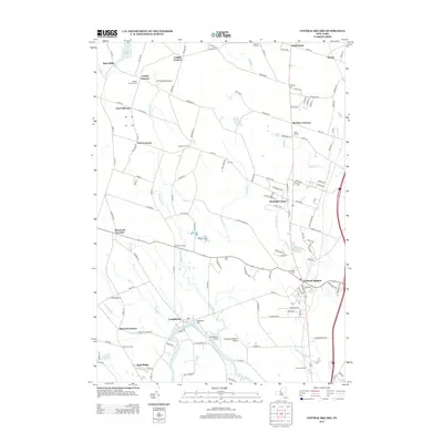
 2010 Brewerton2010 Print · USGSCovers West Monroe, including Clay, Salina, and other nearby areas
 - 2010 Map of Central Square, 2010 Print
 2010 Central Square2010 Print · USGSCovers West Monroe, including Clay, Hastings, and other nearby areas
 - 2010 Map of Cicero, 2010 Print
 2010 Cicero2010 Print · USGSCovers West Monroe, including Cicero, North Syracuse, and other nearby areas
 - 2013 Map of Central Square, 2013 Print
 2013 Central Square2013 Print · USGSCovers West Monroe, including Clay, Hastings, and other nearby areas
Showing maps 1-25 of 40
Top cities near West Monroe
- Syracuse historical maps
- Clay historical maps
- Manlius historical maps
- Salina historical maps
- Cicero historical maps
- De Witt historical maps
See more
Top neighborhoods of West Monroe
- Gulf Bridge historical maps
- Union Settlement historical maps
- Whig Hill historical maps
- Dutch Settlement historical maps
- Mud Settlement historical maps
- Toad Harbor historical maps
Frequently asked questions
- What are the different types of historical maps available for West Monroe?
- What is the oldest map of West Monroe?
- Where can I purchase historical maps of West Monroe for my home or office?
- Where can I download high-res historical maps of West Monroe?
- Are there historical topographic maps available for West Monroe?
- Is there historical aerial imagery available for West Monroe?
- Where are historical maps of West Monroe sourced from?