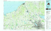
1985 Map of Syracuse
USGS Topo · Published 1985About this map
Syracuse sits as the central hub of this 1985 survey, surrounded by its satellite communities like Solvay, Liverpool, and Mattydale. The landscape is defined by the legacy of New York's waterway network, showing the Erie Canal winding westward toward Clyde and Lyons, while the Seneca River and Oswego River provide natural drainage from the interior lakes toward the shores of Lake Ontario. The industrial and transit infrastructure of the mid-1980s is on full display, with the New York State Thruway and extensive Conrail lines cutting through the terrain.
Find a feature on this map
81 named features on this map. Tap any name to fly to it.
Don’t see what you’re looking for? This feature index may not catch every label — zoom into the map to look around manually.
Map Details
Editions of this 1985 Syracuse Map
3 editions found
Other maps of this area

1895 · Chittenango
USGS Topo · 1:62,500

1895 · Pulaski
USGS Topo · 1:62,500

1895 · Syracuse
USGS Topo · 1:62,500

1897 · Cazenovia
USGS Topo · 1:62,500

1898 · Syracuse
USGS Topo · 1:62,500

1898 · Chittenango
USGS Topo · 1:62,500

1899 · Auburn
USGS Topo · 1:62,500

1899 · Skaneateles
USGS Topo · 1:62,500

1899 · Cazenovia
USGS Topo · 1:62,500

1899 · Palmyra
USGS Topo · 1:62,500