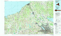
1985 Map of Syracuse
USGS Topo · Published 1994About this map
Syracuse serves as the metropolitan anchor of this mid-1980s landscape, where the urban sprawl of North Syracuse, Liverpool, and East Syracuse contrasts with the specialized environments of the north and west. The map illustrates a complex water system defined by the Seneca River, the historic Erie Canal, and the expansive Oneida Lake. To the west, the Montezuma National Wildlife Refuge and the Montezuma Marsh reflect the persistent natural wetlands that have shaped settlement patterns in Wayne and Cayuga counties.
Find a feature on this map
72 named features on this map. Tap any name to fly to it.
Don’t see what you’re looking for? This feature index may not catch every label — zoom into the map to look around manually.
Map Details
Editions of this 1985 Syracuse Map
3 editions found
Other maps of this area

1895 · Chittenango
USGS Topo · 1:62,500

1895 · Pulaski
USGS Topo · 1:62,500

1895 · Syracuse
USGS Topo · 1:62,500

1897 · Cazenovia
USGS Topo · 1:62,500

1898 · Syracuse
USGS Topo · 1:62,500

1898 · Chittenango
USGS Topo · 1:62,500

1899 · Auburn
USGS Topo · 1:62,500

1899 · Skaneateles
USGS Topo · 1:62,500

1899 · Cazenovia
USGS Topo · 1:62,500

1899 · Palmyra
USGS Topo · 1:62,500