Old Maps of Cranberry Lake, Clifton for Genealogy
Trace your family roots with 19 historic maps of Cranberry Lake. These high-res maps reveal old neighborhoods, homesites, landmarks, and streets — helping you uncover where your ancestors lived and how the area evolved over time.
- Explore historic neighborhoods: Identify where your relatives may have lived in the 1800s or 1900s.
- Compare maps over time: Trace the changes in streets, buildings, and landmarks for multi-generational research.
- Perfect for genealogy & ancestry research: Used by family historians and researchers to map out lineage and migration.
These maps are an incredible resource for exploring your personal connection to Cranberry Lake's past.
Cranberry Lake, Clifton maps
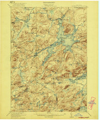
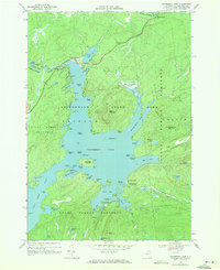
(19)- 1919 Map of Cranberry Lake, 1959 Print
 1919 Cranberry Lake1959 Print · USGSCovers Cranberry Lake, including Webb, Colton, and other nearby areas3 unique versions available
 - 1921 Map of Cranberry Lake
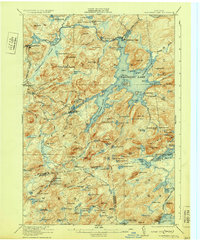
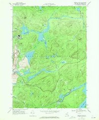
 1921 Cranberry Lake1921 Print · USGSCovers Cranberry Lake, including Webb, Colton, and other nearby areas7 unique versions available
 - 1921 Map of Stark, 1956 Print
 1921 Stark1956 Print · USGSCovers Cranberry Lake, including Pierrepont, Parishville, and other nearby areas2 unique versions available
 - 1923 Map of Stark
 1923 Stark1923 Print · USGSCovers Cranberry Lake, including Pierrepont, Parishville, and other nearby areas4 unique versions available
 - 1931 Map of Cranberry Lake
 1931 Cranberry Lake1931 Print · USGSCovers Cranberry Lake, including Webb, Colton, and other nearby areas
 - 1940 Map of Stark
 1940 Stark1940 Print · USGSCovers Cranberry Lake, including Pierrepont, Parishville, and other nearby areas
 - 1948 Map of Ogdensburg, 1973 Print
 1948 Ogdensburg1973 Print · USGSCovers Cranberry Lake, including Le Ray, Brockville, and other nearby areas2 unique versions available
 - 1951 Map of Ogdensburg
 1951 Ogdensburg1951 Print · USGSCovers Cranberry Lake, including Le Ray, Brockville, and other nearby areas
 - 1953 Map of Ogdensburg
 1953 Ogdensburg1953 Print · USGSCovers Cranberry Lake, including Le Ray, Brockville, and other nearby areas
 - 1961 Map of Ogdensburg
 1961 Ogdensburg1961 Print · USGSCovers Cranberry Lake, including Le Ray, Brockville, and other nearby areas
 - 1968 Map of Cranberry Lake, 1971 Print
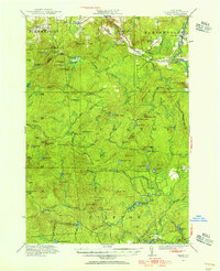
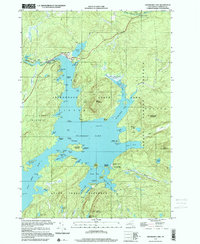
 1968 Cranberry Lake1971 Print · USGSCovers Cranberry Lake, including Colton, Clifton, and other nearby areas2 unique versions available
 - 1968 Map of Newton Falls, 1971 Print
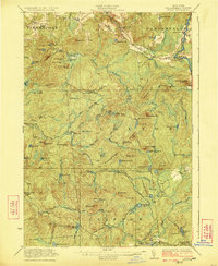
 1968 Newton Falls1971 Print · USGSCovers Cranberry Lake, including Fine, Clifton, and other nearby areas2 unique versions available
 - 1970 Map of Brother Ponds, 1972 Print
 1970 Brother Ponds1972 Print · USGSCovers Cranberry Lake, including Colton, Clifton, and other nearby areas
 - 1985 Map of Tupper Lake, 1986 Print
 1985 Tupper Lake1986 Print · USGSCovers Cranberry Lake, including North Elba, Harrietstown, and other nearby areas2 unique versions available
 - 1999 Map of Newton Falls, 2001 Print
 1999 Newton Falls2001 Print · USGSCovers Cranberry Lake, including Fine, Clifton, and other nearby areas
 - 1999 Map of Cranberry Lake, 2001 Print
 1999 Cranberry Lake2001 Print · USGSCovers Cranberry Lake, including Colton, Clifton, and other nearby areas
 - 2023 Map of Newton Falls, 2023 Print
 2023 Newton Falls2023 Print · USGSCovers Cranberry Lake, including Fine, Clifton, and other nearby areas
 - 2023 Map of Brother Ponds, 2023 Print
 2023 Brother Ponds2023 Print · USGSCovers Cranberry Lake, including Colton, Clifton, and other nearby areas
 - 2023 Map of Cranberry Lake, 2023 Print
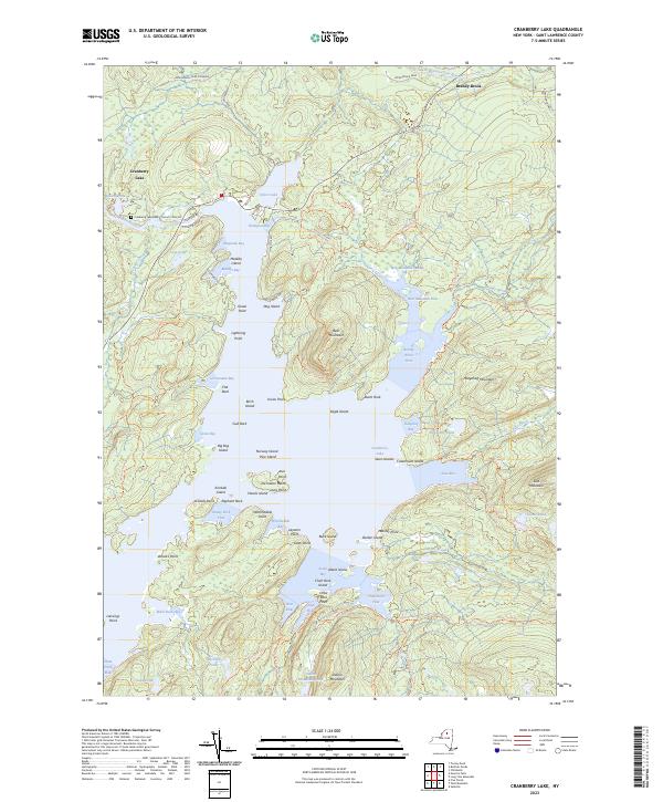 2023 Cranberry Lake2023 Print · USGSCovers Cranberry Lake, including Colton, Clifton, and other nearby areas
End of results
Showing maps 1-19 of 19
Top cities near Cranberry Lake
- Oswegatchie historical maps
- Russell historical maps
- Webb historical maps
- Colton historical maps
- Fine historical maps
- Hopkinton historical maps
See more
Frequently asked questions
- What are the different types of historical maps available for Cranberry Lake?
- What is the oldest map of Cranberry Lake?
- Where can I purchase historical maps of Cranberry Lake for my home or office?
- Where can I download high-res historical maps of Cranberry Lake?
- Are there historical topographic maps available for Cranberry Lake?
- Is there historical aerial imagery available for Cranberry Lake?
- Where are historical maps of Cranberry Lake sourced from?